

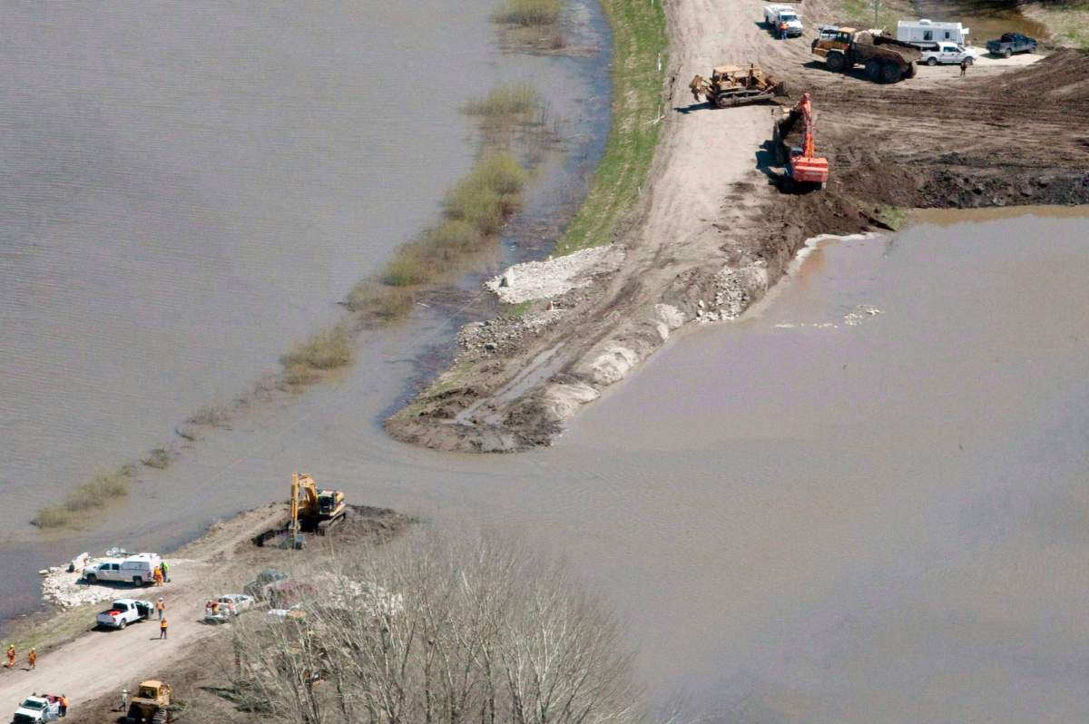
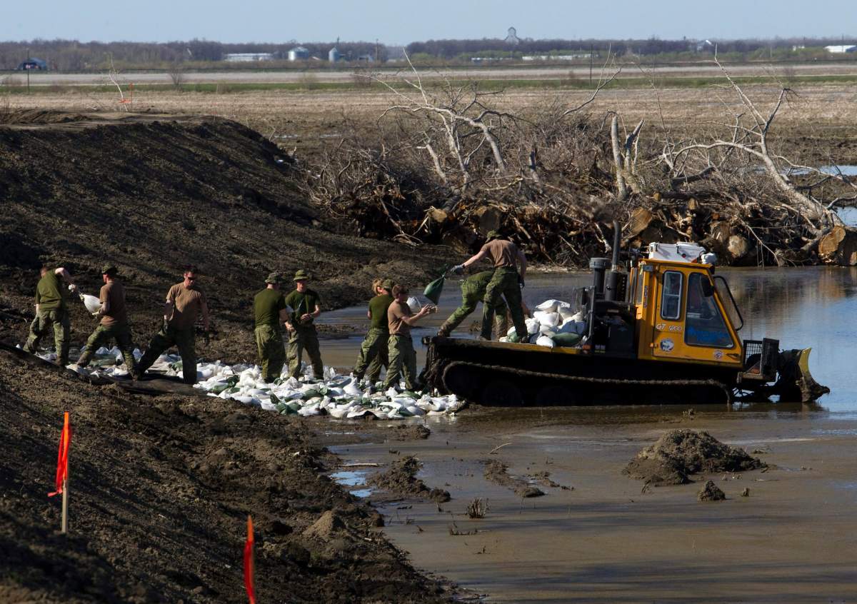
Several communities in Ontario, Quebec and New Brunswick are continuing to feel the wrath of floodwaters, prompting many to declare a state of emergency and get help from soldiers for sandbagging and emergency evacuations.

The historic flooding has caused many residents of Eastern Canada to flee from their homes as water levels surge.
Canadians from coast to coast are by no means immune to devastating flooding. Here is a look at some of the worst floods in Canadian history.
2013 flood in southern Alberta
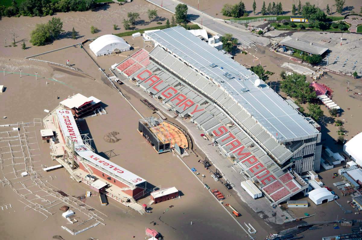
During the spring of 2013, southern Alberta was hit with one of Canada’s most expensive natural disasters, destroying communities from Banff to Calgary and beyond.
Five people died due to the flood, and thousands of people were forced to flee their homes which were destroyed. The rising waters resulted in around $6 billion in damages.
On June 19, 2013, torrential rains began falling over southern Alberta. Over the Canadian Rockies, instead of the precipitation falling as snow – where the ground could slowly soak it up – it fell as rain, saturating the ground and coursed through streams and rivers.
In Calgary, 68 mm of rain fell over 48 hours. West of High River, Burns Creek recorded an astounding 345 mm; Canmore recorded 200 mm, 10 times that of their entire summer rainfall.
Mudslides caused part of the Trans-Canada Highway to close and more than a dozen different communities from north of Calgary, south to Lethbridge and west to the Rocky Mountain parks declared a state of emergency.
2011 flooding in Manitoba and Saskatchewan
At the time, the 2011 flood across Saskatchewan and Manitoba produced the highest water levels and flows in modern history.

Get daily National news
By early April 2011, Manitoba declared a high flood risk for the Red, Assiniboine, Souris, Pembina and Qu’Appelle rivers as well as several lakes. By May 9, a provincial state of emergency was issued.
The Assiniboine River reached its highest level since 1923, and was about 20 to 30 times wider than normal in some places and seven metres higher.
In southern Saskatchewan, the historic flooding was the result of a number of events, including intense June rainfalls at the same time snowmelt waters were arriving from the Rockies and excessive precipitation during the previous summer, fall and winter.
On Lake Manitoba, engineers called the flood a one-in-2,000-year event. Governments at all levels spent close to $1 billion on flood fighting and victim compensation, according to Environment Canada.
2005 flood in Alberta (Alberta’s Flood of Floods)
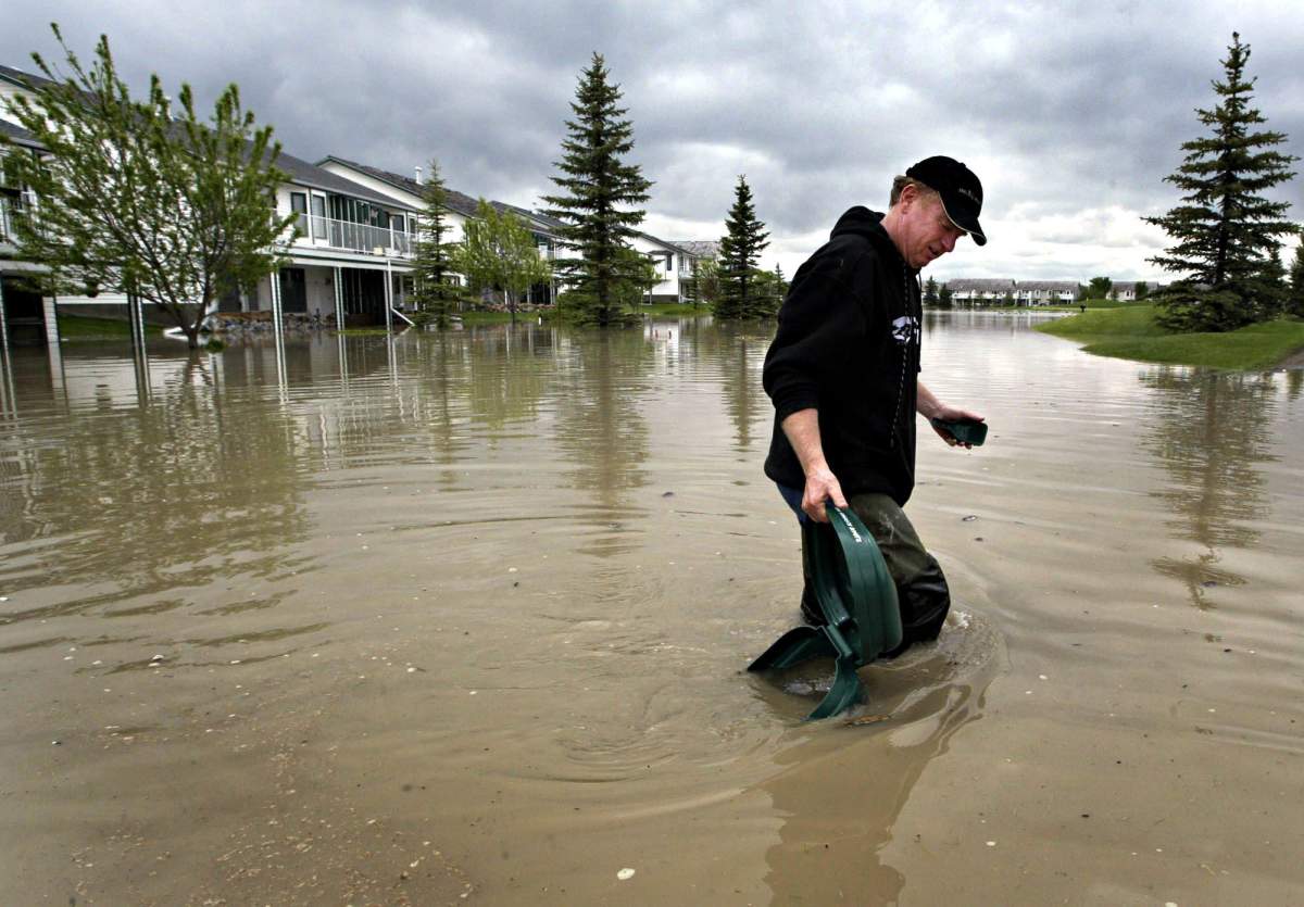
In the spring of 2005, three major storms about a week apart drenched parts of Alberta, creating record high-water levels. The historic flooding inundated southern Alberta towns and forced thousands of residents, including 2,000 Calgarians, to evacuate.
Floodwaters washed out roads and parks, destroyed sewers, bridges and wrecked buildings and drowned livestock, according to Environment Canada.
It was one of the costliest natural disasters in Alberta’s history (at the time) and damages reached more than $400 million.
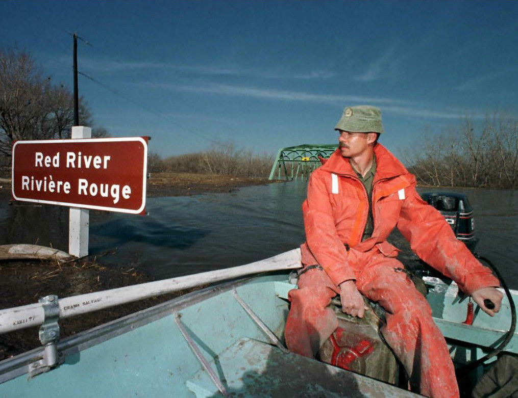
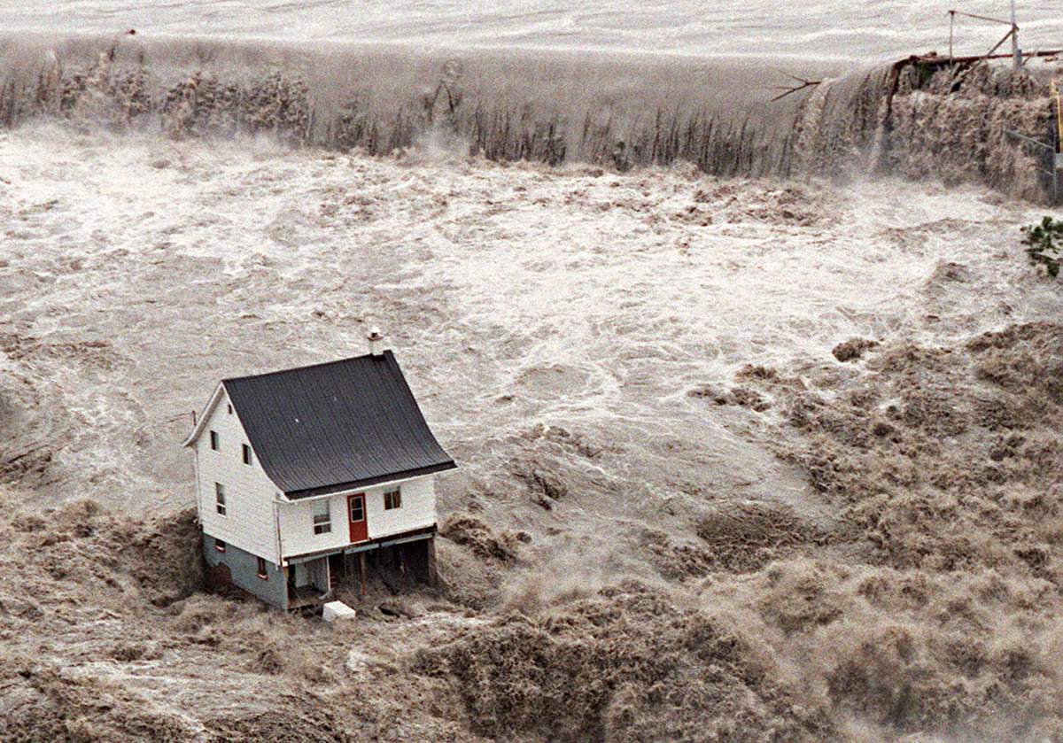
1997 Red River Flood in Manitoba (The Flood of the Century)
Twenty-two years ago, the residents of Ste. Agathe, Man., were forced to watch from a distance as the Red River swallowed their homes, cars and farms.
On April 29, 1997, the southern Manitoba town, located just 40 kilometres from Winnipeg, was the first place to lose its battle with the province’s “Flood of the Century.”


The warning signs of the flood started between April 5-8, when the province was hit by a blizzard that dropped about 50 centimetres of snow across the Red River Valley.
About 2,000 square kilometres of valley lands flooded as the Red River rose 12 metres above winter levels.
Manitoba declared a state of emergency and more than 9,000 people were evacuated from their homes in Winnipeg. The city was saved from complete disaster due to flood-control structures.

According to the City of Winnipeg, 8.1-million sandbags were filled, meaning if you placed the sandbags end to end in a straight line, they would run roughly from Winnipeg to Vancouver.
The total cost of the flood was estimated to be $500 million.
WATCH: Looking back at the Flood of the Century that devastated St. Agathe, Man.

1996 flood in Quebec
What made the 1996 flood in Saguenay, Que., so notable was the event broke a record as Canada’s first-ever billion-dollar disaster, according to Environment Canada.
In July 1996, the region of Saguenay (north of Quebec City) was hit with massive amounts of rain.
The storm produced the largest-ever overland deluge in Canada that century, triggering a surge of water, rocks, trees and mud. Ten people were killed and 12,000 residents were forced to flee their homes. It was the deadliest flood since Hurricane Hazel in Toronto in 1954.
According to Environment Canada, total damage exceeded $1.5 billion.
1950 flood in southern Manitoba

The 1950 flood inundated many valley towns and one-sixth of Winnipeg in May 1950, according to the Canadian Encyclopedia. For 51 days, the Red River remained above the flood stage.
Between 50,000 and 100,000 residents had to be evacuated, and four of 11 bridges were destroyed.
In order to prevent and reduce future damage, the government started constructing the Red River floodway, to help carry off spring overflow.
The total cost of the flood was about $125.5 million (in 1957 dollars).
— With files from Global News and The Canadian Press
Comments
Want to discuss? Please read our Commenting Policy first.