

Wintry blast with heavy snow and strong wind slams into Saskatchewan for the final weekend of April.

Weather forecast
Friday
-10 is what it felt like with wind chill Friday morning as temperatures dipped back to -6 degrees to start the day under a mix of sun and cloud.
The mercury managed to make it into double digits before noon as high clouds slid in across the province with some showers pushing into southwest Saskatchewan.
Mostly cloudy skies stick around all afternoon as the region warms into double digits by a few degrees.
Friday night
Clouds linger Friday evening before Saskatoon sees some clearing overnight as both cities cool back below freezing by a few degrees.
Saturday
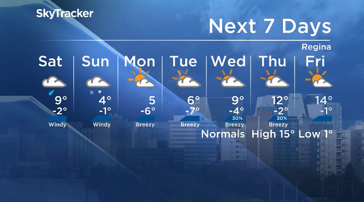
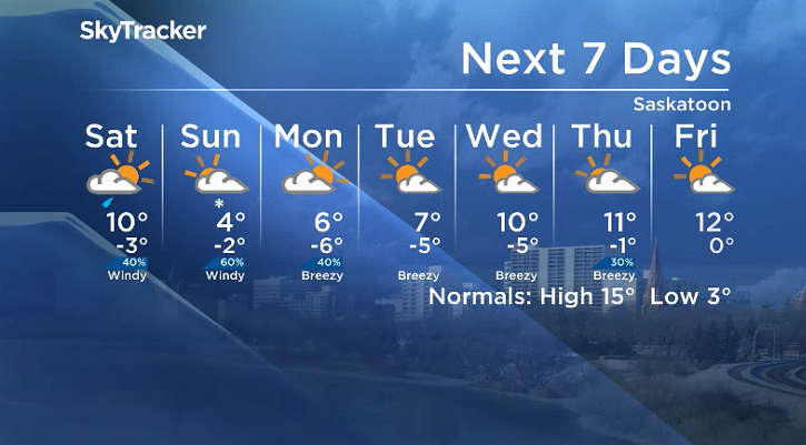
-6 is what it’ll feel like with wind chill Saturday morning with some sunshine possible early in the day in Saskatoon with rain rolling into Regina during the day as temperatures climb toward double digits.

Get breaking National news
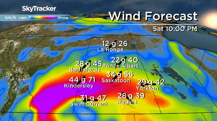
Saskatoon will see showers press in later in the day as a strong, precipitation-packed system pushes in easterly winds gusting up to 60 km/h.

Rain will transition over to snow Saturday night into Sunday morning as winds strengthen even further overnight.
Sunday
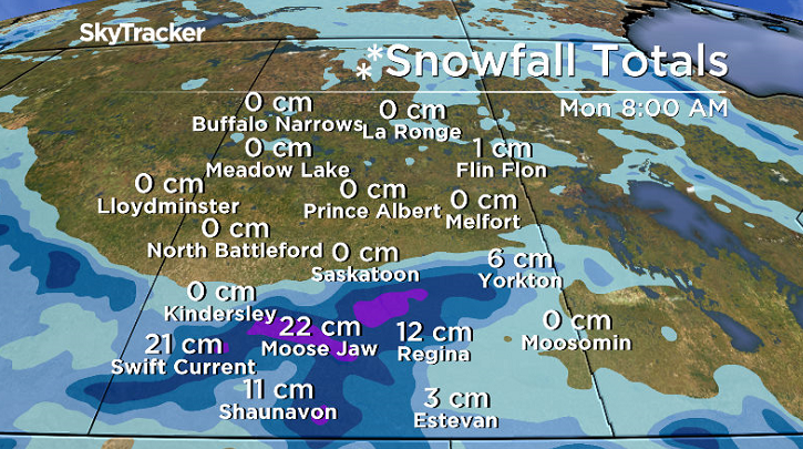
Weather models are having difficulty pinpointing where the system will track and therefore where the heaviest snow will fall, but it does appear that western Saskatchewan will be the area hit hardest.
Some pockets could receive over 20 centimetres of snow, with anywhere from 3 to 12 centimetres possible for Saskatoon and Regina as temperatures only climb a few degrees above freezing.


Gusty northeasterly winds will kick in during the day, up to sustained speeds of 40 km/h with gusts over 60 km/h possible before precipitation tapers off and the system pulls out of the area late in the day.
Workweek outlook
Partly-to-mostly cloudy conditions linger for the final few days of April with a chance of showers late Monday in Saskatoon as daytime highs climb back into double digits by the beginning of May.
The Your Saskatchewan photo for April 26 was taken by Veronica Thomas near Minton:

The Saskatchewan weather outlook is your source for the province’s most accurate forecast and is your one-stop shop for all things weather with comprehensive, in-depth analysis that you can only find here.
For weather on the go, download the Global News SkyTracker Weather App for iPhone, iPad or Android.
Comments
Want to discuss? Please read our Commenting Policy first.