
Minus 5 C is what it felt like with the wind chill on Thursday morning in the Central Okanagan, as temperatures fell to -2 degrees with early day sunny breaks.

Clouds with the next upper trough moved in by mid-morning, helping warm the valley into high single digits before noon.
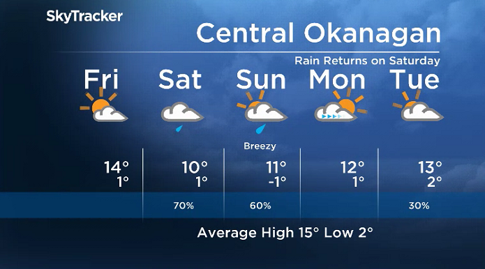
The mercury is making a break for 12 degrees for a daytime high, with a chance of afternoon and early evening showers before skies clear overnight.

Get breaking National news
Beautiful blue skies and sunshine will be back on Friday, with thermometers kicking off the day just below freezing before rising into the mid-teens in the afternoon.
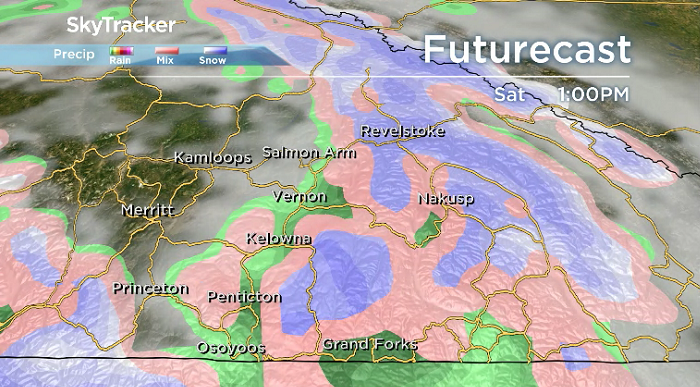
The next round of rain will roll in with a frontal boundary on Saturday. That will put a damper on daytime heating, keeping afternoon highs in low double digits.
Exact rainfall amounts will be difficult to pinpoint due the the convective nature of the next round of precipitation, but freezing levels are expected to fall to around 1,000 metres on Saturday night.


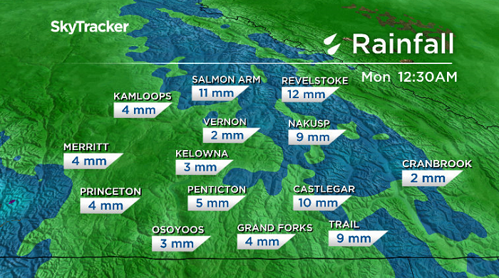
Showers are likely to linger into the day on Sunday under mostly cloudy skies, with a daytime high around 11 degrees, as breezy winds pick up in some areas.
The work week will start out with some sunshine Monday morning before clouds return during the day and linger for the remainder of the short work week ahead, as daytime highs gradually climb into the mid-teens.
For weather on the go download the Global News SkyTracker Weather App for iPhone, iPad or Android.
Comments
Want to discuss? Please read our Commenting Policy first.