
Temperatures soared on Sunday to 17 degrees in the Central Okanagan, but then took a dive back below freezing to start the second week of April.

A mix of sun and cloud started the day, but clouds from a system sliding in will build on Monday afternoon with a chance of showers as the mercury climbs into the low teens.
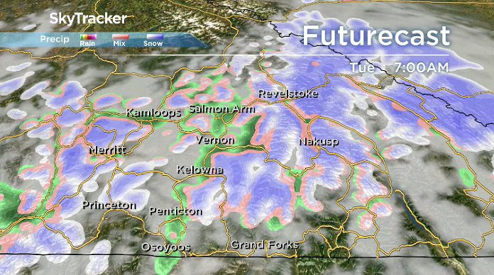
Showers linger Monday evening with a chance of rain continuing into early Tuesday with snow levels around 1200 metres before easing during the day with a chance of some afternoon sunny breaks.

Get daily National news
Thermometers will attempt to make it up to around 14 degrees for an afternoon high before falling back below freezing into Wednesday morning and then returning to double digits during the day.
Clouds roll back in on Wednesday with a chance of late day showers that could linger into early Thursday morning with a slight chance of some wet valley bottom snow.


Mostly cloudy skies with a chance of spotty showers stick around on Thursday with daytime highs climbing into low double digits before returning to the mid-teens with some more sunshine on Friday.
That round of sun is short-lived with the next round of clouds and risk of showers sliding in for the weekend, dropping daytime highs back into low double digits.

For weather on the go download the Global News SkyTracker Weather App for iPhone, iPad or Android.


Comments