

_848x480_1459055171687.jpg?w=1040&quality=70&strip=all)
A flood watch is in effect for the City of Kawartha Lakes.

Kawartha Conservation issued the watch on Friday morning for its watershed jurisdiction after recent precipitation and snowmelt combined with frozen ground conditions have resulted in significant runoff.
Over the last 24 hours, Kawartha Conservation says the area has received five to 15 mm of precipitation with a temperature high of 10 C.
“Water levels in local rivers and streams are currently rapidly increasing or peaking and exceeding their bankfull conditions in multiple locations,” stated Kawartha Conservation. “Smaller steams are responding faster, while it takes longer for larger watercourses to react.”
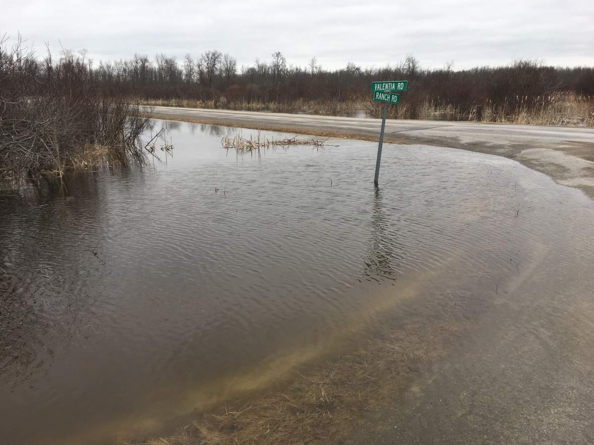
The conservation authority says some flooding has already occurred in low-lying areas and areas adjacent to streams and road ditches. Rapid deterioration of ice cover has also been observed.
As a result, Kawartha Conservation says all watercourses should be considered “extremely dangerous” and is warning residents to stay away from all water bodies and riverbanks, ice cover and structures such as bridges, culverts and dams.

Get daily National news
“Children should be warned of dangerous conditions and caregivers should maintain a close watch on children who are outside,” stated the conservation.
Trent-Severn Waterway officials will be adjusting dam settings throughout the system when the situation warrants. Staff from the Ministry of Natural Resources and Forestry are monitoring water levels of the Burnt and Gull rivers. Residents with concerns along those rivers are asked to contact the MNRF office in Minden at 705-286-5207 or visit the City of Kawartha Lakes website.


Kawartha Conservation says as precipitation moves out of the region later Friday and the air temperature returns to below freezing, it is expected that water levels will stabilize and start declining.
The flood watch will remain in effect until Monday.
The following roads have been closed due to flooding and washouts:
- Blackbird Road
- Sandhills Road from #531 to Glenarm Road
- Sandhills Road from #497 to #531 has been reduced to a single lane
- Grasshill Road between Woodville Road and Lorneville Roads between #145 & #124
- Hollow Tree Road from Birchpoint Road east to Civic address 33
- Doyle Road from 510 north to North Mountain Road
- Four Points Road between civic numbers 70 and 80
- Elm Tree Road from Thunderbridge Road north to civic #1829
- Eldon Station Road between Kirkfield Road and Creek View Road (between #1038 and #1082)
- Goose Road from Fenel Road west for 300 metres
Comments
Want to discuss? Please read our Commenting Policy first.