
There is some encouraging news on the flood-risk front from the BC River Forecast Centre.

Hydrologist Jonathan Boyd said the risk of snow melt related flooding in the Okanagan-Similkameen region this year is lower than in recent flood years.
As of Feb. 1, the Okanagan snowpack was 86 per cent of normal, while the Similkameen snow pack was 74 per cent of normal. Fresh data will be released next week, but Boyd expects snow packs will continue to be below normal.
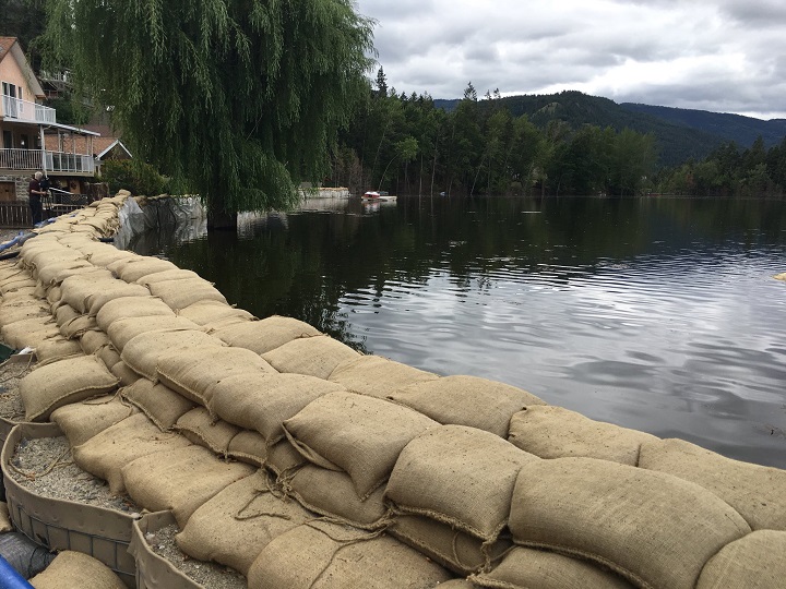
That’s good news for anxious B.C. interior residents after two consecutive years of serious flooding in some areas of the Okanagan, Similkameen and Boundary regions.
“If you wanted my opinion on flood risk, of course a lower snowpack is better. But that causes a separate issue with regards to drought and water supply levels in the summer,” Boyd said.
WATCH: (Aired Feb. 14) UBC Okanagan to research psychological impacts of life in wildfire, flooding areas

“Usually for operations sake and water management, planning is easiest when conditions are around normal. But if it was purely about the risk of flooding, the lower the snowpack, the lesser the risk.”
It was a different story last year. The snowpack level in the Okanagan on Feb. 1, 2018, was 131 per cent of normal. The Similkameen was 135 per cent of normal.
In 2017, there was a stark contrast in January snowpack levels. However, the region still experienced flooding.
In 2017, the Okanagan snowpack was at 79 per cent of normal as of Feb. 1, while the Similkameen was 73 per cent of normal.
“Flooding can be caused by the rapid melt of snow, which occurred last year in 2018 for a lot of the tributaries, so Mission Creek and areas in the Similkameen basin,” Boyd said.
“However, in 2017, the flooding really was isolated more for Okanagan Lake itself, and the result was just sustained intense rainfall systems that fell on the basin throughout April and May.”
Boyd said by Mar. 1, 75 per cent of the total snow fall accumulation has occurred for the season, which means there is still a quarter of the season ahead that can add to the snowpack.
WATCH: (Aired Dec. 29) Jules Knox and Shelby Thom take a look back at one of the biggest stories in 2018: the flooding in Grand Forks and the Okanagan-Similkameen region.

“As long as the snowpack is near normal, the worst-case scenario is a delayed melt period, so cold temperatures through April followed by one to two weeks of sustained hot weather melting the snow rapidly,” he said.
“Then that’s followed by a very, very heavy rainfall event, and that is what happened last year and flows got extremely high in several locations in the Okanagan.”
He said the Okanagan has unique topography and is susceptible to variable flood risks.
“The Okanagan is unique in that it can be susceptible to snow melt-related flooding and then also rainfall-related flooding in the spring, whereas some of the bigger rivers in the province are isolated specifically to snow melt,” Boyd said.
But as of now, he said the snowpack levels are encouraging.
“The risks related to snow melt are lower at this moment in time.”
Comments