


Saskatoon has been bitten by the coldest air seen in over 10 years with -50 wind chills and record low temperatures.

Extreme cold warning
Environment Canada has continued an extreme cold warning for Saskatoon and most of Saskatchewan for -40 to -55 wind chills persisting for the rest of the week.
An arctic high-pressure ridge has settled in over Saskatchewan with -40 degree temperature readings over parts of the western and northern grainbelt.
Saskatoon forecast
Wednesday
Record-breaking cold was reached in Saskatoon Wednesday morning with temperatures plunging into the -40s for the first time in over a decade – you have to go back to Jan. 4, 2009, to see -40 previously.
-53 is what it felt like with wind chill, which meant skin could freeze in a matter of minutes, with temperatures taking until mid-morning to make it back into the -30s.
The mercury will continue to slowly make its way toward the -20s for an afternoon high under sunny skies with wind chills stuck in the -40s all day.

Get daily National news
Wednesday night
Mostly clear skies linger into Wednesday night as temperatures plunge back into the -40s with extreme wind chills making it feel like -54 at times as ice fog develops once again across the region.
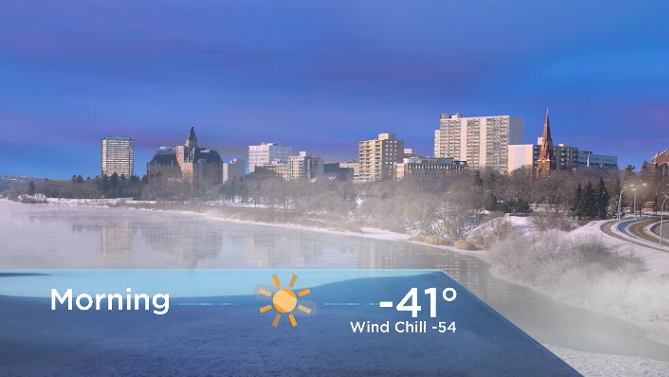
Thursday
-54 is what it will feel like as you’re heading out the door Thursday morning with some ice fog lingering before sunny skies start to warm things up and clear out the fog.
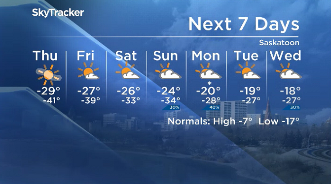
The mercury should make it up to around -29 for an afternoon high, but it will once again feel like -40 to -50 all day with wind chill.


Friday
One more frigid start is expected to finish off the first full week of February on Friday with temperatures nearing the -40s for one more morning.
Sunshine will stick around for the day with a few clouds filtering through later on as conditions warm a few degrees into the -20s for an afternoon high.

Weekend outlook
Moderated temperatures finally start to slide in with a few more clouds over the weekend, with daytime highs recovering into the mid -20s, overnight lows returning to the mid -30s and wind chills warming to the mid -40s.
Harshil Patel took the Feb. 6 Your Saskatchewan photo in Regina:
Saskatoon weather outlook is your source for Saskatoon’s most accurate forecast and is your one-stop shop for all things weather for central and northern Saskatchewan with comprehensive, in-depth analysis that you can only find here.
For weather on the go, download the Global News SkyTracker Weather App for iPhone, iPad or Android.


Comments
Want to discuss? Please read our Commenting Policy first.