

The second warmest day the Central Okanagan has seen so far this year was recorded Sunday with temperatures in Kelowna climbing to 9.8 degrees.

The mild finish to the weekend was quickly followed by a cold front that resulted in the coldest night Kelowna has seen so far this year with the mercury falling to -9 degrees Monday morning to kick off the week.
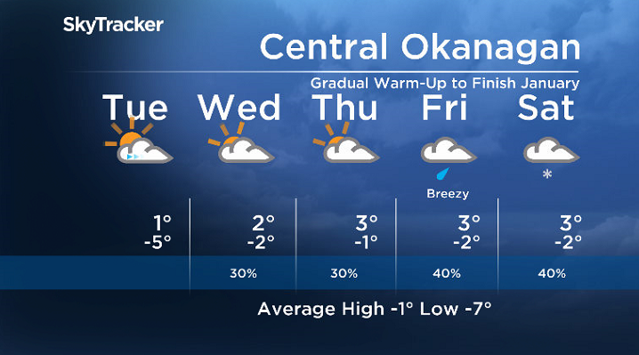
The roller coaster of conditions quickly settle down for the final few days of January as sunny skies continue through the remainder of the day on Monday with an afternoon high making it just above freezing.
Valley cloud and fog patches develop Monday night and linger into Tuesday morning as conditions cool down to around -5 degrees, before making their way back up to +1 for the afternoon as skies clear.
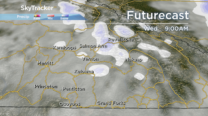
A more organized round of system cloud then swings in on Wednesday with a chance of a few flurries sliding through during the day with an afternoon high just above freezing.
An upper ridge keeps the heat gradually pouring in right through the last day of January on Thursday with temperatures aiming to climb up to 3 degrees under mostly cloudy skies.


February is slated to start on a cloudy and warm note with a daytime high around 3 degrees as well, but there is a chance of showers that will likely change over to a risk of flurries into early Saturday.
The first weekend of February will be marked with some mountain snow, mostly cloudy skies with a chance of flurries in the valley and daytime highs a few degrees above freezing.
For weather on the go download the Global News SkyTracker Weather App for iPhone, iPad or Android.
- What is a halal mortgage? How interest-free home financing works in Canada
- Capital gains changes are ‘really fair,’ Freeland says, as doctors cry foul
- Ontario doctors offer solutions to help address shortage of family physicians
- Budget 2024 failed to spark ‘political reboot’ for Liberals, polling suggests
Comments