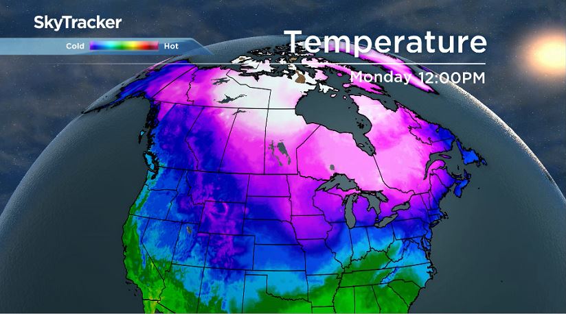
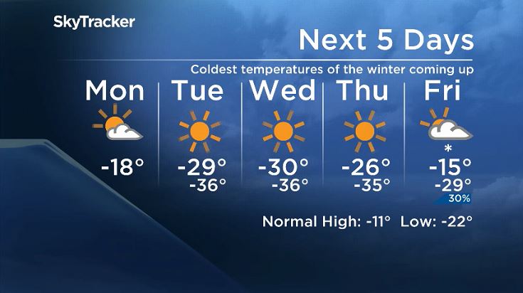
In all likelihood, this week will deliver the coldest temperatures and highest wind chill values of the winter.

Bitterly or brutally cold air is descending over the eastern prairies.
“This is clearly Siberian air. It’s come right over the top of the world and its made a beeline right though the heart of North America,” said David Phillips from Environment and Climate Change Canada told 680 CJOB Monday morning.
“It is one of the coldest moments of the winter.”
The forecast this week includes most nights with temperatures falling below -30 C, wind chill values in the -40s and even -50s, and daytime highs near -30 C.
Overnight temperatures are unlikely to break records for extreme cold but Wednesday afternoon could come close to the record for coldest maximum temperature on Jan 30. Currently the coldest maximum temperature record is -30.8 C registered in 2004. As for wind chill, with a value of -53 expected by Tuesday morning, it is among the highest ever recorded in Winnipeg.
While wind chill isn’t an exact measure, it is still a valuable tool as it describes the increased rate at which exposed skin cools in windy conditions.

Get breaking National news
The highest wind chill values recorded in Winnipeg appear to be -57 on Feb. 1, 1996 and -56 on Jan. 28, 1966.
Temperatures look like they will bottom out around the middle of the week before they start to warm up around the weekend. Extreme Cold Warnings are likely to linger around southern Manitoba and most of the province until much closer to the weekend.
“We think that this will be the coldest time of the winter and as we move into February, it looks like the beginning of February is going to be similarly cold and then I think it’ll break.
“We see some melting temperatures in February,” said Phillips.
While Winnipeg, southern Manitoba — well, really the entire province — has been dealing with significant cold weather lately, the daily mean temperature as of Jan. 28 is still slightly above normal.
The warmer days for the first two weeks have offset the recent cold stretch. As of Monday morning, Winnipeg’s daily mean temperature sits at -15.9 C and typically in January the city will average out to -16.4 C.


Comments