

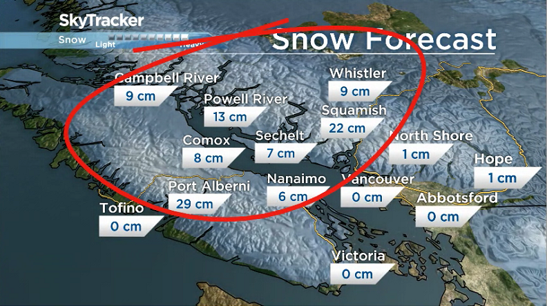
Parts of B.C.’s South Coast are very likely to see some snow Tuesday:

- Vancouver Island – Inland sections including Port Alberni and along the east coast, mainly north of Victoria.
- Howe Sound – Upper levels of the North Shore from West Vancouver all the way up to Whistler.
- Sunshine Coast
Snow is now moving across Vancouver Island and is expected to get heavier.
Snowfall amounts could be as high as 29 centimetres in Port Alberni and 22 centimetres in Squamish, but those are worst-case-scenario numbers.
The approaching Pacific frontal system will spread snow over Howe Sound and the Sea to Sky Highway from Squamish to Whistler by late morning and afternoon.
The snow will change to rain on Wednesday.
WATCH: (Aired Jan. 7, 2019) Certain parts of B.C.’s South Coast could see snowfall, with nearly 30 centimetres falling on Port Alberni. But that’s a worst-case-scenario forecast.

The Sea to Sky Highway will also be windy and could be a mess with whiteout conditions.
A wind warning has been issued for this area.

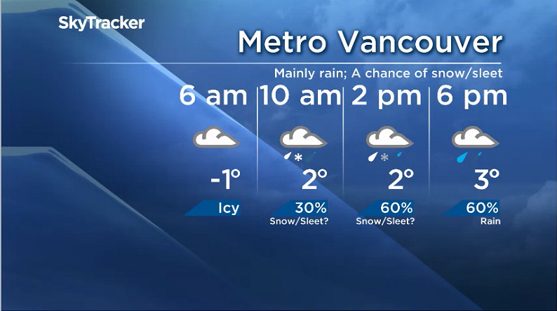
As for the Lower Mainland and Fraser Valley, there’s lots of uncertainly whether residents will see snow or sleet.


Get breaking National news
It is most likely going to be just a rain event that will see most of the moisture push in around 12 p.m. Tuesday.
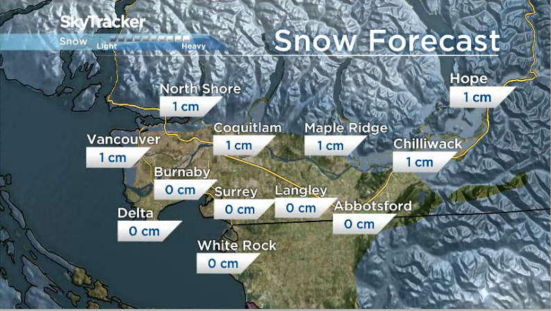
There is a chance, however, that some areas could see the moisture sooner and, therefore, some snow, wet snow or sleet is possible as early as 10 a.m.
Snowfall amounts will likely be minimal if people see any at all.
Of course, higher elevation areas such as Simon Fraser University have the best chance of seeing snowfall pile up on the ground.
Environment Canada has issued Special Weather Statements for a number of regions including Metro Vancouver, the Fraser Valley, Howe Sound, Greater Victoria and the Sunshine Coast.
Comments
Want to discuss? Please read our Commenting Policy first.