
Cold air injects in to start the first weekend of 2019 and then snow returns.

Saskatoon forecast
Friday
-13 is what it felt like to start the first Friday of 2019 as temperatures dipped back to -9 with fog patches reducing visibility to three kilometres at times.
Mostly cloudy skies through the morning helped heat us up to -4 heading into the noon hour as the fog fizzled.
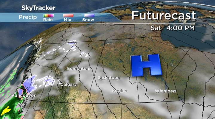
A wave of light snow is slated to slide through during the afternoon as we warm up to a daytime high just shy of the freezing mark.
Friday night
Snow lingers into the evening before easing overnight as conditions cool into minus double digits.
Saturday
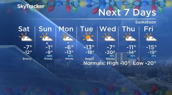
-18 is around what it’ll feel like with wind chill to start the weekend Saturday morning under mostly cloudy skies, which will stick around all day before clearing in the evening.
An arctic high pressure system sliding by to the northeast will keep things cool though, with an afternoon high only making it to around -7 and wind chills stuck in the minus teens all day.
Sunday
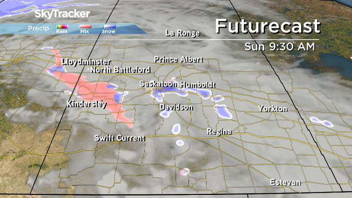
The next system is on deck for Sunday and will bring some snow early in the day that may linger into the afternoon before some late day clearing is possible.
Temperatures will also spike back up to finish the first weekend of 2019 with the mercury making it back up toward the freezing mark in the afternoon as a gusty southeasterly wind kicks in.


Work week outlook
Snow is likely to linger into Monday as cold air gets pumped back in before sunshine returns on Tuesday only to be displaced by another round of clouds with a risk of snow to finish off the week.
Daytime highs will bound back and forth between minus single digits and minus double digits until later in the week when they cool down below seasonal.
Patsy Polsfut took the Jan. 4 Your Saskatchewan photo in Biggar:

Saskatoon weather outlook is your source for Saskatoon’s most accurate forecast and is your one stop shop for all things weather for central and northern Saskatchewan with comprehensive, in depth analysis that you can only find here.
For weather on the go download the Global News SkyTracker Weather App for iPhone, iPad or Android.
- Posters promoting ‘Steal From Loblaws Day’ are circulating. How did we get here?
- Video shows Ontario police sharing Trudeau’s location with protester, investigation launched
- Canadian food banks are on the brink: ‘This is not a sustainable situation’
- Solar eclipse eye damage: More than 160 cases reported in Ontario, Quebec
Comments