

Freezing rain, snow and a big cool down as winter kicks off.

Freezing rain warning
Environment Canada has issued a freezing rain warning for the Saskatoon, Prince Albert, North Battleford and Meadow Lake areas for freezing rain sliding in Thursday night and lingering into Friday morning.
An approaching low pressure system will produce an area of freezing rain over west-central Saskatchewan late Thursday evening into the overnight hours.
The freezing rain will first start in the Lloydminster and Meadow Lake regions Thursday evening before tracking southeastwards towards Saskatoon and Prince Albert later in the evening and overnight.
Surfaces such as highways, roads, walkways and parking lots may become icy and slippery.
Special weather statement
Environment Canada has issued a special weather statement for Regina, Yorkton, Estevan and much of eastern and southern Saskatchewan for a low pressure system bringing a risk of freezing rain Thursday night into Friday.
An area of freezing rain is forecast to develop over central Alberta on Thursday evening that will spread from west-central Saskatchewan to southeastern Saskatchewan Thursday night through Friday.
Regina and Saskatoon, as well as many major highways including the Yellowhead, Highway 11, and the Trans-Canada Highway between Regina and Brandon, look to be at risk for seeing some amounts of freezing rain overnight into Friday.

There is still some uncertainty in the exact track of this band of freezing rain, but it should become apparent as the system develops in Alberta.

Get daily National news
For the latest weather alerts download the Global News SkyTracker Weather App for iPhone, iPad or Android.
Saskatoon forecast
Thursday
-17 is what it felt like with wind chill to start the day as temperatures dove into minus double digits by a few degrees under mostly clear skies.
Beautiful sunshine stuck around through the morning as we warmed into minus single digits before noon.
High clouds roll in during the afternoon as a system and set of fronts approaches, helping to push the mercury toward the freezing mark.
Thursday night
Clouds continue to roll in with the risk of freezing rain rolling into the city Thursday night as temperatures fall back into mid-minus single digits before warming toward the freezing mark.
Friday
Brace for a slippery start to the day Friday morning with the potential for ice on surfaces that could be below freezing as the showers slide out of the area.
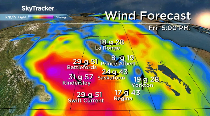
Some sunny breaks are possible midday before clouds roll back in with a chance of snow late in the day through the evening as west-northwesterly winds kick in behind the cold front with gusts up to 60 km/h possible.
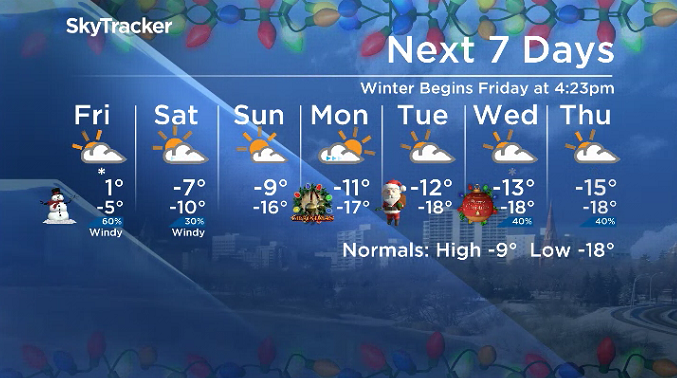
Winter officially begins at 4:23 p.m. CT amidst the busy weather day as temperatures sit around the freezing mark before cooling into mid-minus single digits at night with a chance of flurries.


Weekend
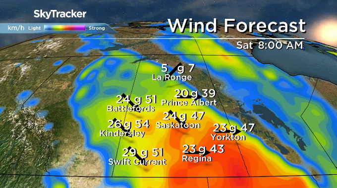
After the chance of some lingering snow early Saturday, clouds will clear out and temperatures are set to stay in mid-minus single digits before falling into minus double digits in the evening.
Sunday should start off sunny and cool with a morning low in the minus teens and a daytime high scraping to get out of minus double digits with some clouds rolling in later on.
Christmas outlook
Clouds will roll back in on Christmas Eve and could stick around at times for Christmas Day with the potential for some sunny breaks before a chance of snow slides in for Boxing Day.

Daytime highs will be stuck in minus double digits through the period with overnight lows in the mid-minus teens and morning wind chills in the mid -20s, so get ready to bundle up this Christmas!
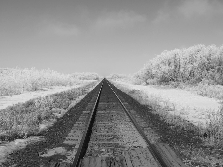
Ariane Muirhead took the Dec. 20 Your Saskatchewan photo in Ituna:
Saskatoon weather outlook is your source for Saskatoon’s most accurate forecast and is your one stop shop for all things weather for central and northern Saskatchewan with comprehensive, in depth analysis that you can only find here.
For weather on the go download the Global News SkyTracker Weather App for iPhone, iPad or Android.
Comments
Want to discuss? Please read our Commenting Policy first.