

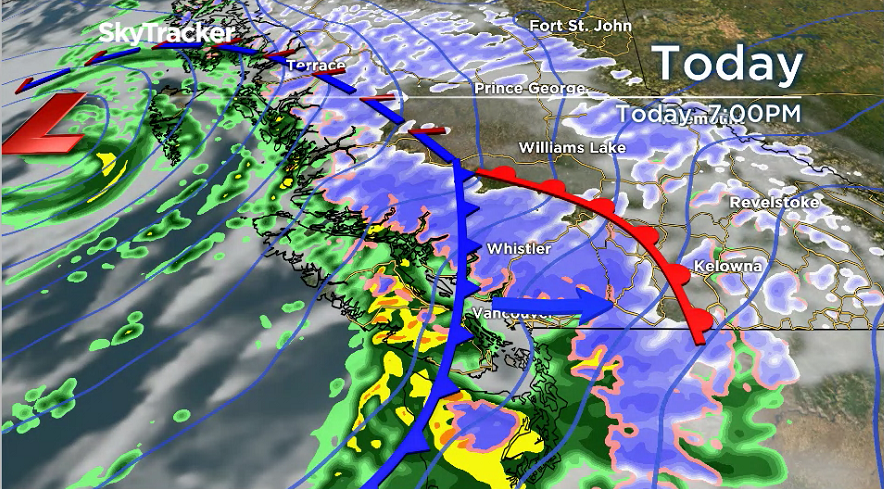
Monday’s wind event is very different from the situation that Lower Mainland residents experienced last Friday.

A cold front will cross the South Coast on Monday.
Cold fronts can affect much larger regions as they pass — therefore, the Lower Mainland will very likely be hit.
Friday’s storm was a small, very intense, low-pressure centre.
These can produce very strong gusts over a small region but they can also easily shift their paths and that is exactly what happened.
Seattle was hammered with gusts up to 95 km/h as the low shifted south. That left tens of thousands of homes without power overnight.
Now today, the winds are already starting to pick up.
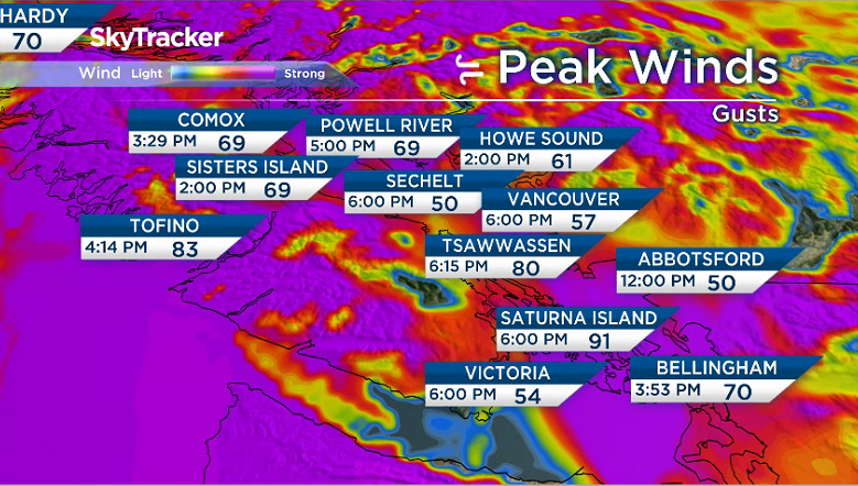


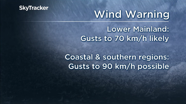
The strongest winds will occur between 6:00 p.m. and 10:00 p.m. All parts of Metro Vancouver and West Fraser Valley will likely see gusts to 70 km/h, but the strongest winds will occur along the water and south of the Fraser River from Tsawwassen out to Abbotsford.
It is possible these areas could see gusts up to 90 km/h. Power outages are very likely.
The winds will ease off near midnight Monday night.

Get daily National news
The next wind and rain storm to be aware of is set for Thursday, so stay tuned.
Kristi Gordon is the senior meteorologist for Global BC.
Comments
Want to discuss? Please read our Commenting Policy first.