

Century-old cold record shattered as snow slides in to start October.

Cool and wet September
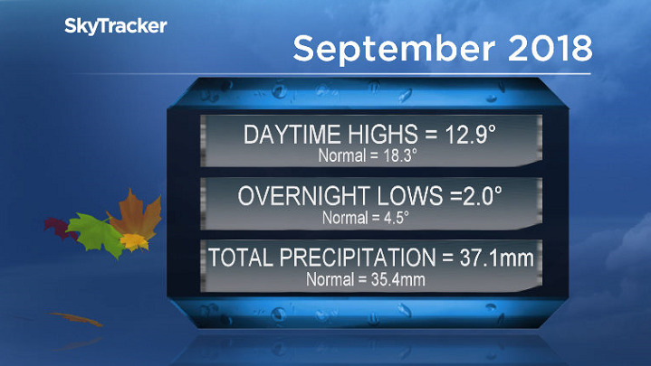
September 2018 was way colder than normal in Saskatoon with temperatures trending a whopping four degrees cooler than normal overall.
Most of that was on the daytime high side of the scale with the mercury averaging out an impressive 5.4 degrees cooler than seasonal with overnight lows 2.5 degrees below normal.
The final day of the month was the coldest ever record in Saskatoon with the mercury plunging back to -8.7 C breaking a century old record of -8.3 C from 1918.
A total of 37.1 millimetres of rain and melted snow fell at the airport throughout the month, which is 105 per cent of the normal amount of 35.4 millimetres that’s seen on average in September.
Saskatoon forecast
Monday
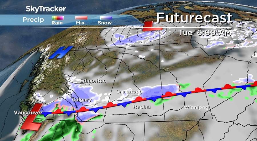
October kicked off on a snowy note in Saskatoon with light snow falling for the entire first half of the day creating sloppy and slippery road conditions for the Monday morning commute.
Temperatures slid back below freezing overnight before making it up above zero before noon.
Light snow will continue to fall through the afternoon as we struggle to make our way up to an afternoon high just a few degrees above freezing.

Get daily National news
Monday night
Clouds stick around Monday night with snow starting back up after a brief break expected in the evening as we cool back below freezing overnight.
Tuesday
-7 is what it’ll feel like on your skin with wind chill as you head out the door Tuesday morning with some light flurries possible.
The risk of snow diminishes through the day, but mostly cloudy skies will linger as we warm up to an afternoon high around 4 C.


Wednesday-Friday
The main front that the snow is being squeezed out along will swing south as cooler air drops in for the rest of the first week of October as clouds slide in and out with just a slight chance of flurries at times.
Daytime highs will continue to make it into mid-single digits, but at night temperatures will fall fast when skies are clear with morning lows dropping down as cool as -8 with minus double digits wind chills Thursday morning.
Thanksgiving long weekend outlook
Another weather shake-up is on the way for Thanksgiving long weekend with partly to mostly cloudy skies and a slight chance of snow at times as cooler air drops in and knocks daytime highs back from mid-single digits Saturday and Sunday toward the freezing mark for Thanksgiving Day on Monday.

Hamilton Greenwood took the Your Saskatchewan photo for Oct. 1 near Candle Lake:

Saskatoon weather outlook is your source for Saskatoon’s most accurate forecast and is your one stop shop for all things weather for central and northern Saskatchewan with comprehensive, in depth analysis that you can only find here.
For weather on the go download the Global News SkyTracker Weather App for iPhone, iPad or Android.
Comments
Want to discuss? Please read our Commenting Policy first.