
The heaviest one-day rain event Kelowna has recorded all summer hit the area on the final full day of the season on Friday with 17.5 millimetres reported during the day.

The soggy end to the season was followed by some lingering showers to start fall this weekend with daytime highs in the mid-teens.
After a cloudy start to the first work week of fall, sunshine started to poke back through during the day on Monday as temperatures hopped up from 10 degrees into the mid-to-upper teens in the afternoon.

Get breaking National news
Skies will further clear Monday night with a risk of frost in low-lying areas as conditions cool down to just a few degrees above freezing.
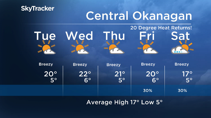
Beautiful blue skies and sunshine will be back in full swing on Tuesday, helping heat things up into the upper teens through the Central and North Okanagan, potentially pushing into the 20s in the South Okanagan.


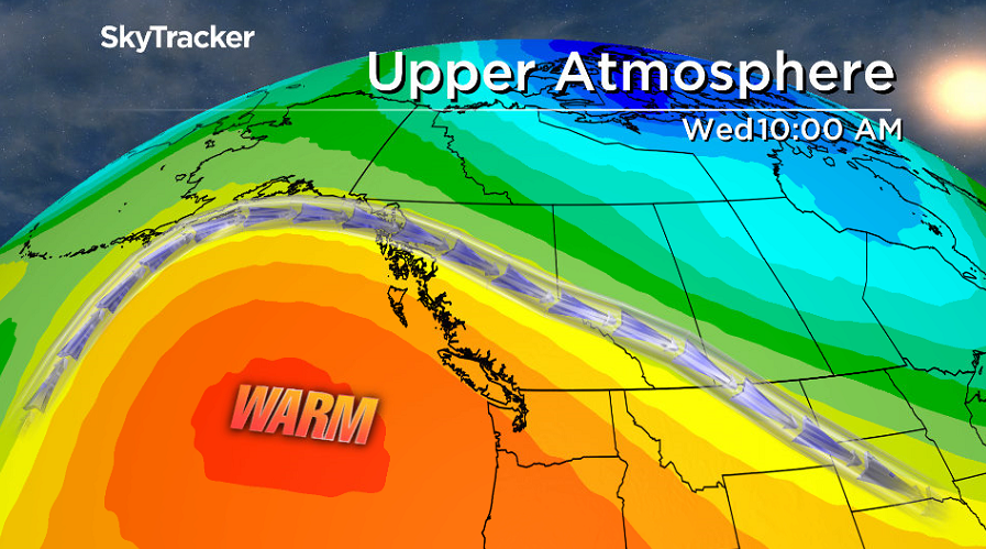
The upper ridge of high pressure building in from off the coast of Vancouver Island will slide in even warmer weather on Wednesday and Thursday with afternoon highs making it safely into the 20s.
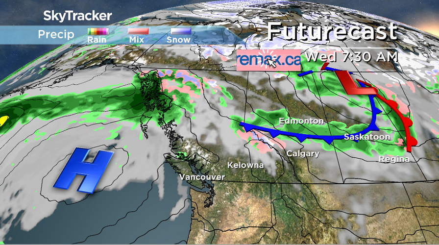
Partly to mostly sunny skies will dominate the middle of the work week with breezy winds at times, but the sunny days won’t last for too long.
The ridge starts to break down this weekend as cloud cover rolls back in with a good chance of rain Sunday into Monday.
Daytime highs should manage to hold out close to 20-degree heat to finish the final work week of September on Friday before falling back into the mid-teens for the weekend.
For weather on the go download the Global News SkyTracker Weather App for iPhone, iPad or Android.


Comments