
A smoky skies bulletin and special air quality statement is in effect for the entire Okanagan Valley and Shuswap for wildfire smoke reducing air quality.

Smoky conditions can change rapidly over a short distance, varying hour-by-hour, so they are advising anyone having difficulty breathing to remain indoors with windows closed.
The special air quality statement has been in effect for the Central and South Okanagan for over a week, which is unprecedented for a weather alert.
Smoke filling into the Okanagan Thursday is being reported by the BC Wildfire Service as being from fires in Greece, Finland and Siberia.
WATCH: Greece seeks survivors and answers after wildfire

Despite the smoke, temperatures are still bounding into the mid-30s on Thursday and Friday under mostly sunny skies and dry conditions.

The peak of the heat will be reached Sunday and Monday as the Okanagan hops into the heart of a massive upper ridge of high pressure that is swinging into BC.

Daytime highs will spike up to 36 or 37 degrees both days under sunny skies with relative humidity values plunging into the mid-teens, which is tinder dry.
WATCH: Greece wildfire survivors share their stories

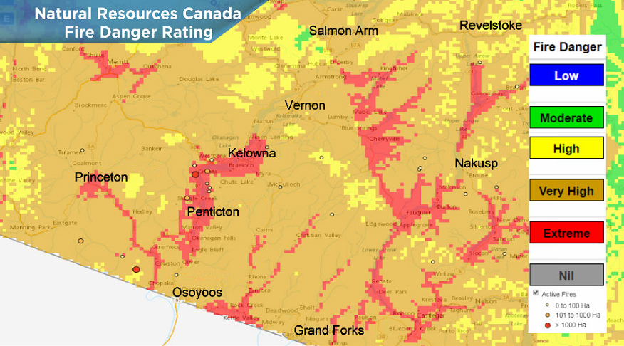
As a result of the dry conditions, the fire danger rating has worsened to extreme across the Okanagan, which is the highest level possible.

Extreme fire danger means that fires will spark up and spread easily, so be sure to be extra cautious over the weekend when venturing outside.
There is no lightning in the immediate forecast, however there is a risk of a shower or thunderstorm on Tuesday and Wednesday as slightly cooler air begins to press in.

For weather on the go download the Global News SkyTracker Weather App for iPhone, iPad or Android.
Comments