

There is not much relief in the forecast for crews fighting fires in the Okanagan.

In fact, the weather will be almost the opposite of what would be wanted for a successful fire fight.
WATCH BELOW: Hot, dry and sunny forecast ahead next week in the Okanagan

More dry conditions, breezy winds and potentially lightning is in the forecast ahead.
Environment Canada has issued a special air quality statement for the Central, South and North Okanagan for smoke causing poor air quality and reducing visibility.
If you are experiencing difficulty breathing, find an indoor place that is cool and ventilated.

Get daily National news
The agency recommends leaving windows closed and using an air conditioner that cools and filters air.
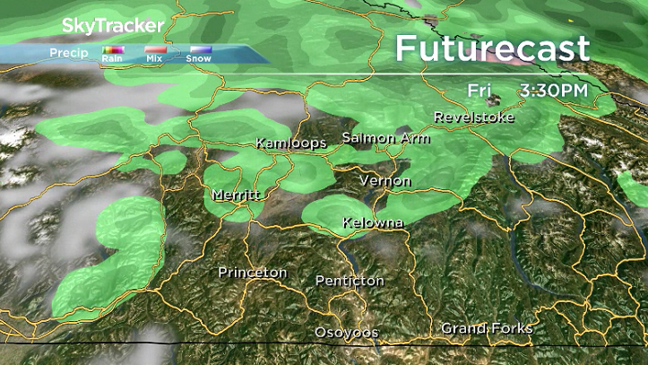
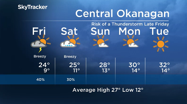
Sunshine will start the day on Friday, but a cold front swinging in will come with a risk of thunderstorms, potentially bringing in more lightning.
Breezy winds are also expected ahead of and behind that front with gusts upwards of 40 km/h possible.


The good news is that temperatures will be a bit cooler on Friday, which may help inhibit fire spread slightly.
Daytime highs will be back in the mid-20s both Friday and Saturday as a result of some of the sun’s rays getting trapped by smoke, with a slight chance of late day storms on Saturday.
A southwesterly winds is expected to blow thick smoke into the Central Okanagan on Friday, but behind the cold front will be more of a west-northwesterly flow pattern, helping push smoke to the east.
Another big warm up kicks in on Sunday with a return to mostly sunny skies and daytime highs in the upper 20s before an upper ridge pushes highs up even further, into the low 30s early next week.
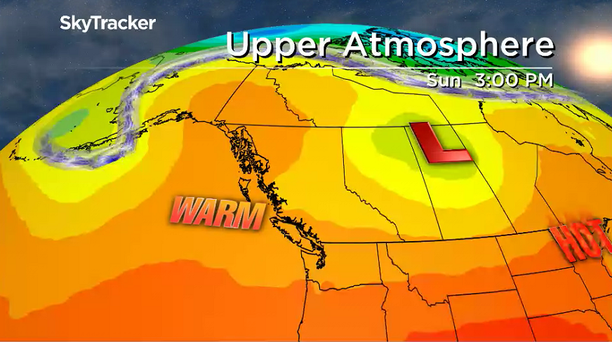
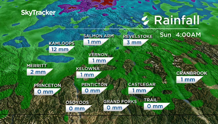
There is no significant precipitation expected right into next week, with the continuation of dry conditions and hot temperatures likely to raise the fire danger rating to extreme in most areas.
For weather on the go download the Global News SkyTracker Weather App for iPhone, iPad or Android.
Comments
Want to discuss? Please read our Commenting Policy first.