

Risk of severe thunderstorms as the hottest air of the year so far gets kicked out.

Severe Thunderstorm Watch
Environment Canada has issued a severe thunderstorm watch for the Saskatoon, Prince Albert, North Battleford, Melfort, Kindersley, Nipawin and Hudson Bay areas.
Conditions are favourable for the development of severe thunderstorms that may be capable of producing strong wind gusts, large hail and heavy rain.
Thunderstorms are forecast to develop Wednesday in central Saskatchewan as a low pressure system tracks into the area.
Some of these thunderstorms may become severe during the afternoon and evening as the environment becomes increasingly unstable.
For the latest weather alerts download the Global News SkyTracker Weather App for iPhone, iPad or Android.
Saskatoon Forecast
Wednesday
The hottest day so far this year on Tuesday with temperatures sizzling up to 34.6 degrees, Saskatoon cooled off overnight into the mid-teens.
Mostly cloudy skies started off the day with a few mid-morning sunny breaks before some showers swept in before noon as we warmed up into the mid-20s with humidex values into the 30s by 10 a.m.
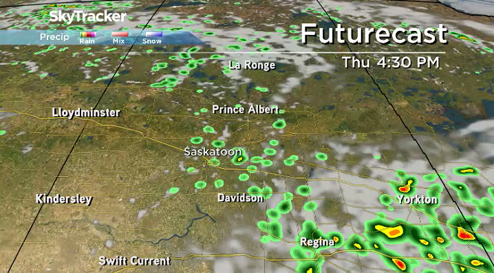
There is the risk of a severe thunderstorm in the city with more scattered showers during the afternoon and early evening as we heat up toward the 30s, which will feel like the mid-30s with humidity.
Wednesday Night
The risk of showers and thunderstorms subsides during the evening and clouds clear out over the area overnight as the mercury falls back into the mid-teens.
Thursday
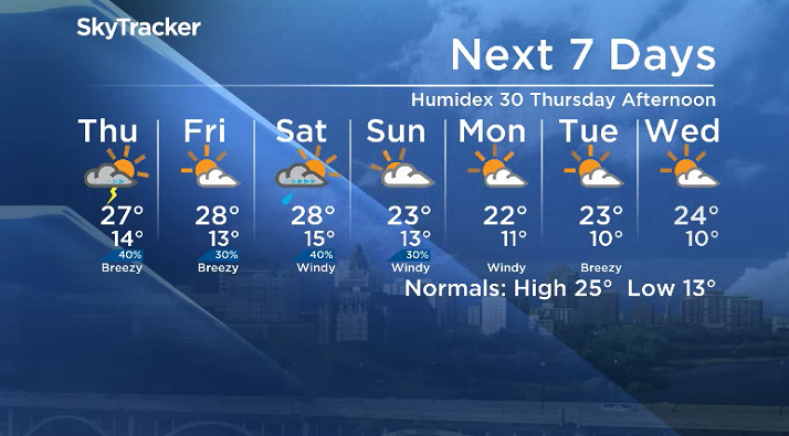
Slightly cooler air will slump in behind the system that brought in the unsettled day on Wednesday with northerly winds keep conditions cool with an afternoon high stuck in the mid-20s.
A mix of sun and cloud will start off the day with a chance of showers and thunderstorms in the afternoon, but despite the slightly cooler temperatures, it’ll feel like 30 in the afternoon with humidity.
Friday
The next system swings into Alberta on Friday and will bring some evening showers and thunderstorms to western Saskatchewan with just a slight chance for the Saskatoon area under a mix of sun and cloud.
Temperatures should climb up a bit further during the day with an afternoon high headed for the upper 20s with humidex values making it feel around 30.


Weekend Outlook
That system will sweep into Saskatchewan this weekend with a chance of showers and thunderstorms with partly to mostly cloudy skies.
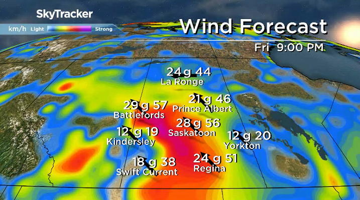
Daytime highs will drop from the upper 20s on Saturday to the low-to-mid 20s Sunday as a cold front sweeps in and kicks up windy conditions for yet another weekend.
Dre Erwin took the July 18 Your Saskatchewan photo in Pinehouse:

Saskatoon weather outlook is your source for Saskatoon’s most accurate forecast and is your one stop shop for all things weather for central and northern Saskatchewan with comprehensive, in depth analysis that you can only find here.
- Toronto Pearson gold heist: Ontario man arrested at airport after arriving from India
- Capital gains changes could have ‘irreversible’ effects, business groups warn
- ‘FLiRT’ COVID-19 subvariant dominant in Canada. What to know about the strain
- After tornado outbreaks in the U.S., could Canada see similar storms?
Comments