
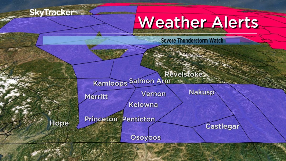
Environment Canada has issued a severe thunderstorm watch for the Okanagan, Shuswap and Boundary regions.

Conditions are favourable for the development of severe thunderstorms that could produce heavy rain.
The strong upper ridge of high pressure that brought in the heat this week has moved into Alberta, causing the airmass to become moist and unstable over the BC Interior.
The main thunderstorm threat will be rainfall rates of up to 25 mm in an hour due to the slow motion of the storms, however strong wind gusts are also possible.


Intense lightning is likely with any thunderstorm that develops and heavy downpours can cause flash floods and water pooling on roads.
For the latest weather alerts download the Global News SkyTracker Weather App for iPhone, iPad or Android.
- Posters promoting ‘Steal From Loblaws Day’ are circulating. How did we get here?
- Video shows Ontario police sharing Trudeau’s location with protester, investigation launched
- Canadian food banks are on the brink: ‘This is not a sustainable situation’
- Solar eclipse eye damage: More than 160 cases reported in Ontario, Quebec
Comments