

All politics is local, or so we’re told. Elections certainly express themselves in a telling level of local detail.

Ontario’s provincial election is the first where detailed poll-level data has been available on election night, as opposed to a week or two afterward. Here, we’ve used it to tell the stories of Ontario’s dramatic election.
Not all polls had reported when we prepared the maps, but enough have to give a general idea. Our 2014 maps use an overlay of the 2018 ridings.
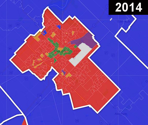
Guelph
Guelph elected Ontario’s first Green MPP, party leader Mike Schreiner. In the end, it wasn’t all that close, as you can see below. The Greens followed a strategy similar to the one that’s worked for them federally: focusing on one riding instead of dissipating effort and not winning any seats. (The Greens got 354,000 votes in Ontario’s 2007 election, but won no seats at all.)
WATCH: Following the majority government win by the Progressive Conservatives, Eric Sorensen takes a look at the new make-up of Queen’s Park when the new government returns to the legislature.

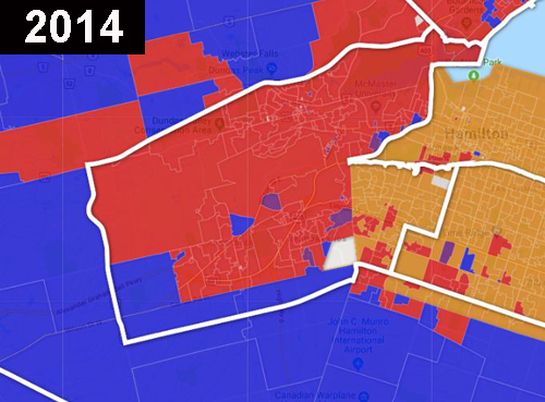
Hamilton West-Ancaster-Dundas
It was going to be interesting to see where Hamilton West-Ancaster-Dundas, a new riding created in the last redistribution, went in this election. It was cobbled together out of part of Hamilton Mountain, reliably NDP, and Ancaster and Dundas, which traditionally vote either Liberal or NDP.
In the end, Ancaster voted PC, but Dundas joined Hamilton Mountain in voting NDP, swinging the riding to the NDP.


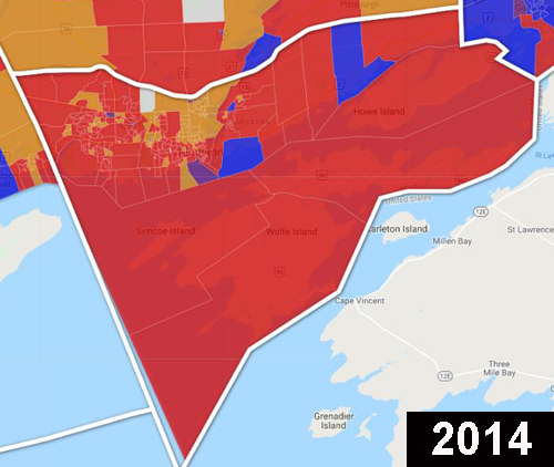
Kingston and the Islands

Get daily National news
Kingston’s 2018 map is unrecognizable, compared to 2014. It becomes one of a few NDP outposts in eastern Ontario,.
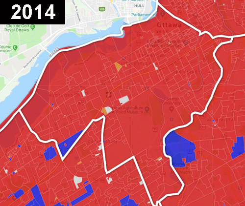
Ottawa Centre
As expected, Ottawa Centre swung to the NDP. Andrea Horwath had fought hard for the seat, as the party’s likeliest pickup in the Ottawa area.
WATCH: Ipsos CEO Darrell Bricker called the 2018 Ontario Election results as the “revenge of the commuters” after a majority of rural voters turned to the Conservatives.

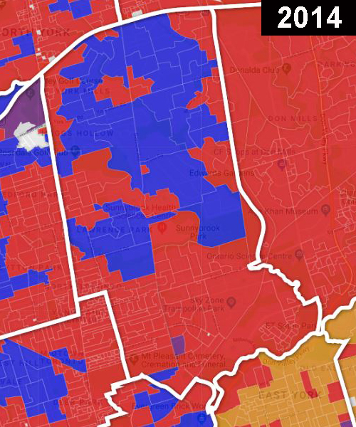
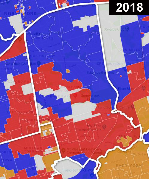
Don Valley West
Liberal leader Kathleen Wynne was re-elected in a nail-biter finish that in the end was settled by fewer than 200 votes, after the very last poll reported. Don Valley West moved west in a recent redistribution, changing its political personality but not its name. The shift favoured the PCs, adding Tory polls and dropping Liberal ones. (The map below shows the 2018 boundaries on the 2014 results.)
The political divisions in the riding are related to income, with high-income Tory polls in the north of the riding, and more mixed-income polls to the south.
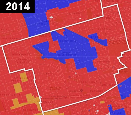
St. Paul’s
St. Paul’s, an upscale midtown Toronto riding traditionally thought of as an impregnable Liberal stronghold, fell to the NDP in a three-way race. Once a solid brick of red with a few Tory polls in the wealthy Forest Hill area, the neighbourhoods to the south and west, and along Yonge St., opted for the NDP.
Ford Nation turned out for the PCs
In Toronto, PC polls have a strong relationship to polls won by Doug Ford when he was a mayoral candidate in the city in 2014 – northern Etobicoke, Scarborough and, to a lesser degree, North York. The maps raise questions about whether the federal Conservatives can hope for inroads in the 416 area code, until recently a bastion of Liberal and NDP support, in 2019.
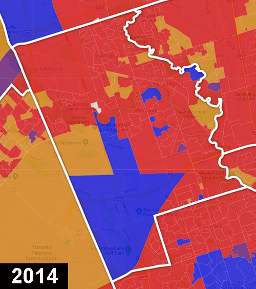
Etobicoke North
Etobicoke North was reliably Liberal for many years. When PC leader Doug Ford ran there, some wondered if he was taking a risk, notwithstanding his family’s political dynasty in that part of the city. How did that turn out? Have a look at the maps:
Comments