

First thunderstorms of 2018 roll into the Saskatoon area ahead of a cool down.

Weather Advisory for Funnel Clouds
Environment Canada has issued a weather advisory in the Biggar, Kindersley, Rosetown, Leader, Shaunavon and Swift Current areas for conditions favourable for the development of funnel clouds Tuesday.
A low pressure system moving through the area may bring funnel clouds Tuesday afternoon and early evening.

These types of funnel clouds are generated by weak rotation under rapidly growing clouds or weak thunderstorms and the weak rotation is normally not a danger near the ground, however, there is a chance that this rotation could intensify and become a weak landspout tornado.
Treat any funnel cloud sighting seriously and if a funnel cloud develops nearby, prepare to take shelter.
These funnel clouds usually appear with little or no warning.
For the latest weather alerts download the Global News SkyTracker Weather App for iPhone, iPad or Android.
Saskatoon Forecast
Tuesday
Single digits was where Saskatoon started out the day with southeasterly winds gusting upwards of 30 to 40 km/h.
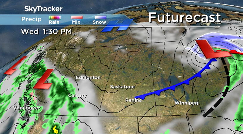
Mostly cloudy skies lingered through the morning as we made our way up to the high teens before noon as rain and a few embedded thunderstorms began moving into western Saskatchewan.
READ MORE: Extreme fire danger across Saskatchewan

Get breaking National news
Rain and some embedded thunderstorms will roll into Saskatoon during the afternoon with a disturbance pushing in after we climb up to an afternoon high around 20 degrees.
Tuesday Night
Clouds, showers and thunderstorms slide out Tuesday evening as mostly clear skies move in overnight as we cool back toward the freezing mark as strong 30 km/h northerly winds kick in with gusts upwards of 50 km/h.

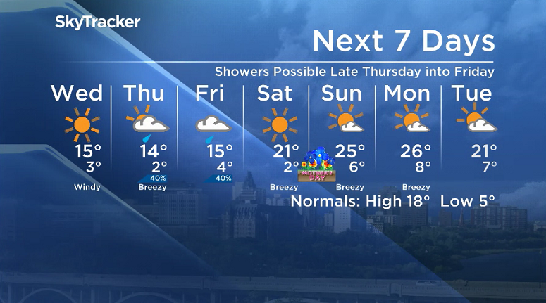
Wednesday


Winds will remain brisk behind the cold front swinging through early Wednesday before easing during the day as cooler air settles in with an afternoon high only making it into the mid-teens.
Blue skies and sunshine will be back as high pressure nudges in, keeping skies clear until evening when clouds start moving back in.
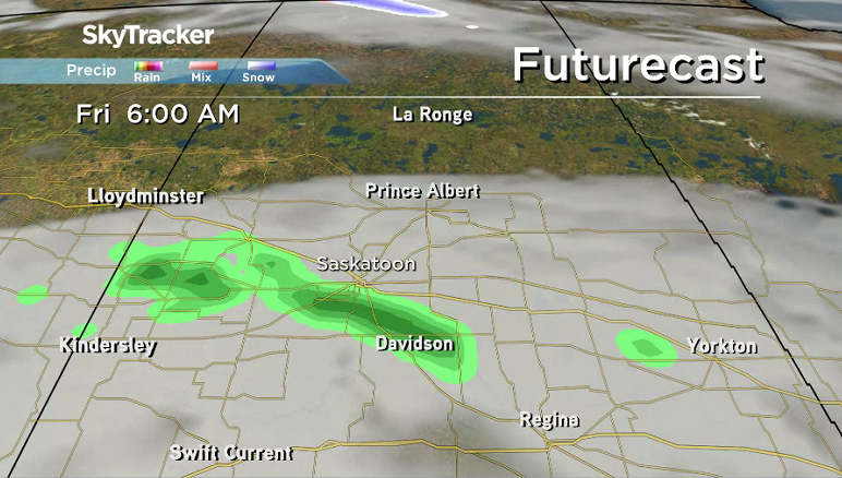
Thursday-Friday
Clouds will be back in full force Thursday and Friday as a slow-moving upper-level low pressure system pushes in and brings with it a chance of rain, particularly late Thursday and into Friday.
Daytime highs will struggle to get into the mid-teens both days as cooler air settles in for the rest of the week.
Weekend Outlook
Mother’s Day weekend will mark a return of the upper ridge, which will bring back sunny skies and heat with daytime highs in low-20s on Saturday and into the mid-20s Sunday.
Trevor Thoms took the May 8 Your Saskatchewan photo at Pike Lake:

Saskatoon weather outlook is your source for Saskatoon’s most accurate forecast and is your one stop shop for all things weather for central and northern Saskatchewan with comprehensive, in depth analysis that you can only find here.


Comments