

Extreme fire danger in Saskatoon and across Saskatchewan with tinder dry conditions.

Saskatoon Forecast
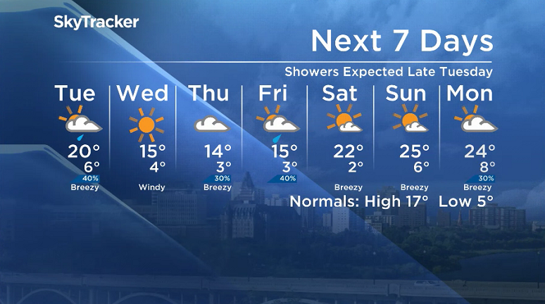
Monday
After the hottest day so far this year on Sunday with temperatures skyrocketing up to 28 degrees, warm air continues to flow into the work week with the mercury only falling to 8 degrees Monday morning.
Mostly cloudy skies started the day, but that didn’t put a damper on daytime heating – temperatures climbed all the way into the 20s by mid-morning with scattered showers around the region.
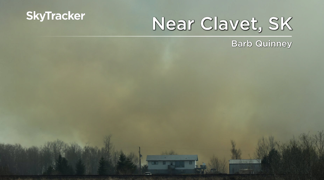
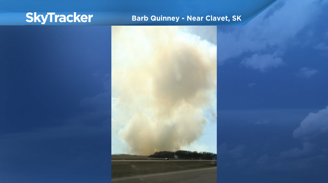
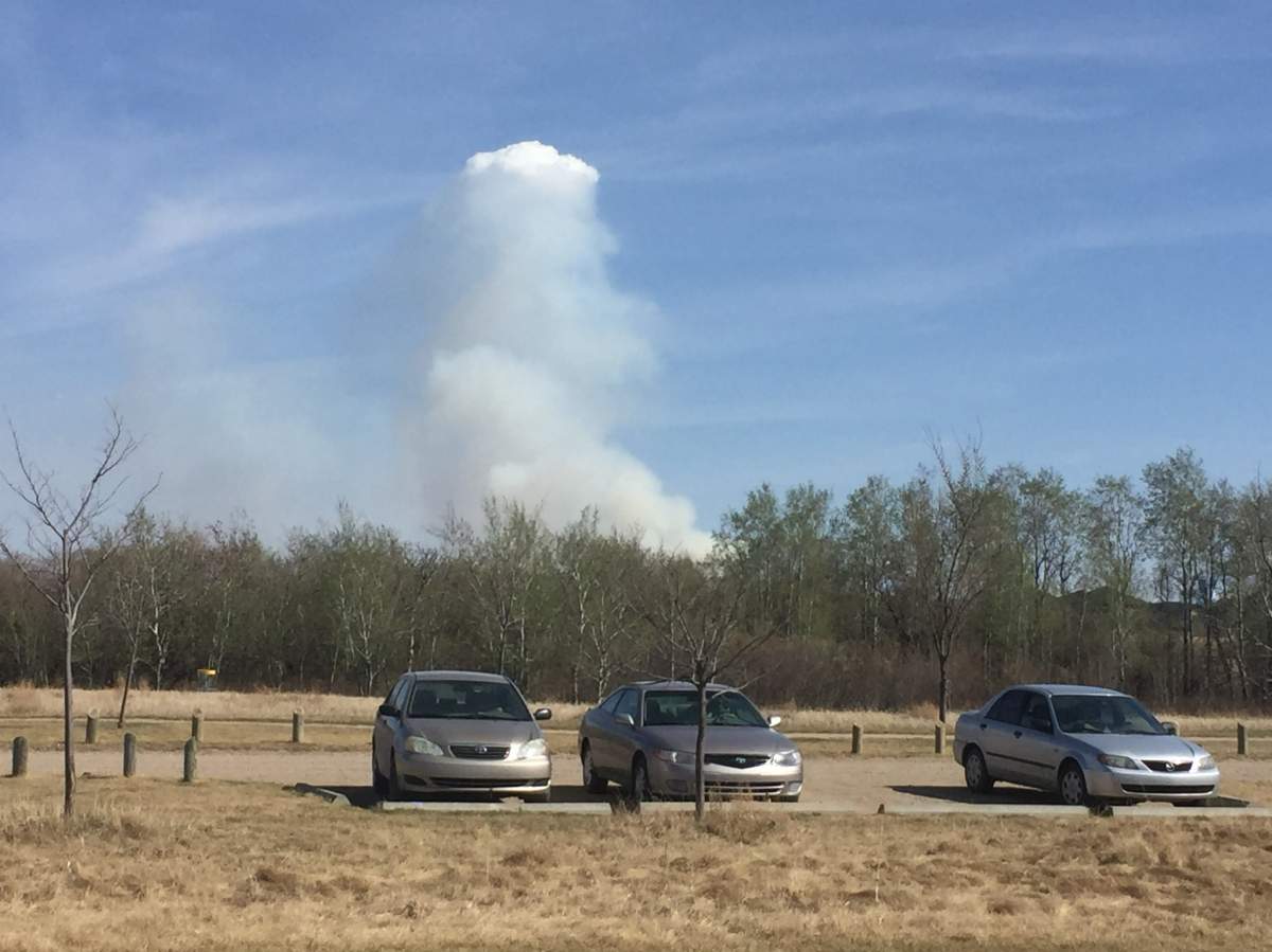
Bone dry conditions continue across Saskatchewan with relative humidity dropping into the teens at times and an extreme fire danger reported, meaning fires that spark up will be high intensity, fast moving and very difficult to control.
Mostly cloudy skies with a slight chance of an isolated shower stuck around for the remainder of the day as we sat in the mid-20s for the rest of the day.


Get daily National news
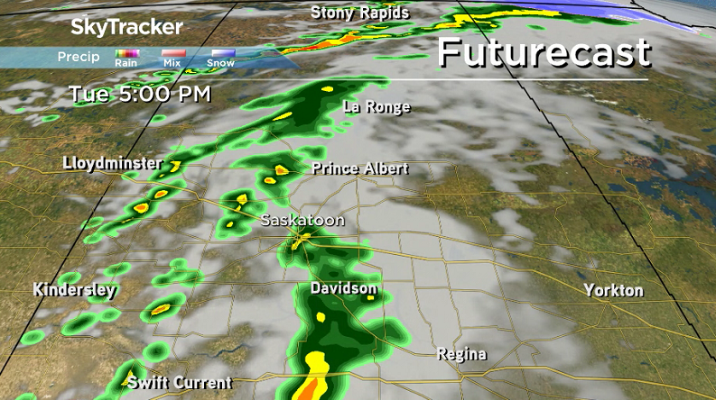
Tuesday
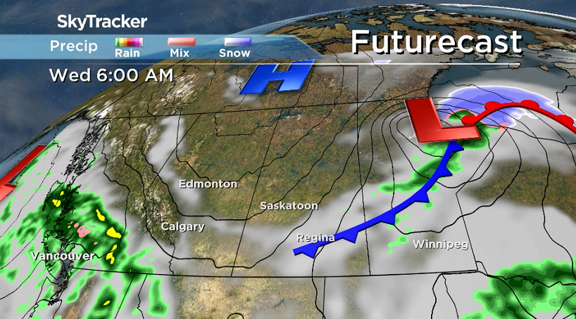
A breezy south-southeasterly wind will start the day Tuesday as clouds roll back in with a good chance of late day showers as a wave of instability passes through.
Temperatures will climb into the upper teens by noon before pushing up even further toward the 20s for an afternoon high.
Wednesday-Friday
A system bringing through a cold front will drop daytime highs back into the mid-teens for the rest of the week with breezy winds right up until Friday.
A sunny day is on the way Wednesday before a system nudging up from the south brings back the clouds for the remainder of the week with a slight chance of showers – but no significant rainfall is expected.
Weekend Outlook
Another upper ridge of heat builds in this weekend, bringing back blue skies and sunshine and pumping back in daytime highs in the 20s.
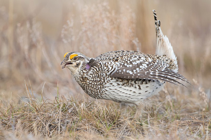
The May 7 Your Saskatchewan photo of a sharp-tailed grouse doing its spring mating ritual dance was taken by Hamilton Greenwood near Prince Albert:
Saskatoon weather outlook is your source for Saskatoon’s most accurate forecast and is your one stop shop for all things weather for central and northern Saskatchewan with comprehensive, in depth analysis that you can only find here.
Comments
Want to discuss? Please read our Commenting Policy first.