Special Weather Statement

Environment Canada has issued a special weather statement for Saskatoon, Prince Albert and parts of central and southern Saskatchewan for up to 10 centimetres of snow on Tuesday.
A slow-moving low pressure trough will spread showers into western Saskatchewan Monday evening, which will turn to snow overnight as it moves east towards Highway 2 with a risk of freezing rain possible during the transition.
On Tuesday, most of the precipitation will take the form of snow, with five to 10 cm forecast over much of central and south-central Saskatchewan.
There may be locally heavier snow bands that develop giving more than 10 cm in some areas.
The agency says that the situation will be monitored closely, and warnings will be issued if necessary.

Get breaking National news
For the latest weather alerts download the Global News SkyTracker Weather App for iPhone, iPad or Android.
Saskatoon Forecast
Monday
Light rain wrapped up the weekend late Sunday and into early Monday before partly to mostly cloudy skies moved in to kick off the work week with wind chills around -7 and temperatures just below freezing.
A warm east-southeasterly wind picked up to gusts upwards of 40 to 50 km/h during the morning as we warmed up to -3 before noon under mostly cloudy skies.
Clouds stuck around for the rest of the day as we continued our climb up into mid-single digits for an afternoon high.
Tuesday
Snow will be falling with heavier pockets as you head out on Tuesday, which will continue into the middle of the day before easing off during the afternoon.
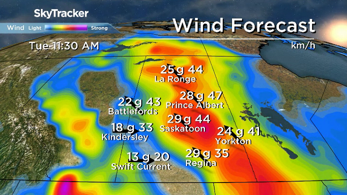
Southeasterly winds will remain brisk during the day, around 30 km/h with gusts in excess of 50 km/h as we rise up to an afternoon high a few degrees above freezing.
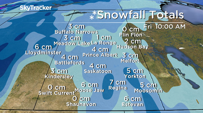
Another band of snow will swing through Tuesday night, but snowfall totals will hard to pinpoint due to a number of factors, including the warm ground, but 3 to 6 centimetres is possible in the city.
Wednesday-Friday
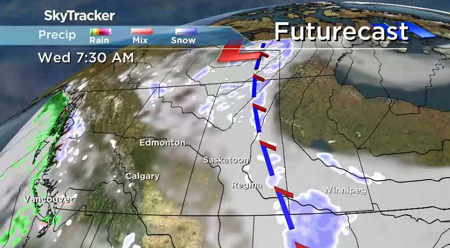
Snow may linger into early Wednesday morning in eastern Saskatchewan where upwards of 10 centimetres of total accumulation is possible with lingering cloud cover across the region that’ll clear out in the city during the afternoon.
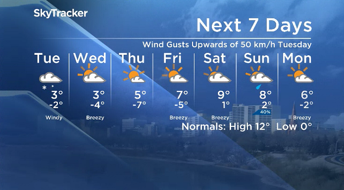
Sunshine with just a few passing clouds will dominate the remainder of the week with afternoon highs springing up from a few degrees above freezing Wednesday up into mid-single digits Thursday and Friday.
Weekend Outlook
A kick of heat is expected ahead of the next system swinging by north of the area later this weekend, which should help push afternoon highs toward double digits under mostly cloudy skies with a chance of showers on Sunday.
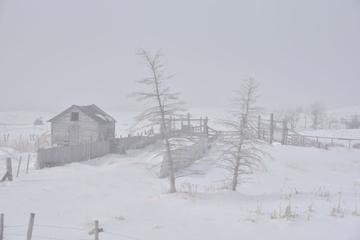
The April 16 Your Saskatchewan photo was taken near Pilger by Diane Zilkowsky:
Saskatoon weather outlook is your source for Saskatoon’s most accurate forecast and is your one stop shop for all things weather for central and northern Saskatchewan with comprehensive, in-depth analysis that you can only find here.





Comments