

Winter blast on the way with another dose of snow.

Special Weather Statement
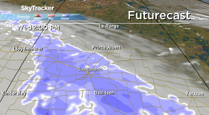
Environment Canada has issued a special weather statement for Saskatoon and parts of central Saskatchewan for an Alberta Clipper bringing a swath of five to 10 centimetres of snow.
It will begin early Wednesday morning and taper off Wednesday evening with highest accumulations between Highway 16 and Kindersley in western regions, and between Highway 16 and Highway 1 in eastern regions.
Snow will start early Wednesday morning over the Battlefords and Kindersley regions as this clipper exits Alberta with snow will starting over the Humboldt region later in the morning before tapering off over western regions in the afternoon and over eastern regions in the evening.
There will also be a slight risk of freezing rain over southwestern sections along Highway 1 early Wednesday morning.
Road conditions may become hazardous due to falling and accumulating snow.
If travelling, please take your time if conditions deteriorate and reference the local forecasts for more details.
Motorists planning to head out on roads are advised to use caution and check in with Saskatchewan Highway Hotline before heading out.
Saskatoon Forecast
Tuesday
Fog and mist started our day as temperatures slid back to 12 degrees with wind chills down as cool as -18 to start.
Beautiful blue skies and sunshine kicked in for the morning, which helped warm us up into mid-minus single digits before noon.
A few more clouds filtered through during the afternoon as we rose up to a daytime high a few degrees above freezing for the first time this month.

Get breaking National news
Wednesday
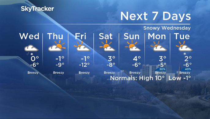
Snow will fall heavily at times during the day on Wednesday as an Alberta Clipper, a fast moving low pressure system, moves through the province.
4 to 6 centimetres is possible in Saskatoon with locally heavier amounts possible in parts of central Saskatchewan as we climb up to an afternoon high around the freezing mark.


Winds won’t be too strong with this system, only picking up to 20 km/h with gusts upwards of 30 to 40 km/h at times.
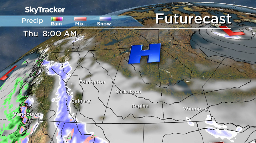
Thursday-Friday
We could catch a few sunny breaks to start the day on Thursday before clouds roll back in as we climb up to an afternoon high likely just shy of the freezing mark.
Friday may start out with some sunny breaks as well before another round of clouds slide back in and we once again clamber our way up toward freezing.
Weekend Outlook
Clouds will continue to swing in and out over the weekend, but the big story will be the temperatures, which will spring up above freezing in the afternoon before more clouds return for the work week.
Saskatoon weather outlook is your source for Saskatoon’s most accurate forecast and is your one stop shop for all things weather for central and northern Saskatchewan with comprehensive, in-depth analysis that you can only find here.


Comments