

After nearly half a metre of snow fell on central Saskatchewan for the first weekend of spring, more is on the way as we dive into the deep freeze for Easter weekend.

Weekend Snowstorm
A low pressure system passed through the province early Sunday and left its mark on parts of central Saskatchewan.
There are reports of up to 48 centimetres of snow at Wakaw Lake with Environment Canada reporting 10 to 15 centimetres as of 3 p.m. CT Sunday in Prince Albert.
Strong winds reduced visibility and created treacherous road conditions with travel not recommended on many highways north of Saskatoon during the day on Sunday.

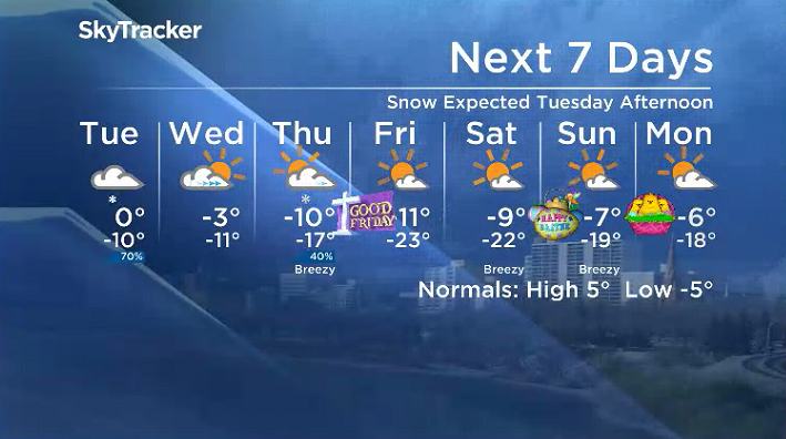
Saskatoon Forecast

Get breaking National news
Monday
It was a mild start to the last week of March with temperatures only dipping back to -6 overnight with wind chills slipping back into minus double digits under partly to mostly cloudy skies.
Those clouds did clear out by midday with a warm south-southwesterly wind kicking in with gusts upwards of 50 km/h, which helped push the mercury up above freezing before noon.


Beautiful blue skies and sunshine stuck around all day as we continued to climb up to an afternoon high a few degrees above freezing.
Tuesday
Wind chills will start out in the minus teens with cloudy skies sticking around to start the day as a low pressure system pushes in.
That system will bring in a few centimetres of snow during the afternoon before easing into the evening as temperatures climb up to the freezing mark for a daytime high.

Wednesday-Thursday
Cooler air will slide in behind Tuesday’s system, dropping daytime highs back below freezing on Wednesday as clouds roll back in after some sunshine to start the day.
More snow is likely to fall early Thursday before arctic air ushers back in behind that disturbance, which will drop our daytime high back into minus double digits as skies clear back out during the day.

Easter Long Weekend Outlook
A piece of the polar vortex will edge toward our area over Easter weekend, dropping overnight lows into the -20s with morning wind chills into the -30 to -40 range as daytime highs stay in minus double digits Good Friday before aiming to make it into minus single digits for the rest of the weekend.
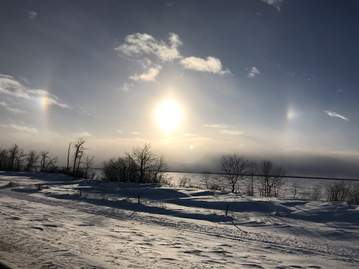
The March 26 Your Saskatchewan photo was taken near Spiritwood by Ella Heide:
Saskatoon weather outlook is your source for Saskatoon’s most accurate forecast and is your one stop shop for all things weather for central and northern Saskatchewan with comprehensive, in depth analysis that you can only find here.
Comments
Want to discuss? Please read our Commenting Policy first.