
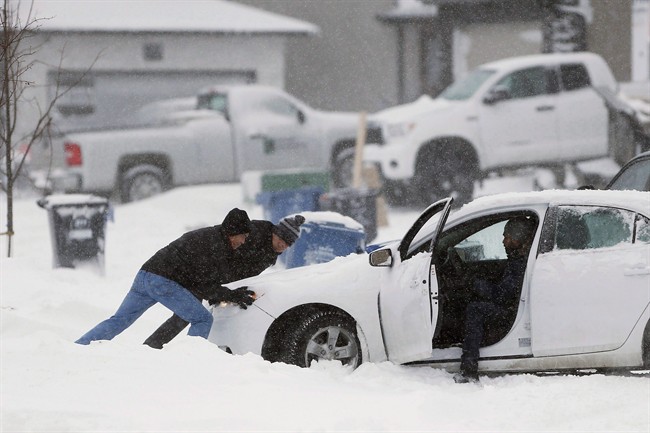
It looks like March will be coming in like a lion with a Colorado Low likely heading for southern Manitoba.

Two separate systems will be impacting the southern part of the province, bringing snow and potentially some rain as well. Rain remains a question mark based on the amount of warm air that enters the region. As of Thursday morning, the Colorado Low has not yet formed, so the track it will take is still not very predictable. That being said, there is still solid model agreement that precipitation is coming from this system Sunday.
RELATED: This is what the province looked like, through a camera lens, in March of 2017
Saturday will see light snow move into the province courtesy of a low pressure system coming off the Canadian Rockies. As of Thursday morning, general snowfall indicators across southern Manitoba suggest an accumulation of around 2-5 centimetres, but higher amounts are possible around the Parkland area.
Thursday afternoon, Environment and Climate Change Canada issued a special weather statement for the southern half of the province in anticipation of the incoming Colorado Low.
The expectation for this storm is to have the majority of its impact on Sunday night and through Monday. Environment and Climate Change Canada will be monitoring the development of this system as Sunday evening and Monday could bring enough snow to prompt snowfall warnings, but if other winter weather hazards appear likely, winter storm warnings would be issued instead.
Models have shown a wide range of snowfall predictions leading up to this weather event and that remains the case Friday.


Tuesday night, up to 70 cm of precipitation was predicted by one model. Friday afternoon there is still a wide range in precipitation predictions with the most extreme precipitation amount being 57 cm.
Models for Winnipeg generally show between 10 and 30 cm of snow possible with the median for these models expecting just over 20 cm by Tuesday.
According to Environment and Climate Change Canada Friday afternoon, 15-30 cm is still a good general expectation for snowfall amounts across southern Manitoba with winds near 40 km/h producing persistent blowing or drifting snow is some areas. And while models continue to indicate 40 or 50 cm is possible with this system, there is very little confidence in pinning down a likely location where this may occur.
You can monitor watches and warnings across southern Manitoba here.
Comments