
Hell? No, high water.

That’s what Vancouverites can expect when the “King Tides” arrive on Wednesday and stick around until Jan. 7.
WATCH: Warning issued about ‘King Tides’
King Tides happen twice a year, the City of Vancouver explained on its website.
They’re “extreme high tides” that occur when the gravitational forces of the sun and the moon “reinforce one another.”
And for the city, it provides a snapshot of what future sea levels could look like if water rises due to climate change.
READ MORE: Metro Vancouver braces for possible flooding ahead of ‘King Tide’
The King Tides are expected to arrive as follows:
- B.C. Conservative leader pledges not to ‘reopen the abortion debate’
- A look inside the now-sidelined ‘floatel’ meant to house LNG workers near Squamish
- Canfor to shutter B.C. sawmill, curtail Prince George pulp mill
- South Surrey restaurant forced to close after suspicious fire, more criminal acts reported
- Jan. 3, 7:23 a.m.
- Jan. 4, 8:06 a.m.
- Jan. 5, 8:48 a.m.
- Jan. 6, 9:29 a.m.
- Jan. 7, 10:10 a.m.
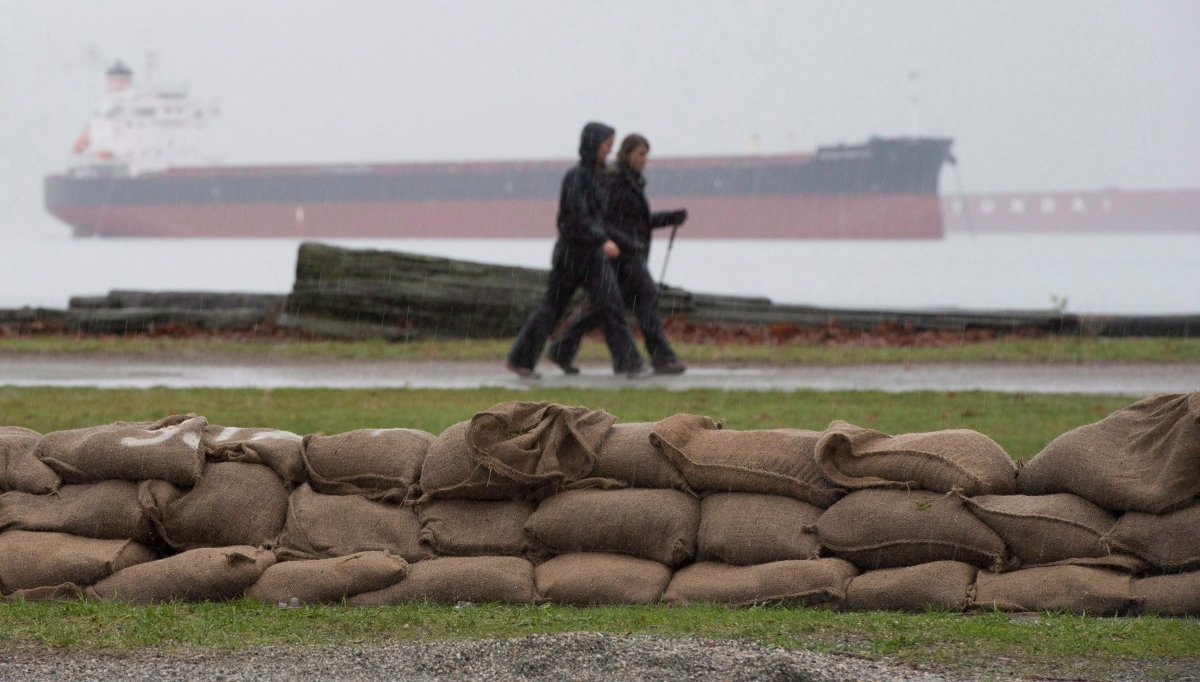
The tides have been known to reach elevations as high as five metres, which is approximately a metre higher than a regular high tide would be.
They bring concerns about flooding: a King Tide hit Vancouver in 2012 and caused flooding at the Stanley Park Seawall, Locarno Beach and the Kitsilano pool.
READ MORE: Two Canadian places that could be under water in 100 years — or sooner
But it’s too early to tell what will happen this time, said Global BC meteorologist Kasia Bodurka.
Winds are expected to stay northerly until Saturday, the day of the second-to-last King Tide. Those winds could help to push water offshore.


But on Saturday, winds are expected to blow southeast at speeds of up to 40 km/h, “so that could potentially be an issue,” Bodurka said.
But that would depend on when the King Tides reach their maximum height, she added.
Rising sea levels
The City of Vancouver is asking people to take photos of the high tide on these dates so that it can track sea level rise.
In a map on its website, the city anticipates that parts of Vancouver could be under water in an extreme weather event by 2100 “if no adaptation measures are implemented.”
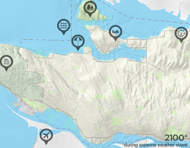
Areas that could find themselves underwater include parts of Stanley Park, as well as Kits Beach and other locations along the shoreline.
- With files from Simon Little
Comments