

London and the surrounding area is bracing for another dose of winter.

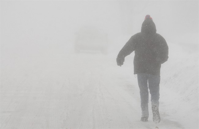
Much of the area is under a snow squall warning as Environment Canada says lake effect snow could dump a significant amount of snow on the area Tuesday.
The national weather agency has a snow squall warning in effect for London, Komoka, Strathroy, Parkhill, as well as Eastern and Western Middlesex County. The warning also extends to neighbouring Lambton, Huron and Perth counties.
My Big Yellow Bus says school buses in London are operational today but buses in Oxford, Elgin, Middlesex, and Red Zone are cancelled. Despite the cancellations, both the Thames Valley District School Board and the London District Catholic School Board say the schools will remain open today.
The weather has also impacted flights out of the London International Airport, with the airport reporting some delays and cancellations this morning.

Get daily National news
Warning Preparedness Meteorologist Geoff Coulson says London received about 5 to 10 centimetres overnight, and squalls off of Lake Huron could dump another 20 to 25 centimetres on the area today.
He says how much the city gets depends on the wind.
“It does look like that is a possibility, that once these bands lock in from the northwest they could sit over the city of a number of hours, and would be the concern then for the possibility of large accumulation,” said Coulson.


“Certainly it does look quite possible to get some of a higher amounts falling right in the city.”


Coulson says the snowfall could be significant, especially if the squalls stick around Tuesday evening into Wednesday morning.
He says a combination of snow and wind could make it tough on motorists.
“By late Tuesday morning the snow will start falling more heavily, we’re also expecting the winds to pick up out of the northwest, gusting to 70 km/h, that could produce some reduced visibility and blowing snow.”
Coulson says the colder-than-normal temperatures are expected to stick around for most of the week, with the mercury expected to rise by the weekend.
In a tweet last night, the city says overnight parking on city streets is prohibited until further notice to allow for snow and ice removal.
Comments