
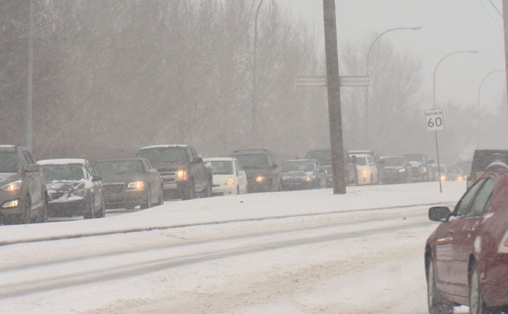
Environment Canada has issued a special weather statement for London, and pretty much the rest of southern Ontario.

The national weather agency is calling it the first widespread snowfall of the winter season.
Locally, a weather statement is in effect for London, Parkhill, Strathroy and Komoka as well eastern and western Middlesex County.
It also extends to neighbouring Lambton, Huron, Oxford and Perth Counties.
Meteorologist David Rogers says an Alberta clipper is expected to come through the area, which could bring about 10 centimetres of snow by Tuesday morning.
“For Monday, we can expect the snow to be in late morning, early afternoon, with a couple centimetres of snow in the afternoon, then more snow tonight,” said Rogers.
“The afternoon commute could be a little slower and a little messier because of the snow, and Tuesday morning could be interesting as well depending how the road crews do.”
Although some areas could receive 10 to 15 centimetres, Environment Canada isn’t expecting the 15 centimetres in 12 hours that’s required for a warning.


He says flurries are in the forecast for London most of this week, with snowsqualls possible in areas near Lake Huron Tuesday.
“The possibility of snowsqualls continues into Wednesday and then we’re looking at scattered flurries for the remainder of the week with temperatures well below normal.”
Rogers says to brace for colder than normal temperatures this week, expecting highs around -5 C.
He says it’s a little early to say for certain, but there’s a decent chance the snow will stick around until Christmas.
- Posters promoting ‘Steal From Loblaws Day’ are circulating. How did we get here?
- Video shows Ontario police sharing Trudeau’s location with protester, investigation launched
- Canadian food banks are on the brink: ‘This is not a sustainable situation’
- Solar eclipse eye damage: More than 160 cases reported in Ontario, Quebec
Comments