

Over the years, we have made a series of interactive maps showing the war dead of Canadian cities at the scale of individual homes (or sometimes towns.)

Stalin, a cynic, said that one man’s death is a tragedy, while that of a million is a statistic. There is a truth here, which is why we often tell the story of vast tragic events, like wars or disasters, in part from the point of view of the individual.
Visualizations like these, however, aim for both scale and intimacy: both the sense of specific tragedies, specific homes whose doors opened to a dreaded telegram and also the vast scale of what the community experienced, at the same time.
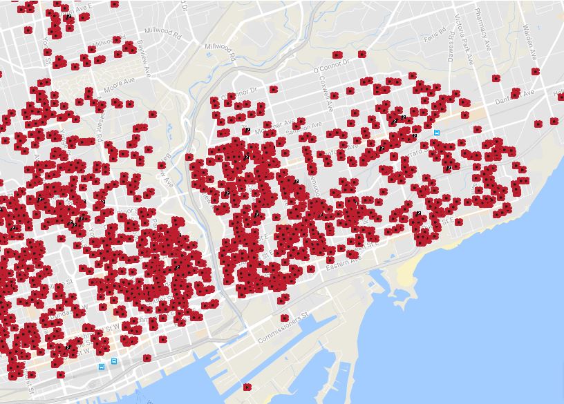
Toronto
Two interactive maps show the homes of the city’s war dead of the First and Second World Wars, and a calendar-based interactive shows how they varied by time. In total, we show the homes of 6,160 of the city’s war dead.


Get daily National news
Vancouver

Winnipeg
Similarly, Winnipeg’s map shows only First World War dead.

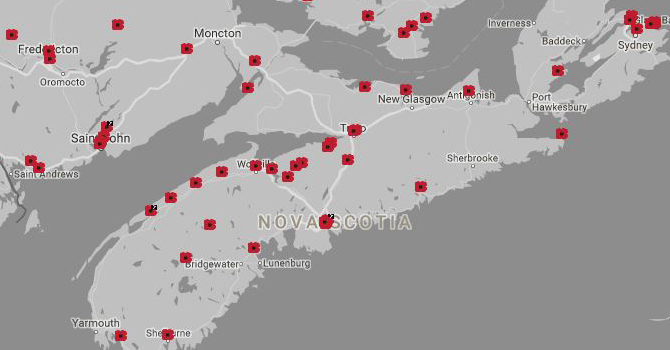
D-Day
The D-Day landings on June 6, 1944, marked the beginning of the liberation of western Europe, but it came at a high price – almost 400 Canadian soldiers and aircrew died on the day of the invasion. We tracked down nearly all of them.


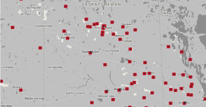
Korea
For the 50th anniversary of the ambiguous truce that ended Canada’s forgotten war, we set out to find the hometowns of Canada’s Korean War dead. The map shows 474 of them, or over 90 per cent of the total.
Comments
Want to discuss? Please read our Commenting Policy first.