

UPDATE: All warnings and special weather statements mentioned in this story have ended.

First snowfall of the season hits Saskatoon Wednesday with warning level wind gusts possible in areas.
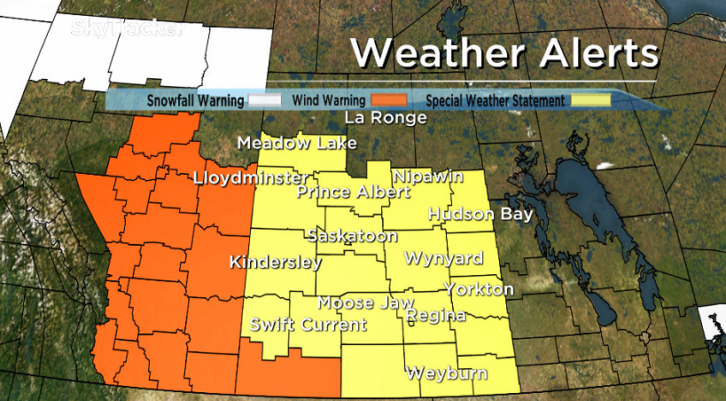
Special Weather Statement
Environment Canada has issued a special weather statement for Saskatoon, Prince Albert and all of central and southern Saskatchewan.
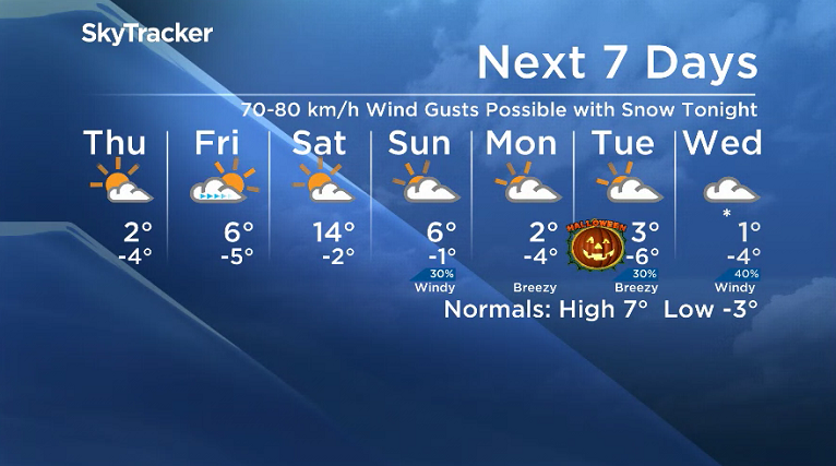
A strong Alberta Clipper will track across central Saskatchewan today and into northwestern Minnesota by Thursday morning, spreading wet snow across the northern grainbelt, generally north of the Yellowhead Highway corridor.
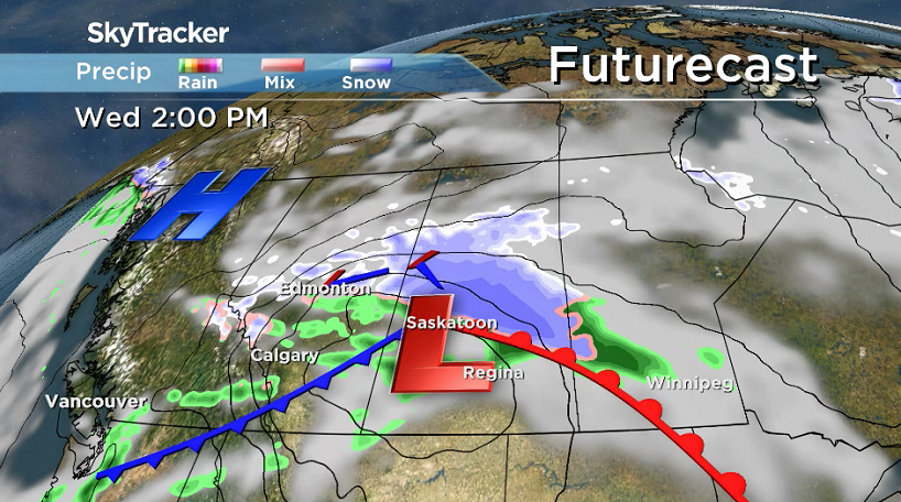
Six to 12 centimetres of snow can be expected into the evening before the snow tapers off from west to east overnight.
Snowfall amounts will be less further south with 2 to 4 centimetres possible between the Trans Canada highway and Yellowhead highway and generally under 2 centimetres south of the Trans Canada Highway.

In addition, strong northwest winds will develop early Wednesday evening and continue overnight.

Get breaking National news
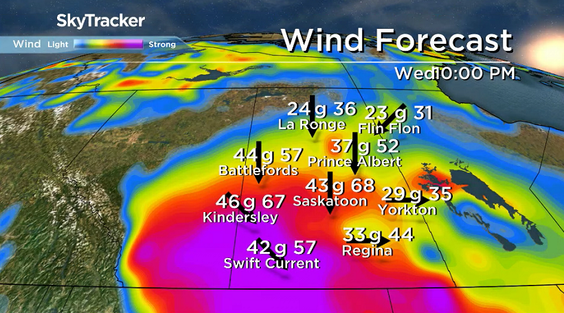
Widespread wind gusts to 80 km/h are expected for much of southern and western Saskatchewan, with the highest gusts expected in Cypress Hills where a wind warning is in effect.
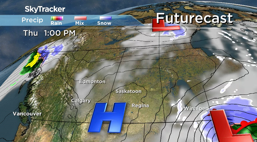
The system will be mainly out of the province by Thursday morning with conditions gradually improving as a ridge of high pressure builds in from the west.
For the latest weather alerts download the Global News Skytracker weather app for iPhone, iPad or Android.
Saskatoon Forecast
Wednesday
3 degrees was where Saskatoon started off the day under mostly cloudy skies before a breezy east-southeasterly wind around 40 km/h with gusts upwards of 53 km/h before noon.
Cloudy skies continued into the afternoon as we rose up into mid single digits by noon as rain and snow started to fall in areas north of the city the low pressure system moved in.


Rain moved in during the afternoon as temperatures edged up a bit further into mid single digits.
Wednesday Night
The real effects of this system and coupled cold front were felt Wednesday night as northerly winds kicked in even stronger with winds gusting upwards of 50 to 60 km/h.
Rain switched over to snow during the evening with a few centimetres possible, most of which melted on contact with the warm ground, with minor accumulations on grassy surfaces.

Temperatures slid below freezing, which felt like minus double digits with wind chill.
Thursday
Clouds will clear out of the area early Thursday morning with some midday sunshine before the next batch of clouds builds in later on.
It will feel like minus double digits with wind chill as you head out the door in the morning with winds easing during the day as the mercury attempts to rise just above freezing in the afternoon.
Friday
Some sunshine is expected to start the day Friday before more clouds move in during the day with a push of warm Pacific air.
Temperatures will slide a bit further up with an afternoon high around 6 degrees or so with light winds through the day.

Weekend Outlook
An upper ridge brings back the heat to start the weekend with a daytime high soaring back up into the teens under a mix of sun and cloud Saturday.
The warm up is short-lived though, with another cold front sliding through on Sunday, bringing back some clouds, a slight chance of precipitation and kicking up strong northwesterly winds with a daytime high back in mid single digits.
The Your Saskatchewan photo for Oct. 25 was taken at Carrot River by Fran Bryson:

Saskatoon weather outlook is your source for Saskatoon’s most accurate forecast and is your one stop shop for all things weather for central and northern Saskatchewan with comprehensive, in depth analysis that you can only find here.
Comments
Want to discuss? Please read our Commenting Policy first.