

Hurricane Maria is a Category 5 storm that packed winds of up to 260 km/h on Monday.

And it’s on track to blow through Caribbean islands that were only just devastated by Hurricane Irma.
Coverage of Hurricane Maria on Globalnews.ca:


The Leeward Islands were pummeled by Hurricane Irma, a storm that brought winds of up to 300 km/h and devastated areas such as Barbuda, which saw damage estimated at $150 million.
Other islands that saw destruction from the storm included Puerto Rico, Antigua, Saint Martin and the British Virgin Islands.
Public advisories issued by the National Hurricane Center (NHC) show Maria cutting along a similar path up to Friday.

Get daily National news
Here’s what Hurricane Maria’s trajectory looked like on Monday:
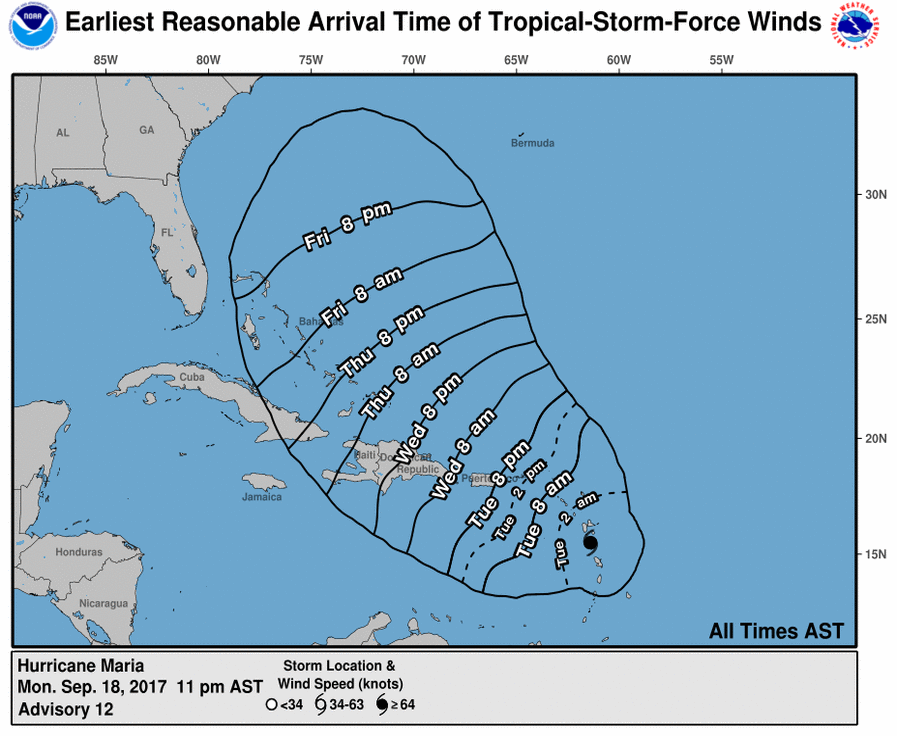
A map provided by the National Hurricane Centre showed tropical storm-force winds possibly hitting the vicinity of the British Virgin Islands and the U.S. Virgin Islands on Tuesday at about 2 p.m. AST.
Winds are then expected to hit Puerto Rico in the evening at about 8 p.m. before moving on to the Dominican Republic and Haiti on Wednesday.
The eye of the storm is expected to move toward the Virgin Islands and Puerto Rico on Tuesday night and the following day.
After that, storm-force winds are set to hit Cuba on Thursday and the Bahamas on Friday.
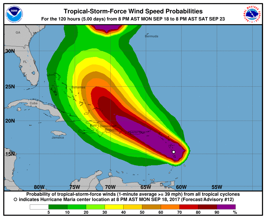
Another probability chart provided by the NHC showed the strongest winds blowing through areas such as the Leeward Islands.
Strong winds were also expected to hit the Dominican Republic and the Bahamas throughout the week, while lesser winds were projected to blow across southeastern Cuba, according to an advisory issued on Monday night.
Storm watch
Areas facing a hurricane warning on Monday included Guadeloupe, Dominica, St. Kitts, Nevis, Montserrat, the U.S. and British Virgin Islands, Puerto Rico, Culebra and Vieques.
Regions that are under “hurricane watch” mean that “preparations to protect life and property should be rushed to completion.”
Storm surge could raise water levels by as much as seven to 11 feet above normal tide levels in areas like the Leeward Islands and the British Virgin Islands, the NHC said.
Meanwhile, Puerto Rico and the U.S. Virgin Islands can expect to see storm surge of anywhere between six and nine feet.
Comments
Want to discuss? Please read our Commenting Policy first.