UPDATE: All frost advisories mentioned in this story have ended

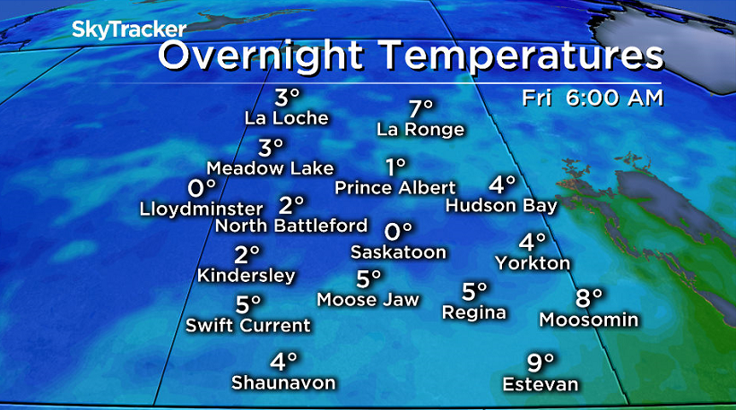
Saskatoon dives down toward freezing with frost expected Friday morning.
Frost Advisory
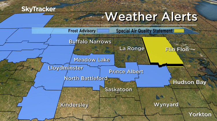
Environment Canada has issued a frost advisory for the Prince Albert, Meadow Lake, North Battleford, Lloydminster and Melfort areas for frost that may damage some crops in frost-prone areas.
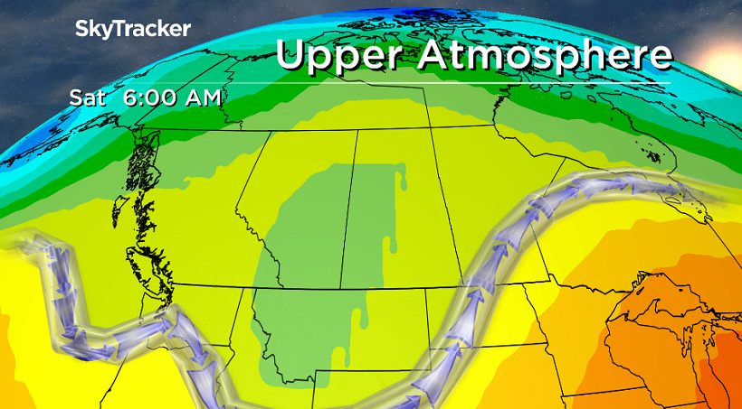
Frost is likely to develop Thursday night as a ridge of high pressure builds in from Alberta.
The agency says some patchy cloud may persist through the night keeping local temperatures above zero.
This ridge will also bring mostly clearing skies and overnight temperatures approaching the freezing mark to the rest of the northern grainbelt with local frost possibly occuring in frost prone areas.
Cover up plants, especially those in frost-prone areas and take preventative measures to protect frost-sensitive plants and trees.
For the latest weather alerts download the Global News Skytracker weather app for iPhone, iPad or Android.
Saskatoon Forecast
Today
A cool 2 degrees was where Saskatoon started off the day and it was a slow warm up under mostly cloudy skies this morning.
We did manage to make it up to double digits by noon despite a breezy northerly wind suppressing temperatures.
Clouds and that breezy northerly wind will stick around for the rest of the day with a very slight chance of showers as we climb up a few degrees into double digits.

Get daily National news
Tonight
The big question of the night will be how much will clouds clear out, which will determine how cold it gets overnight.
Right now it looks like mostly cloudy skies will stick around this evening with a bit of clearing overnight, which is expected to allow temperatures to dip back to and possibly even a bit below the freezing mark with a risk of frost.
Be sure to cover up, bring in or harvest any tomatoes and other frost sensitive plants to prevent them from being damaged from the frost.
Friday
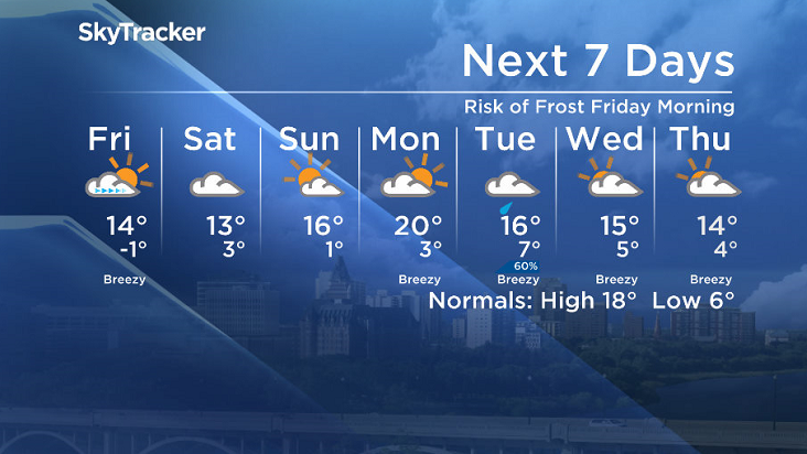
After a cool start to the day, we’ll see the mercury rise up into the low teens by afternoon.
A mix of sun and cloud should start off the day before we see another wave of clouds slide in later in the day with a bit of a breezy northeasterly wind kicking in during the afternoon.
Weekend
The cool and unsettled conditions will stick around to start the weekend as the upper trough that brought them in lingers, keeping us in the clouds with a high in the low teens on Saturday.
Slightly nicer conditions will move in on Sunday as we start to see a bit of warming and upper ridging that’ll bring us back into some sunshine and help boost our daytime high into the mid teens after starting out around the freezing mark with a risk of frost.
Work Week Outlook
The peak of the heat will be hit on Monday as we climb back into the low 20s, but clouds will build back in as a system that’ll bring in a chance of rain Tuesday and mid-week clouds drops highs back into the mid-teens.
This Your Saskatchewan picture was taken by Philippe Gaudet along Valley Road:
Saskatoon weather outlook is your source for Saskatoon’s most accurate forecast and is your one stop shop for all things weather for central and northern Saskatchewan with comprehensive, in depth analysis that you can only find here.


Comments