

As Irma has been losing steam while it is travelling up the U.S., eyes have started turning to Hurricane Jose, which is sitting north of the Caribbean Islands.

Jose, which has currently lessened from a Category 4 to a Category 2 hurricane, was called a “messy looking hurricane” but the U.S.’s National Hurricane Center latest update as of Sept. 11.
Global News meteorologist Ross Hull says it’s expected to weaken to a Category 1 over the next few days.
Currently, it’s spinning out in the Atlantic, away from land masses.
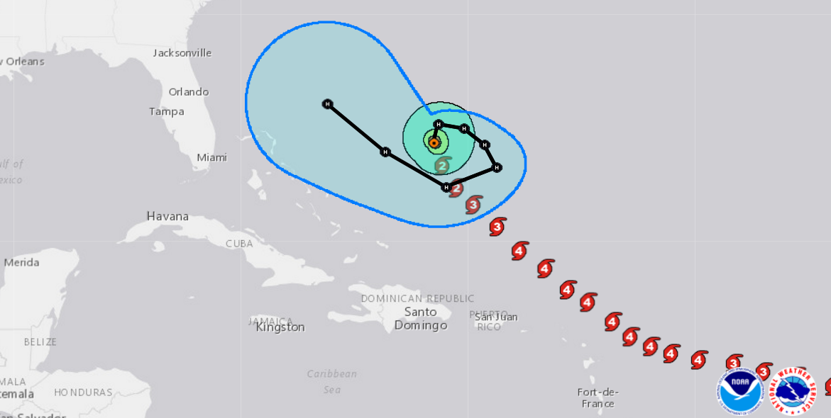
It is currently going in a circle, but is expected to come up the coast and could make landfall anywhere from the Carolina’s all the way to Newfoundland.
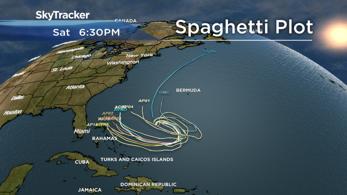
The timing of a frontal boundary (a separation of air with different densities) along with the strength of a ridge of high pressure will determine whether or not it will hit Canada, Hull explained.
- Manitoba Hydro warns of widespread power outages after hail, heavy rain hit province in another massive storm
- ‘Significant’ flooding leaves western Manitoba town sandbagging homes, businesses
- Tanmaxxing: Why tanning is making a comeback despite the health risks
- No relief: Environment Canada predicts hot, humid summer across country


Parts of Eastern Canada including Ontario, Quebec and Atlantic Canada could feel Jose’s effects by next week.

Get breaking National news
“It’s important to emphasize that there is a still a lot of computer model uncertainty on Jose’s next move but it still is a storm to watch for the U.S. and Canada,” he said.
WATCH: Latest news on Hurricane Irma

-
![]() Storm surges from Irma leaving large portions of Florida under water
Storm surges from Irma leaving large portions of Florida under water -
![]() Dogs Rescued in Florida after Hurricane Irma
Dogs Rescued in Florida after Hurricane Irma -
![]() Families disappointed by government response to Canadians stranded by Hurricane Irma
Families disappointed by government response to Canadians stranded by Hurricane Irma -
![]() Boats completely destroy after Hurricane Irma hit Monroe County, Florida
Boats completely destroy after Hurricane Irma hit Monroe County, Florida -
![]() Reporter gives tour of areas flooded in Jacksonville, Florida after Hurricane Irma
Reporter gives tour of areas flooded in Jacksonville, Florida after Hurricane Irma -
![]() Maritime ball player watches as new home struck by Hurricane Irma
Maritime ball player watches as new home struck by Hurricane Irma -
![]() Trudeau says government will assist those dealing with aftermath of Hurricane Irma
Trudeau says government will assist those dealing with aftermath of Hurricane Irma -
![]() Former Kingstonians feel lucky in wake of Hurricane Irma
Former Kingstonians feel lucky in wake of Hurricane Irma -
![]() Helicopter view over Orlando reveals Irma’s damage
Helicopter view over Orlando reveals Irma’s damage


Comments
Want to discuss? Please read our Commenting Policy first.