

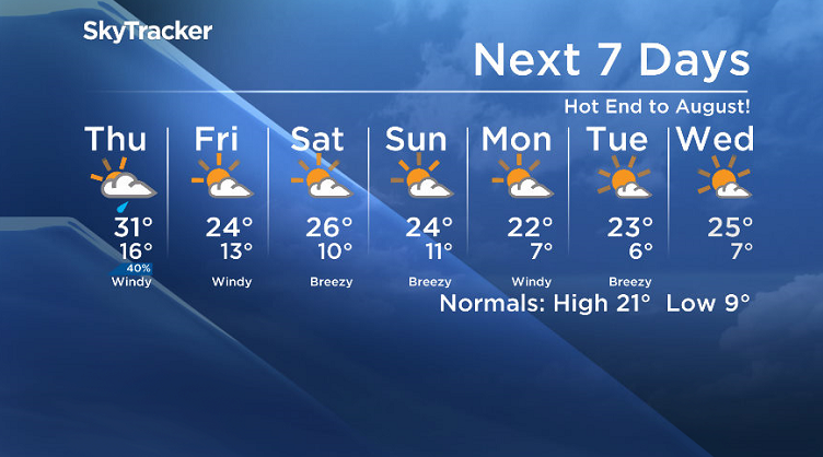
Hot end to August as sizzling 30 degree heat continues, but changes move in to start September.

Special Weather Statement/Wildfire Update
Environment Canada has issued a special weather statement for the city of Saskatoon, Prince Albert, Meadow Lake, La Ronge, Meadow Lake, Nipawin, Southend, Pelican Narrows, Flin Flon, Hudson Bay and Lloydminster areas.
The agency says high levels of air pollution are expected or occurring due to smoke from wildfires in northern Saskatchewan.
Winds will gradually turn southeasterly on Thursday, which will begin to shift the heaviest bands of smoke back toward northern Saskatchewan through the day.
Local wind flow will still affect the distribution of the heaviest smoke, but in general much of central and northern Saskatchewan will see reduced visibilities and extremely poor air quality at times today into Thursday.
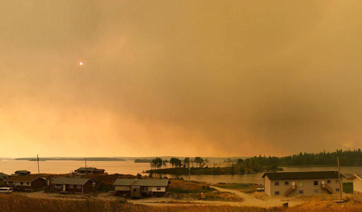
Thousands of people have been placed under a general evacuation in Pelican Narrows, a community of nearly 3,000 people, where a state of emergency has been issued.
There are three large, uncontained fires near Pelican Narrows, one of which is approximately 3 kilometres from the community.
The evacuation began Tuesday with nearly 500 people being transported to Saskatoon.
Emergency Social Services is currently supporting residents from the communities of Birch Portage and Pelican Narrows.

The resort community of Jan Lake has declared a state of emergency due to smoke concerns from area wildfires.

Get daily National news
15 residents of the mostly seasonal community will self-evacuate and stay with family and friends.

Saskatoon Forecast
Wednesday
Smoke from fires in northern Saskatchewan was reported at the Saskatoon airport to start the day around 6 a.m. with visibility down to 10 kilometres.
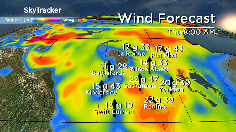
We dipped back to 14 degrees in the morning before warming right up into the mid 20s by noon under sunny skies with a strong southeasterly wind around 30 km/h with gusts upwards of 50 km/h.


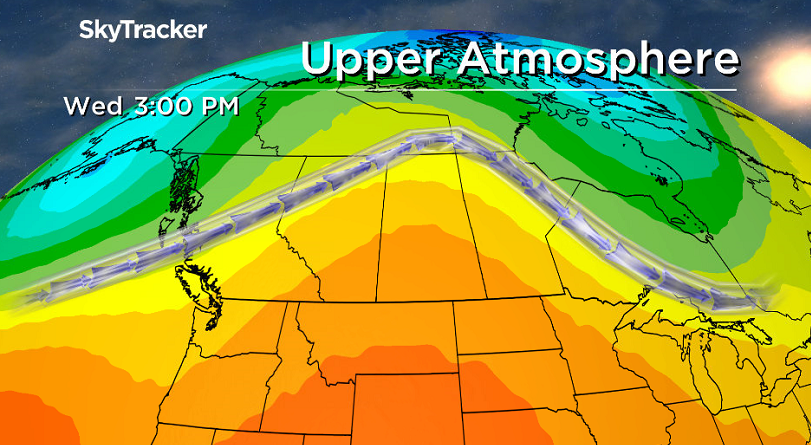
Heat will continue to truck this afternoon thanks to an upper ridge of high pressure over the area, which will keep skies mostly sunny and help boost us up as high as 30 degrees this afternoon with wind continuing.
Wednesday Night
Clouds built back in as a trough of low pressure moved in, which helped keep conditions mild with an overnight low only dipping back into the upper teens.
Winds were quite breezy through the night, with gusts into the 40 km/h range.
Thursday
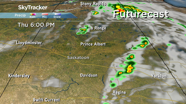
That trough will keep us under mostly cloudy skies throughout much of the day Thursday and bring in a chance of showers and even the risk of a thunderstorm.
After a warm start, temperatures should climb up into the low 30s with warm southeasterly winds around 30 km/h, with gusts upwards of 50 km/h, before easing back later on.
There is a risk of thunderstorms along this trough in parts of northeastern Saskatchewan dealing with lightning-sparked fires that have prompted thousands to evacuate.
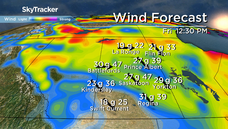
Friday
After a brief break from the winds late Thursday, they’ll be back in full swing as a cold front slides through to kickoff September on Friday, but this time from a cooler, west-northwesterly direction.
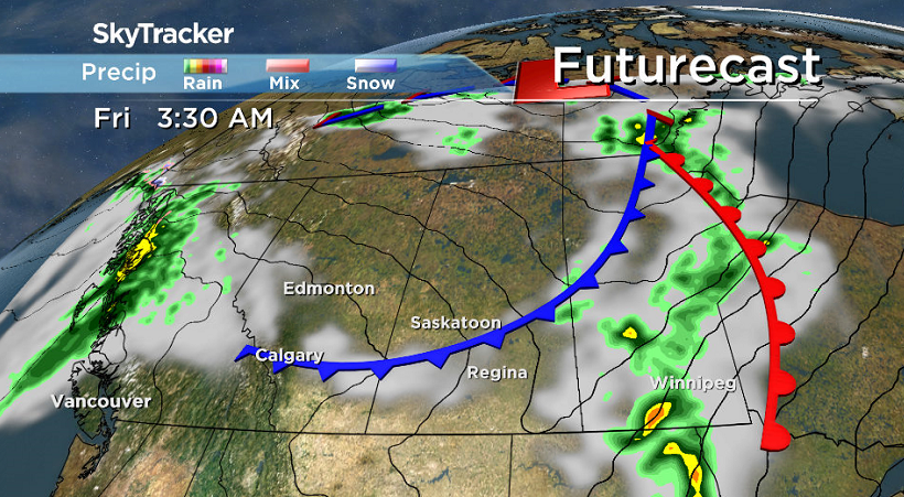
Clouds are expected to be in and out during the day with the mercury rising up into the mid 20s for an afternoon high.
Labour Day Long Weekend Outlook
A mix of sun and cloud is expected to dominate much of the long weekend with daytime highs starting out in the mid 20s both Saturday and Sunday before cooling back into the low 20s for Labour Day Monday.
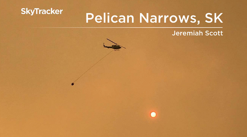
This Your Saskatchewan photo was taken by Jeremiah Scott in Pelican Narrows:
Saskatoon weather outlook is your source for Saskatoon’s most accurate forecast and is your one stop shop for all things weather for central and northern Saskatchewan with comprehensive, in depth analysis that you can only find here.
Comments
Want to discuss? Please read our Commenting Policy first.