

Hurricane Harvey has pounded Texas for four days, and the pictures on the ground are stunning.

Images from inside the storm show Texans fighting to escape the flooding, traversing the streets on powerboats and using trash bags for cover.
Coverage of Hurricane Harvey on Globalnews.ca:

-
![]() Civilian boats help rescuers to save those stranded after Hurricane Harvey
Civilian boats help rescuers to save those stranded after Hurricane Harvey -
![]() Texas streets flood as Hurricane Harvey batters coast
Texas streets flood as Hurricane Harvey batters coast -
![]() Pool flooding in Texas home as result of Hurricane Harvey
Pool flooding in Texas home as result of Hurricane Harvey -
![]() Thousands of pets and livestock saved after Hurricane Harvey
Thousands of pets and livestock saved after Hurricane Harvey -
![]() Houston mayor discusses decision not to evacuate ahead of Hurricane Harvey
Houston mayor discusses decision not to evacuate ahead of Hurricane Harvey


And the scene from above also provides some memorable pictures.
NASA has released a number of views of the hurricane, using satellites, data and pictures taken directly from the International Space Station (ISS).
They show the Category 4 hurricane as it approaches Texas over the course of four days, bringing wind and rain so strong that it drowns people’s homes, forcing residents into shelters and even killing at least three people.
READ MORE: Harvey leaves Houston paralyzed with no relief in sight
The storm has brought over 30 inches of rain, with almost two more feet expected, in what a FEMA director called “probably the worst disaster the state’s seen.”
Here are some photos of what the storm looks like from above:
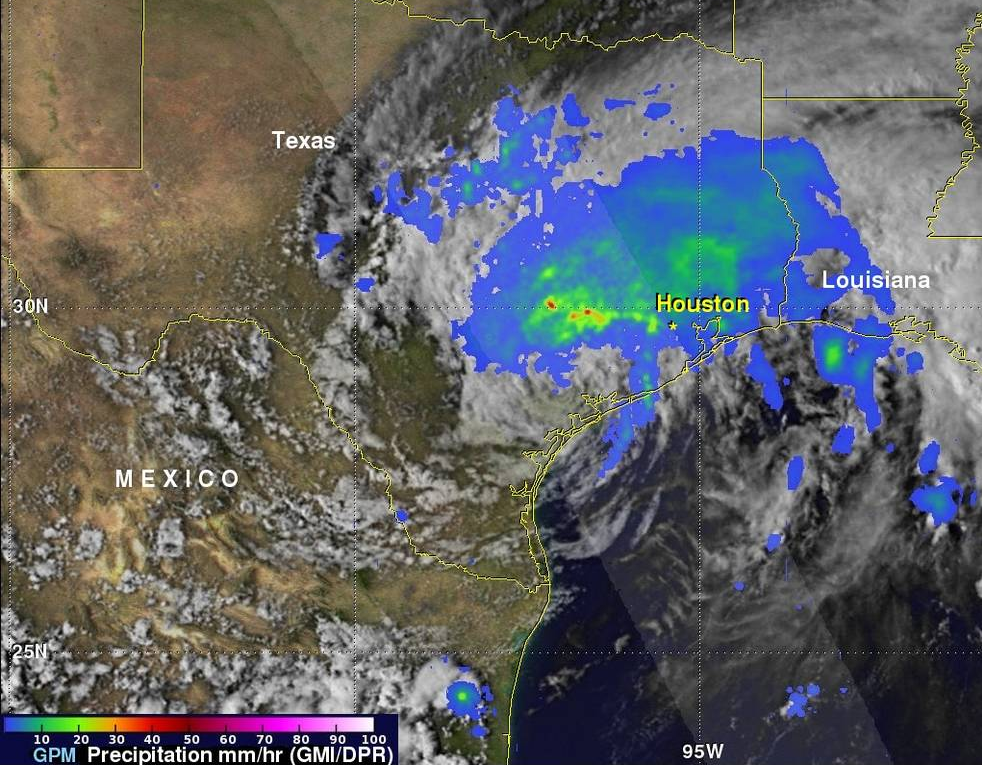
Rainfall
NASA’s Goddard Space Flight Center in Greenbelt, Md. analyzed Hurricane Harvey’s rainfall using satellite data from eight days.
The resulting visualization shows some of the strongest rains happening over the Houston area and nearby, falling at up to 50 millimetres per hour.
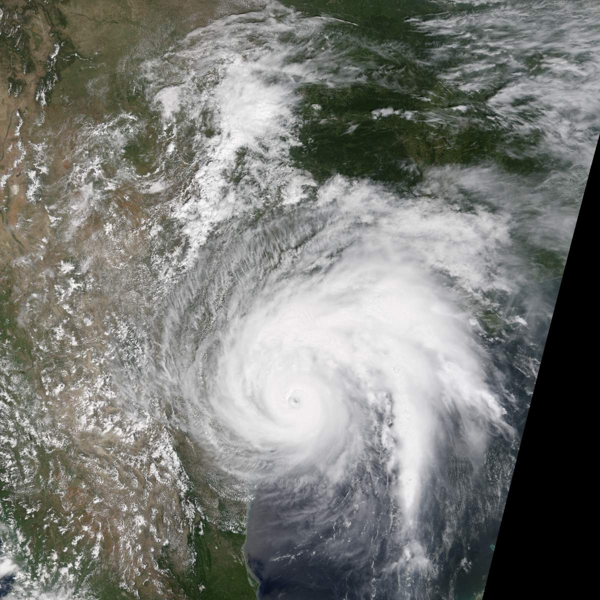
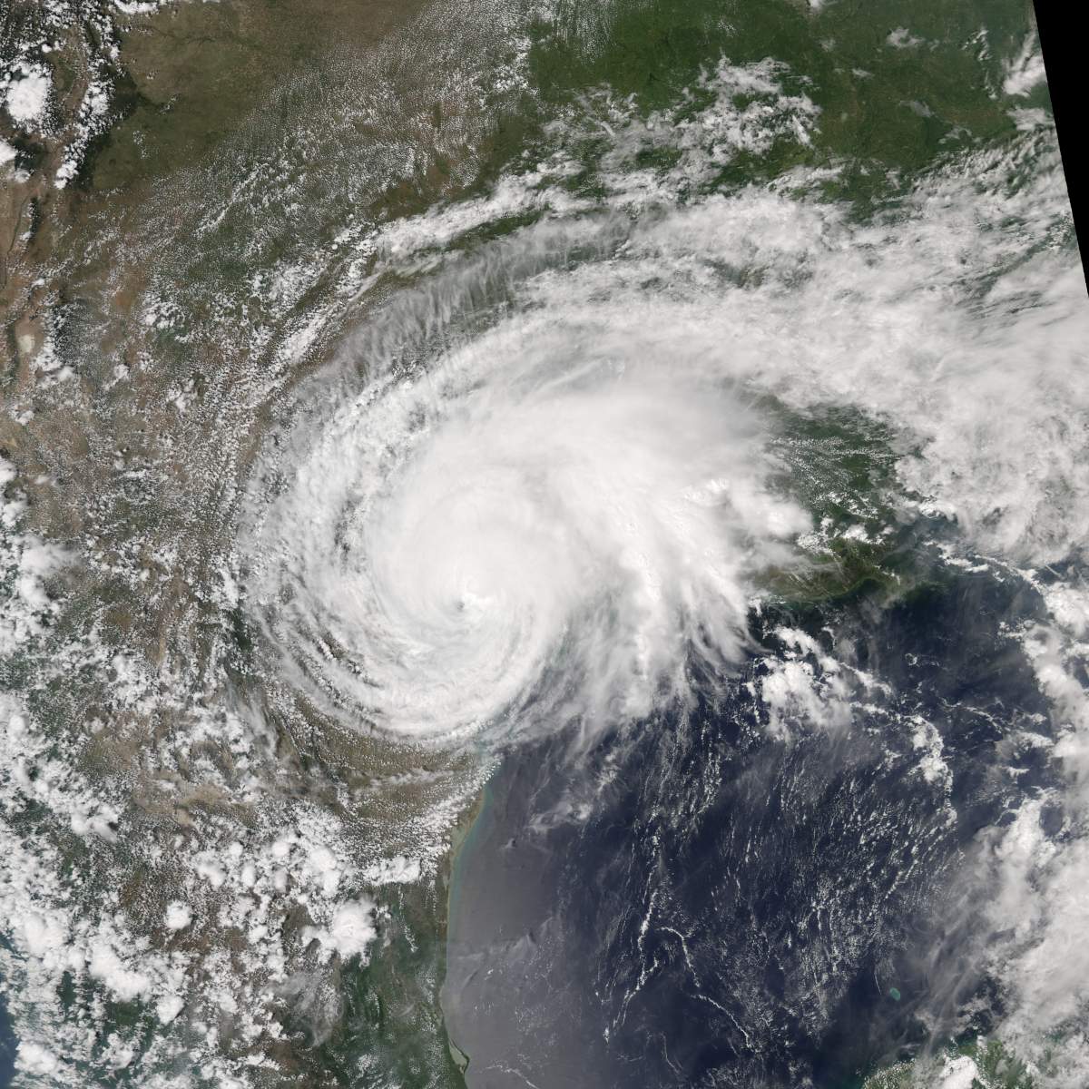
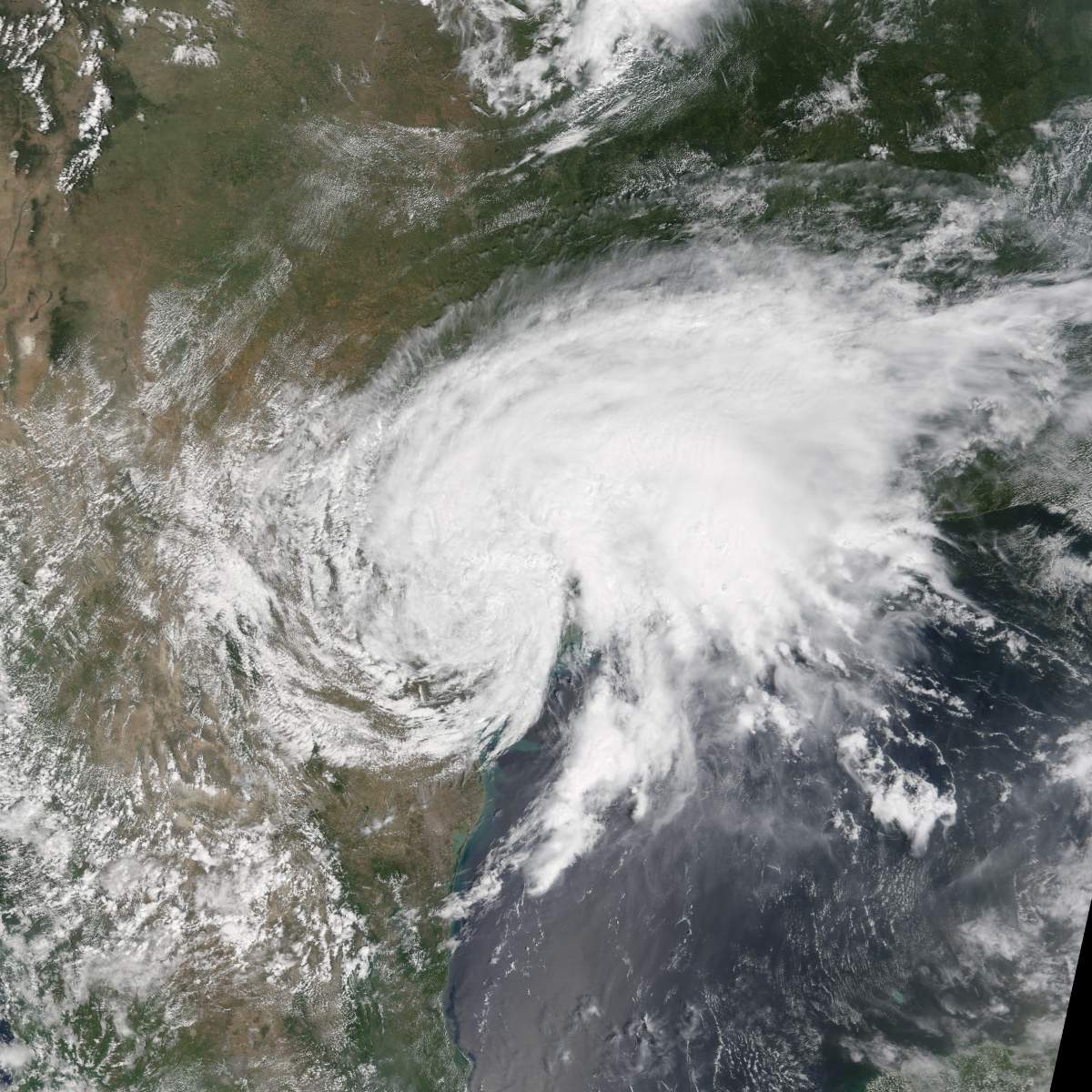
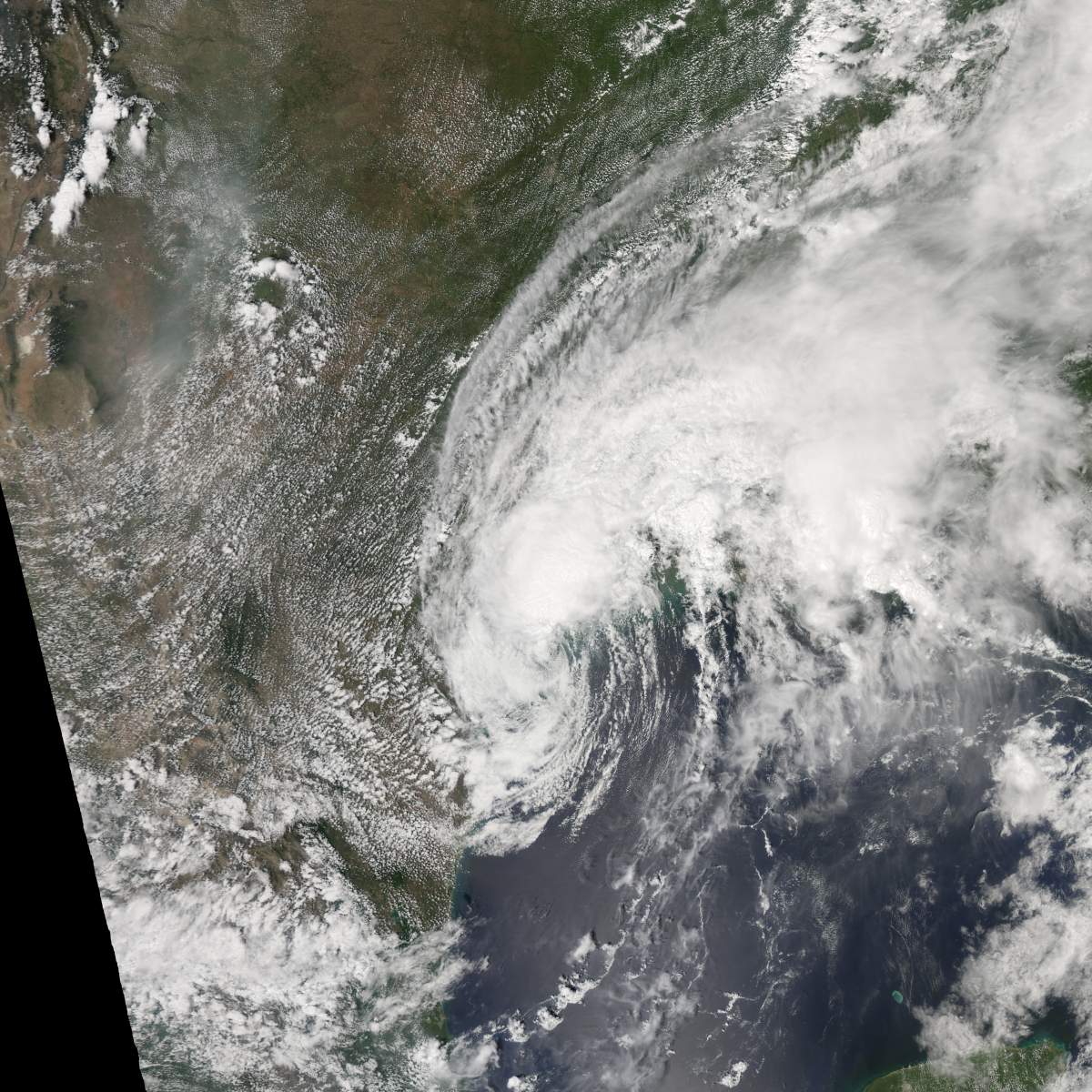
Harvey makes landfall

Get breaking National news
NASA Earth Observatory captured images of the storm slowly approaching the Texas coast from Aug. 25 to 28.
The storm lost some steam on the last day, as it moved toward the coast at only seven kilometres per hour.
Aug. 25
Aug. 26
Aug. 27


Aug. 28
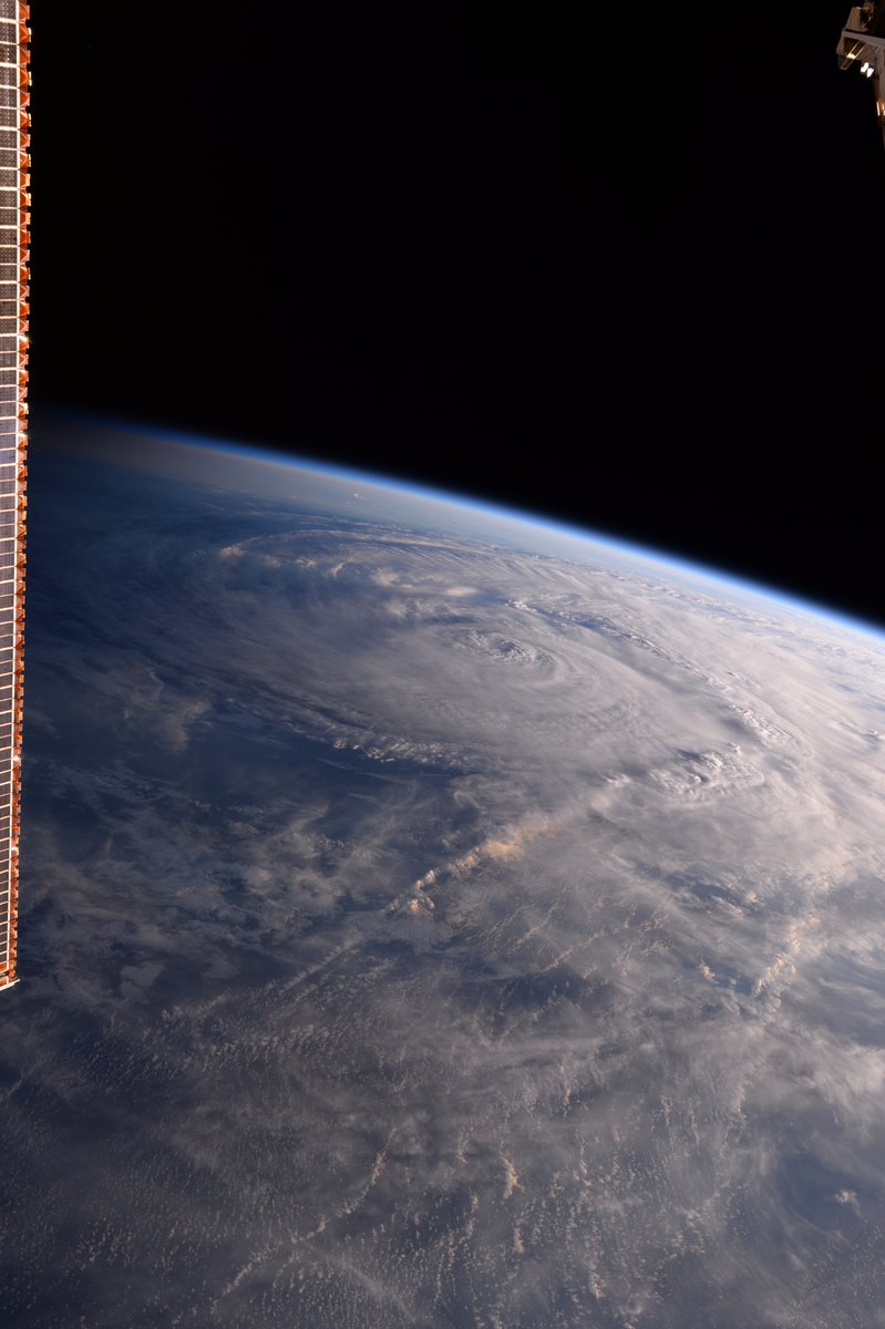
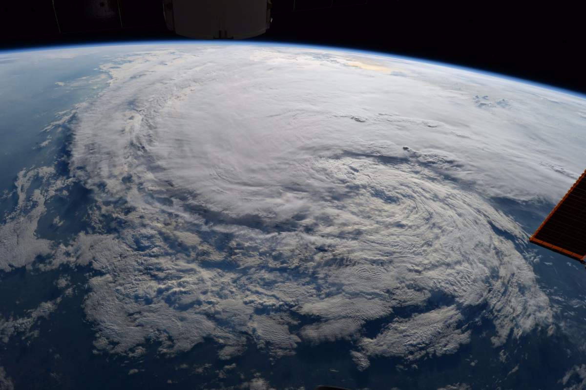
From the International Space Station
Images captured from the International Space Station provided a wider view of the hurricane as it approached Texas from Aug. 25 to 28.
Astronaut Randy Bresnik tweeted some of the photos saying, “God bless Texas, may you weather the storm as you always have!”


Comments
Want to discuss? Please read our Commenting Policy first.