
It’s been hot in the west and wet in Ontario and, unfortunately for B.C.’s firefighters, Environment Canada doesn’t expect that to change much in early August.

“I’ve never seen differences as extreme across the country as I’ve seen in this summer so far,” said David Philips, senior climatologist for Environment Canada.
“This year, it’s like the east versus the west. It’s really like night and day in terms of the kind of conditions.”
Ottawa, for example, in July came within 0.4 millimetres of breaking a record for the wettest month ever, originally set over a century ago in 1899. “It was like the water torture test. Just kind of drizzly and spitty and then you’d get a thunderstorm. Then it would dry up and you’d think, ‘Oh good, I’m good for two or three days,’” he said. And then it would be the same the next day.
And although temperatures in eastern and southern Ontario have been close to normal, it’s been so cloudy that it doesn’t always feel that way.
Regina has had the opposite problem: a nearly record-breaking dry spell. That record was set in 1887, when there was “a tad” less rain, he said.
May, June and July were the warmest on record in Calgary, according to Philips, with those records being set in the 1930s.
- ‘It’s nice to be the villain’: Vancouver Canucks gear up for Game 3 in Nashville
- ‘Why aren’t we doing more?’ White Rock on edge with killer on the loose
- Joffre Lakes to close for 3 periods this year under agreement with First Nations
- B.C. carjacking victim says she doesn’t trust the ‘catch-and-release’ system
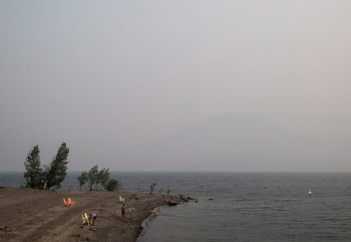
Dry weather and persistent heat have contributed to hundreds of forest fires in B.C., and Kamloops has set all-time records for dryness. “That problem still exists,” he said.
READ MORE: Worst wildfire season in B.C. since 1958
“The weather pattern has really locked in this summer,” said Anthony Farnell, Global News’ chief meteorologist. “A persistent cyclone has been spinning over Hudson Bay since June which is acting like a traffic cop steering other storms around it and through the Great Lakes and southern Quebec. The trough in the east is rivalled by the big ridge out west. This persistent high pressure system has kept B.C. very dry, sunny and hot and is the reason for the bad forest fire season.”
READ MORE: Poor air quality remains as heat records broken in B.C.
Philips thinks the jet stream was the dominant factor in the consistent weather so far this summer. But other things, like tropical storms, were so weak that they didn’t have much of an effect on Canada’s weather either. “They’re the biggest storms on earth. They kind of stir up the pot,” he said. Without them, the weather systems stayed put.
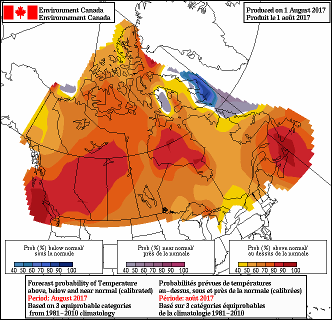
Hot weather to continue
Environment Canada is predicting above-average temperatures for most of the country in August.
“It looks like the heat continues across the country, at least in the west. In the east, it looks like we’re going to get a change,” said Philips.
Farnell agrees. “The cool wet weather should shift west towards the prairies while Ontario and Quebec are finally able to dry out. Unfortunately for B.C., I see the dry and warm weather lasting into the fall which means more fires and more smoke.”
“The tropics will become very active in the coming weeks with the potential for a few hurricanes making the turn up the coast. This is something Atlantic Canada residents will need to watch closely later in August through September.”
Comments