

30 degree heat scorches Saskatchewan with warnings issued for the excessive period of hot weather.

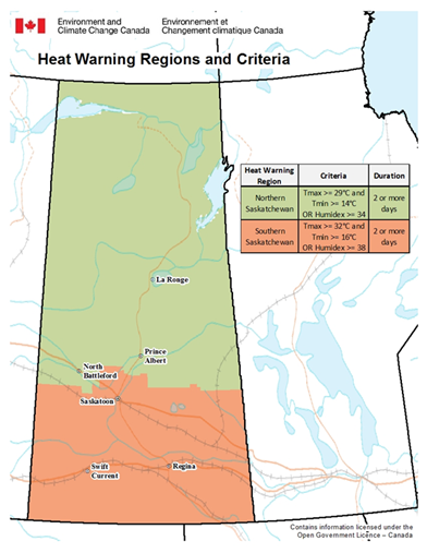
Heat Warning
Environment Canada has issued a heat warning for the Prince Albert, North Battleford, Lloydminster, Meadow Lake, La Ronge, Melfort, Nipawin, Regina, La Loche and Buffalo Narrows areas as well as much of eastern, northern and southern Saskatchewan.
A period with maximum daily temperatures near 29 C or above, and overnight low temperatures near 14 C or above, continues and isn’t expected to abate somewhat until Saturday with the arrival of a cold frontal passage.
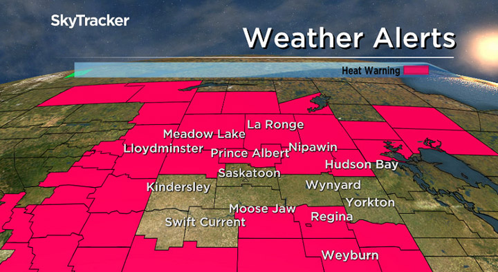
The agency says to watch for the effects of heat illness, including swelling, rash, cramps, fainting, heat exhaustion, heat stroke and the worsening of some health conditions.
For the latest weather alerts download the Global News Skytracker weather app for iPhone, iPad or Android.
Saskatoon Forecast
Today
Beautiful blue skies and sunshine were back again on Thursday morning, helping warm us temperatures up from 12 degrees to start the day into the upper 20s with humidex values into the 30s before noon!
We’ll heat up even further in the sun during the afternoon with a daytime high in the low 30s, which will feel like the mid 30s with humidity.
Tonight
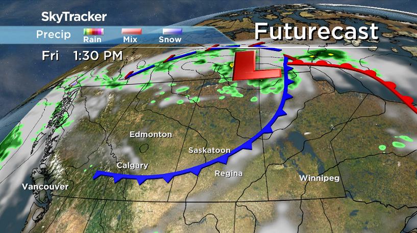
The evening will start off with clear skies, but clouds associated with a cold front will sweep through overnight with a slight chance of showers and risk of a thunderstorm as we cool back to the upper teens.
There is a risk of severe thunderstorms moving into western Saskatchewan late this evening and overnight, in areas like Meadow Lake, North Battleford and Buffalo Narrows, which will track northeast.
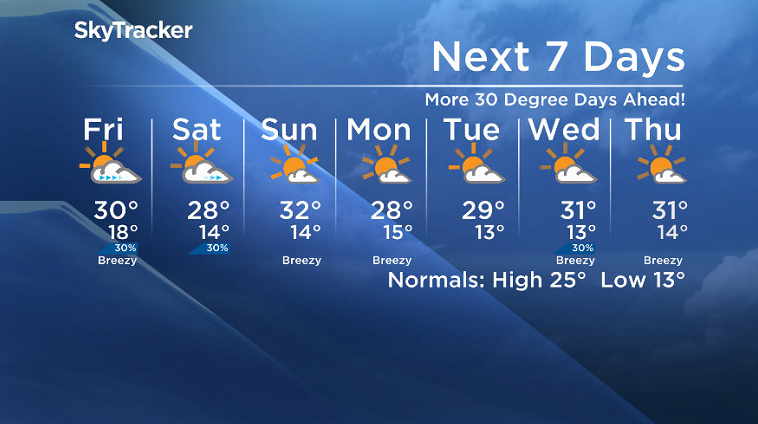
Friday
A cold front will sweep through the region on Friday, bringing with it some morning cloud cover and a chance of showers before clouds clear out during the day.
Our daytime high is largely dependent on the timing of the front, but it looks like it’ll be around 29 or 30 degrees with breezier northwesterly winds kicking in during the afternoon.
Weekend
A disturbance will ripple through the region on Saturday and bring in some clouds and a chance of showers to start the day before skies start to clear in the afternoon as we rise to a high in the upper 20s.
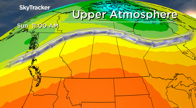
On Sunday we’ll see the upper ridge build back in the heat and sunshine with a daytime high a degree or so into the low 30s with a very slight chance of showers and the risk of a thunderstorm in the evening.
Work Week Outlook
The work week looks to start off on a sunny note on Monday with afternoon highs in the upper 20s until Wednesday when they rise into the low 30s as a few more clouds build in.
Sunday is likely to start off with some sunshine with rebounding temperatures back into the 30s, but late in the day will likely see more clouds bubble up with a slight chance of late day showers as a system moves in.
This Your Saskatchewan photo was snapped near Saskatoon by Jim Gawluk:

Saskatoon weather outlook is your source for Saskatoon’s most accurate forecast and is your one stop shop for all things weather for central and northern Saskatchewan with comprehensive, in depth analysis that you can only find here.
Comments