

Air quality has vastly improved, but the smoke will move back in soon.

Saskatoon Forecast
Today
It was a cooler start to the day in the city with temperatures down to 7 degrees to start the day before warming up into the high teens by noon under mostly sunny skies.
Air quality has improved vastly in Saskatoon compared to where we were at 24 hours ago, but the smoke will be back.
A special air quality statement remains in place for smoke from B.C. wildfires moving into southwest Saskatchewan and the Lloydminster area during the day.

Get daily National news
Clouds will build back in this afternoon with a chance of showers and the risk of a thunderstorm later on as we climb up to a high in the low 20s.
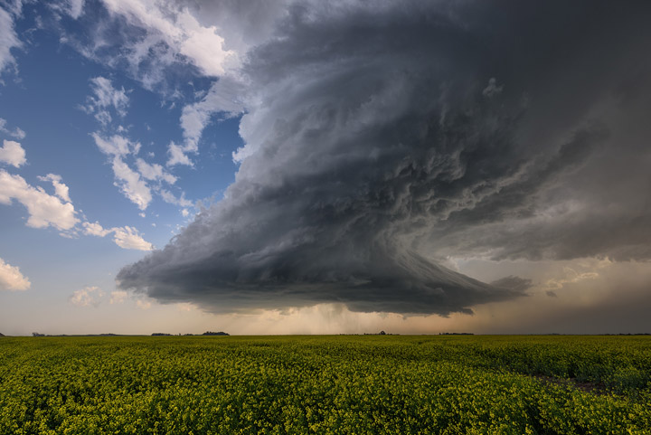
READ MORE: Tornado-warned storm near Saskatoon, baseball sized hail in parts of Sask.
Tonight
That chance of showers and thunderstorm risk will diminish overnight as clouds clear out of the area and we cool down just barely into single digits.
Wednesday
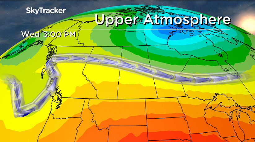
An upper ridge will start building back into the area on Wednesday, bringing us back into beautiful blue skies and sunshine right through the day.
Temperatures will also climb back up into the mid 20s by midday with an afternoon high around 27 degrees or so and a bit of smoke expected to filter back in.


Thursday-Friday
The path of the upper level wind is likely to bring in some thicker smoke from the B.C. fires on Thursday after a sunny start to the day with a few clouds and slight chance of showers later on.
The smoke should get shaken out on Friday as a low pressure system slides through, bringing us back into the clouds with a good chance of showers and thunderstorms.

Daytime highs could climb up into the low 30s on Thursday, depending how much smoke moves in to trap the sun’s energy, so we’ve opted to keep the high just into the upper 20s Thursday and around 27 for Friday.
Weekend Outlook
A slightly cooler Saturday is expected behind Friday’s system, with a daytime high in the mid 20s under clearing skies before we rebound back into the upper 20s with more sunshine Sunday under a rebuilding upper ridge.

This Your Saskatchewan photo of a tornado warned storm on Sunday was taken by Jeff Wizniak near Perdue:
Saskatoon weather outlook is your source for Saskatoon’s most accurate forecast and is your one stop shop for all things weather for central and northern Saskatchewan with comprehensive, in depth analysis that you can only find here.
Comments
Want to discuss? Please read our Commenting Policy first.