

Sunshine and heat return, but how long does it last?

Saskatoon Forecast
Today
2 degrees was where Saskatoon started the day, however we warmed up quite quickly under clear skies and sunshine, bringing us into double digits by 8 a.m. and into the high teens by noon!
Moderate northwesterly winds kicked in late morning with sustained speeds upwards of 36 km/h and gusts into the 45 to 50 km/h range.
Skies will remain mostly sunny for the rest of the day as we continue to warm up into the low 20s for a daytime high.

Get breaking National news
Tonight
Clear skies will stick around tonight as winds ease and we cool back down toward the freezing mark with a risk of frost tonight as a high pressure system drops in right over our area.
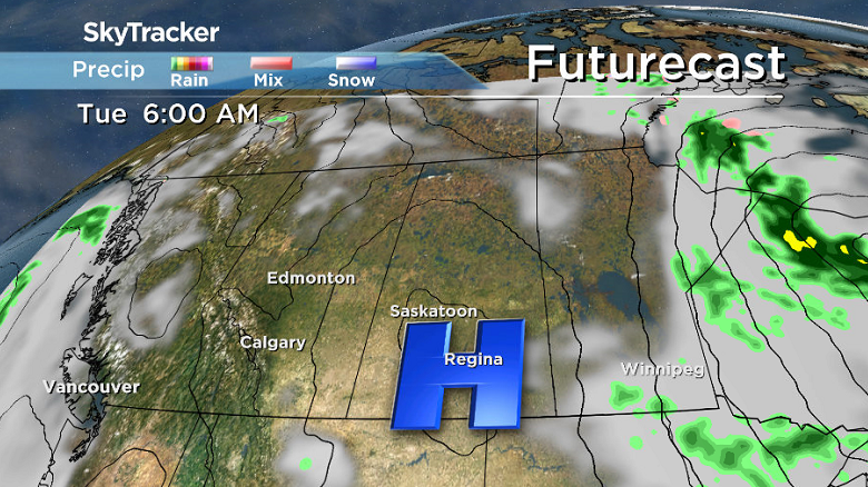
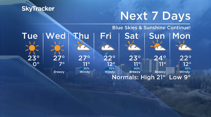
Tuesday
That high pressure system will help give us another beautiful day filled with nothing but blue skies and sunshine on Tuesday!
Temperatures are expected to continue their climb into the 20s with a daytime high around 23 degrees.


Wednesday-Friday
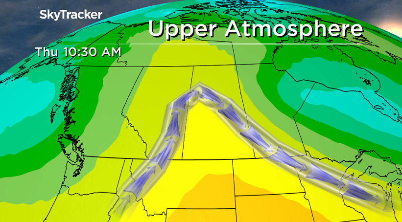
The upper ridge of high pressure that’s funneling in the heat will continue to do so on Wednesday with another sunny day on tap with a daytime high around 27 degrees.
The heat will stick around on Thursday as clouds push in from the west as a low pressure system moves into Alberta.
Then on Friday, we’re likely to get into some rain as the associated trough moves through, dropping us back into the low 20s and keeping us in the clouds.
Weekend Outlook
Some showers and clouds may linger on Saturday before we should get back into some more sunshine on Sunday with afternoon highs in the low-to-mid 20s both days.
Wendy Trask took this Your Saskatchewan photo south of Langham:

Saskatoon weather outlook is your source for Saskatoon’s most accurate forecast and is your one stop shop for all things weather for central and northern Saskatchewan with comprehensive, in depth analysis that you can only find here.
Comments
Want to discuss? Please read our Commenting Policy first.