

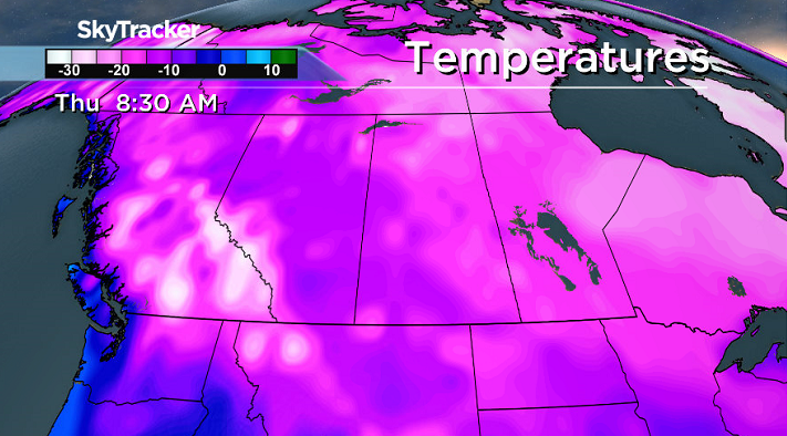
An arctic front moves through Saskatoon dropping temperatures back down into February!

Saskatoon Forecast
Today
After a warm, above freezing weekend with a daytime high of +3 on Saturday and +4 on Sunday, the big cool down is about to kick in!
Saskatoon saw some rain overnight night as the first disturbance associated with the cool down passed through, pulling us into a northwesterly flow with temperatures sitting around +1 this morning.
Northwesterly winds picked up midday with sustained speeds around 30 km/h and gusts into the 40 to 50 km/h range, which will continue into the afternoon as temperatures sit around freezing with a chance of light snow, which is scattered around the region today under mostly cloudy skies.
Tonight
Cool northwesterly winds of 30 gusting to 50 km/h will stick around tonight as temperatures fall back into mid-minus single digits with a chance of light snow.
Tuesday
The arctic front associated with a low pressure will move through on Tuesday, dropping temperatures to during the day from around -8 with wind chills around -17 in the morning, down to around -11 with wind chills in the -20s by afternoon.

We’ll sit under mostly cloudy skies during the day with a good chance of flurries early on before skies finally clear in the evening.
Our chilly northwesterly wind will also drop during the day from 20 gusting to 40 km/h in the morning, down to 25 km/h with gusts into the 30 to 35 km/h range.
Wednesday-Friday
Much cooler air settles in behind the arctic front for the middle to end of the week with daytime highs dipping back into minus double digits and morning lows dropping into the -20s.


Partly cloudy skies are expected on Wednesday before clouds clear out even more as an arctic high pressure system moves in giving us mostly sunny skies both Thursday and Friday.
Weekend Outlook
A system sliding by south of the area is expected to push in some clouds with a chance of flurries on Saturday before we get back into some sunshine on Sunday.
Daytime highs are likely to remain in minus double digits as cooler air prevails right into the first full week of February.
Colin Dutton took this Your Saskatchewan photo of a Zamboni driving on Cory Road in Saskatoon:

READ MORE: Get a 2017 Your Saskatchewan calendar today
Saskatoon weather outlook is your source for Saskatoon’s most accurate forecast and is your one stop shop for all things weather for central and northern Saskatchewan with comprehensive, in depth analysis that you can only find here.
- Posters promoting ‘Steal From Loblaws Day’ are circulating. How did we get here?
- Video shows Ontario police sharing Trudeau’s location with protester, investigation launched
- Canadian food banks are on the brink: ‘This is not a sustainable situation’
- Solar eclipse eye damage: More than 160 cases reported in Ontario, Quebec
Comments