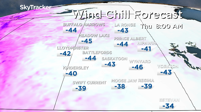
-47 is what it felt like with wind chill Wednesday morning and we dive back down for Thursday before warming up.

Extreme Cold Warning
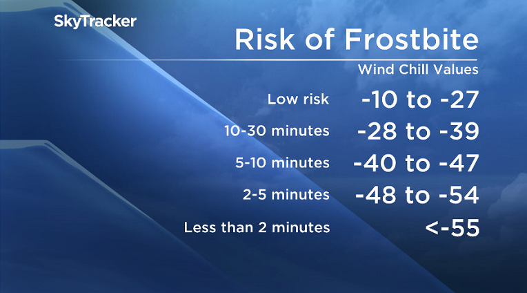
An arctic high pressure ridge brought temperatures of -30 to -35 overnight into Thursday morning, which combined with winds of 10 to 20 km/h to produce extreme wind chills of -40 to -50.
More extreme cold conditions will follow the fast-moving system overnight into Thursday morning before moderating.
Extreme cold warning are issued when very cold temperatures or wind chill creates an elevated risk to health such as frost bite and hypothermia.
For the latest weather alerts download the Global News Skytracker weather app for iPhone, iPad or Android.
Saskatoon Forecast
Thursday
-47 is what it felt like in Saskatoon early Thursday morning with wind chill as the polar vortex pushed in aloft and arctic air slid in underneath.
-51 is where wind chill values fell to in the Key Lake area as extreme cold continued into the afternoon across the province.
Temperatures fell to a frigid -34 degrees in the morning in the city with ice crystals with clouds rolling back in as a low pressure system, bringing in the snow midday, moved in.
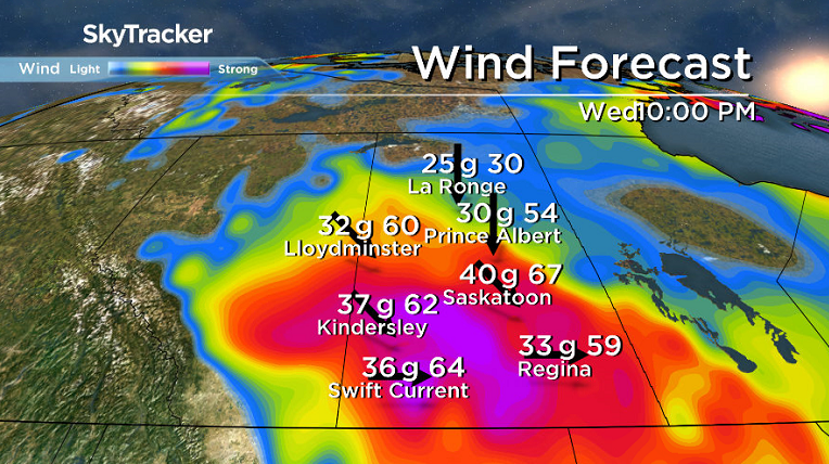
This system kicked up southwesterly winds at sustained speeds of 30 to 40 km/h with gusts of 50 to 60 km/h that helped to briefly warm up temperatures into the mid-minus teens during the afternoon as snow and blowing snow continued.
Thursday Night

Get daily National news
Snow and clouds cleared overnight and we dove back into the arctic air as winds switch around to be from the north behind the system at sustained speeds of 30 to 40 km/h with gusts upwards of 50 to 70 km/h.
Temperatures dropped back into the -30s overnight with wind chill values once again reaching extreme cold warning criteria.
Thursday
Mid -40s will be what it’ll feel like once again with wind chill Thursday morning when you head out the door in the morning.
It’ll be a frigid day as arctic air settles back in for the day behind the system under mostly sunny skies.
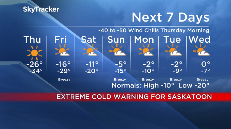
A daytime high around -26 is expected, but that’ll feel like the low -30s all day with wind chill.
Friday
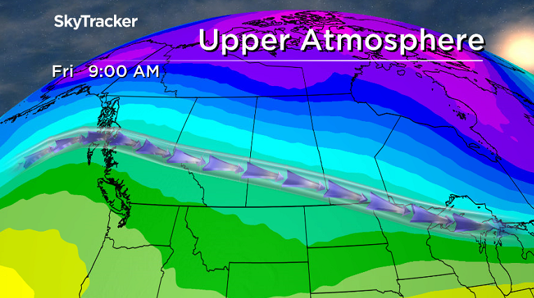
We finally start to dig out of the deep freeze on Friday as an upper ridge moves in after starting out in the low -20s with wind chills in the mid -30s.
Under mostly sunny skies we’re expecting to climb up to a daytime high in the mid minus teens.
Weekend Outlook
The warming trend continues this weekend under partly to mostly sunny skies as the upper ridge of high pressure continues to build in!
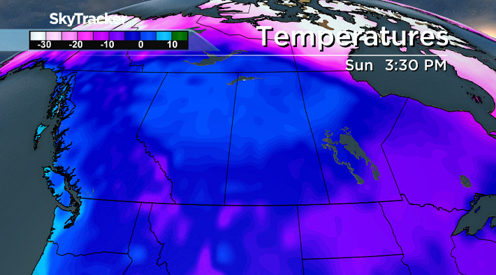
Daytime highs will bound up from around -11 on Saturday up to mid-minus single digits on Sunday and then push up toward the freezing mark early next week.
READ MORE: Get a 2017 Your Saskatchewan calendar today
Saskatoon weather outlook is your source for Saskatoon’s most accurate forecast and is your one stop shop for all things weather for central and northern Saskatchewan with comprehensive, in depth analysis that you can only find here.






Comments