

Extreme cold into Saturday before an arctic blast kicks into full swing next week.

Saskatoon Forecast
Today
Saskatoon started out the day under an extreme cold warning, however the -40 threshold for that was not met as clouds that have been acting like a blanket and keeping us warmer took their time clearing out.
We did finally see skies clear before sunrise, which allowed temperatures to fall back to our morning low of -26 with wind chill values down to -36 by 10 a.m. before warming up to -19 by noon.
Sunny skies them moved in and are expected to stick around for the rest of the day as temperatures warm up another degree or so into the minus teens for an afternoon high.

Get daily National news
Tonight
Clear skies tonight under an arctic high pressure system will allow temperatures to fall fast, down into the -30s with extreme wind chill criteria of -40 likely met.
Saturday
-40 is around what it’ll feel like with wind chill on Saturday morning under mostly sunny skies before clouds build in by midday.
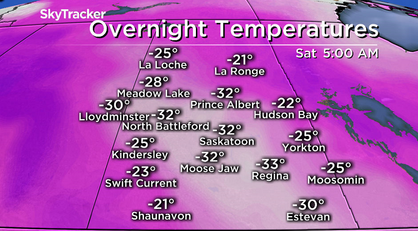
These clouds are associated with some milder Pacific air that’s trying to push in and should help the mercury push up close to or just into the minus teens for an afternoon high.
Sunday
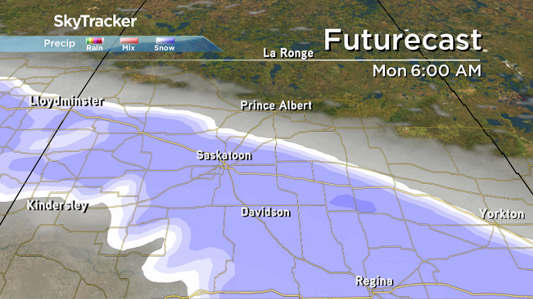
Sunday looks to remain mostly cloudy with a very slight chance of light snow during the day.
The cloud cover overnight will allow us to stay a bit milder in the morning with a low in the mid-minus 20s and an afternoon high hoping to once again just edge into the minus teens.


Work Week Outlook
Arctic air once again surges in next week, but this time it’ll likely be accompanied by the polar vortex – the main cold pool of air that normally sits over the North Pole.
As it pushes in, we’ll see mostly cloudy skies with some snow likely on Monday and Tuesday, which will help keep temperatures in the -20s and wind chills in the -30s.
Then skies clear out later in the week, allowing us to cool right down to morning lows in the -30s with wind chills in the -40 to -50 range and afternoon highs struggling into the mid -20s.
This Your Saskatchewan photo was taken by Brett Burzminski at Katepwa Lake:

READ MORE: Get a 2017 Your Saskatchewan calendar today
Saskatoon weather outlook is your one stop shop for all things weather for Saskatoon, central and northern Saskatchewan with a comprehensive look at your local forecast that you can only find here.
Comments
Want to discuss? Please read our Commenting Policy first.