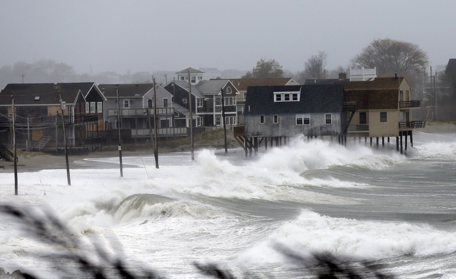
TORONTO – Hurricane Sandy could affect parts of Eastern Canada early next week, according to the Canadian Hurricane Centre.

The centre said the storm will move through the Bahamas with winds in excess of 140 kilometres into Friday.
The storm is expected to track northward while remaining at or near hurricane strength over the weekend.
“Monday evening, the centre of the storm is close to the coastline in the U.S. and…a lot of that circulation starts to move into Canadian territory,” said Bob Robichaud, program manager for the Canadian Hurricane Centre while referring to a graphic model of the storm. “So we would see winds in western Nova Scotia into Southern Quebec and southern Ontario, probably increasing towards the day on Monday.”
While the chance of snow in the Maritimes is considered “almost zero,” it is a possibility in northwestern Ontario, though the centre said it’s too early to predict amounts.
INTERACTIVE: Track Hurricane Sandy with our interactive Skytracker map below.


When asked where the largest impact in Canada will be, he said everyone in the Maritimes, southern Quebec and eastern and southern Ontario should be monitoring the storm closely.
“I know it’s a big area, but it just speaks to the actual size of this storm. This storm is a very huge storm by the time it gets close to here.”
He also compared Sandy to the “Perfect Storm” of 1991, which was a strong storm that captured a weakening Hurricane Grace, and was made famous by Sebastian Junger’s book and a Hollywood movie of the same name. It struck off the coast of New England, and did about $200 million of damage.
“That storm was particularly large and this one is certainly on par with the size of that particular storm,” said Robichaud. “The only difference is this particular storm is actually going to affect more people on land than the Perfect Storm did.”
With files from The Canadian Press


Comments