

Three Pacific storms are expected to roll over the B.C. South Coast beginning Wednesday night, bringing with them strong winds and heavy rain.

The first storm passed through the region on Wednesday night bring about 35 mm of rain to Metro Vancouver by Thursday morning. The second storm is expected to hit Thursday night with gusting winds and more rain. The third and possibly most severe storm could make landfall by late Saturday afternoon.
Update – Thursday, Oct. 13, 11:35 p.m.:
Winds are rain are beginning to pick up across much of the B.C. South Coast.
Live #BCStorm Updates – October 13, 2016
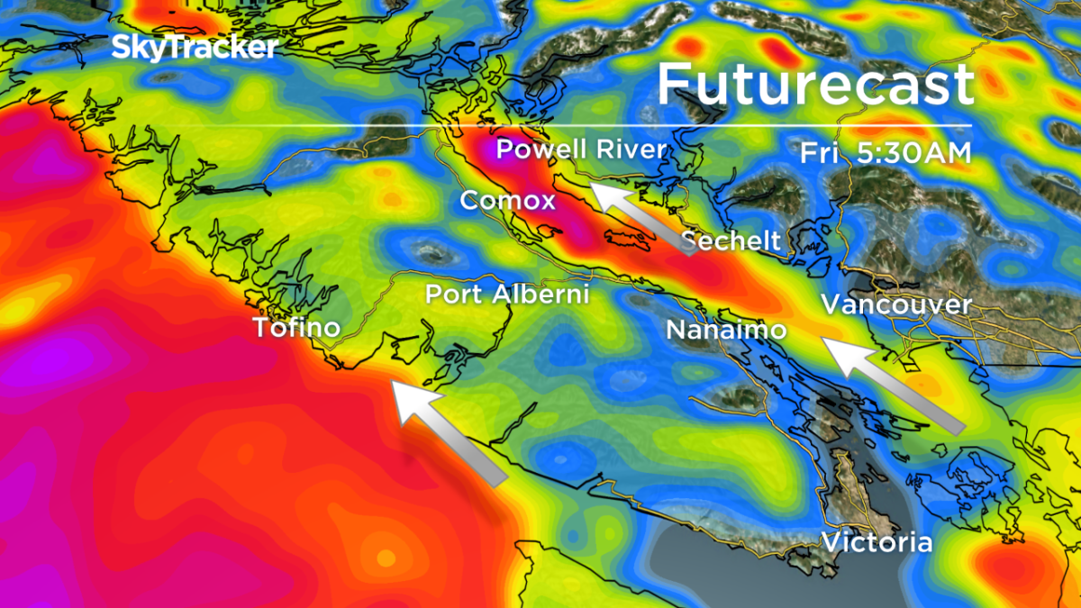
Wind warning issued
Environment Canada has issued a wind warning for the Lower Mainland, Howe Sound, Sunshine Coast, Southern Gulf Islands, and Vancouver Island. The west coast of Vancouver Island will see winds of up to 100 km/h overnight and the rest of the South Coast will see southeast winds of up to 80 km/h by Friday morning.
The winds continue throughout Friday coming from the southwest at 70 to 90 km/h.
Wind this strong could knock down trees and power lines, causing power outages. Loose objects may be tossed by the wind to cause injury or damage.


Rivers and creeks could flood
Rainfall accumulation over the next several days is causing concern that some rivers and creeks could flood.
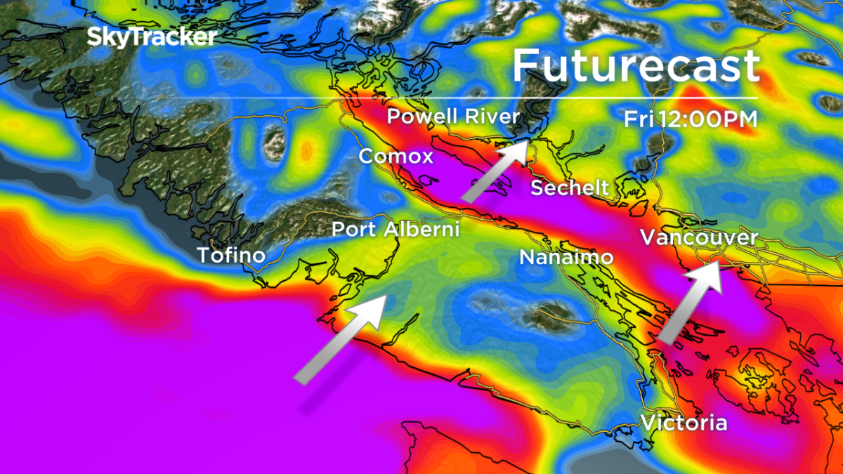
The River Forecast Centre is advising rivers on south, central, and north Vancouver Island could produce minor flooding as the B.C. South Coast is expected to receive up to 200 mm of rain between Wednesday night and Saturday.
The second storm will hit by Thursday night and will include strong winds. The third and most powerful storm is expected to make landfall on Saturday.
Where the storm hits landfall will determine the severity of the weather, according to Environment Canada.
“Rivers across the region are expected to rise rapidly on Thursday in response to rainfall, and remain elevated into the weekend, with increased flows likely as each of the remaining two systems move through,” said the River Forecast Centre in its High Streamflow Advisory.
“Hydrologic modelling based on current weather forecasts indicates the possibility of flood conditions over the Saturday to Sunday period, particularly over the Central Vancouver Island region during these storms.”


People are warned to stay away from rivers and culverts due to fast-flowing water and potentially unstable riverbanks.


The rivers noted for possible flooding or rising levels include:
- South Vancouver Island: Englishman River, Chemainus River, Cowichan River
- Central Vancouver Island: Tsolum River, Browns River, Sproat River, Somass River
- North Vancouver Island: Salmon River, Gold River
Metro Vancouver
Metro Vancouver was issued a rainfall warning for Wednesday night and Thursday with up to 60 mm of rain forecast. Actual accumulation totaled about 35 mm in some areas.
The forecast caused the popular Grouse Grind hiking trail to close for the season as of Oct. 13.
The combination of wet leaves, rain, and high winds in the coming days could mean possible power outages across the South Coast. BC Hydro suggests people be prepared for the storms by putting together an emergency kit that will last them up to 72 hours without power.
A few important items to have on hand ahead of losing power include:
- Plenty of water;
- Non-perishable food or food that does not need to be refrigerated;
- Flashlights, matches, and candles;
- Hand-crank or battery-operated radio
- Batteries
Also make sure your devices are fully charged leading into the stormy weather and use a surge protector on any electronics plugged in at home or work.
The Pacific Rim
The Pacific Rim region is also urging for caution near the ocean as the storms are expected to create strong breaking waves.
Pacific Rim National Park Reserve of Canada has issued a ‘High’ warning for Wednesday and Thursday and an ‘Extreme’ warning for Friday.
During a ‘High’ warning, people are cautioned to avoid water activities within 400 metres of rocky headlands and small islands. Storm surges of up to three metres will be expected and surges and waves may be unpredictable.
Under an ‘Extreme’ warning, breaking waves continuously exceed three metres combined with very strong rip currents.
People are urged not to travel along the shoreline of rocky beaches or headlands as “violent and unpredictable” surges over three metres are expected. The advisory added that the large swells combined with high tides could cause beaches to flood.
- Joffre Lakes to close for 3 periods this year under agreement with First Nations
- ‘Why aren’t we doing more?’ White Rock on edge with killer on the loose
- B.C. carjacking victim says she doesn’t trust the ‘catch-and-release’ system
- B.C. woman’s journey to sobriety highlights the need for drug treatment
Comments