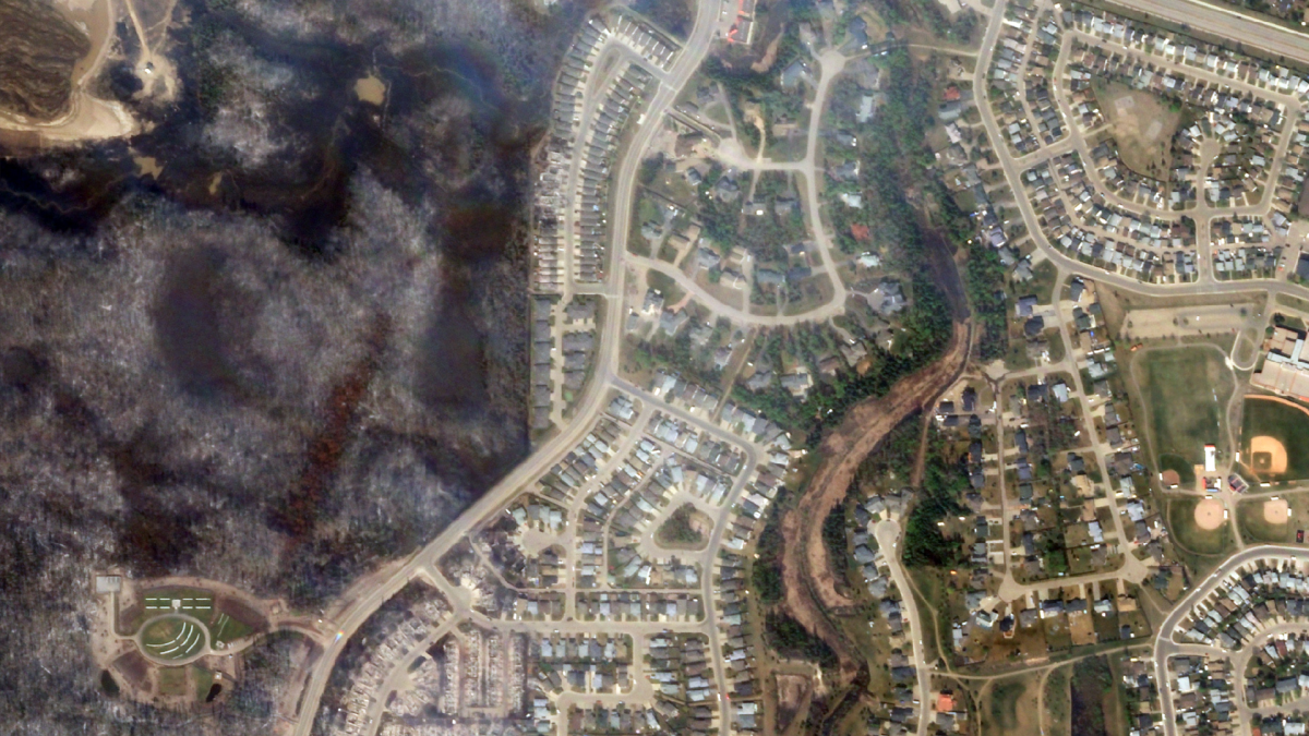
Fort McMurray residents wanting to survey the property damage left behind by the devastating wildfires can now do so through a satellite imagery app released by the province, entitled Fort McMurray Damage Map Application.

The maps provide a high-level satellite overview of the city after the fires, and shows only the areas with the most severe damage.
In a news release Saturday, residents were warned that structures which may appear to still be standing, “should not be considered undamaged.”
The release also states the map images should not be used for official damaged assessments, determining the status of your home or planning re-entry into the city.

Get weekly health news
Over 2,400 homes and other buildings were destroyed, and more damaged by heavy smoke. Slowly, however, a detailed picture of the damage is emerging, as seen from space.
Satellite images taken May 6 were released to Global News on Friday by Effigis, a Montreal-based geospatial information company. The 50 centimetre-resolution images were taken by Pléiades satellites.
READ MORE – Fort McMurray wildfire: Search these high-resolution satellite maps of the damage
“Having been through a devastating fire and evacuation myself, I know firsthand how stressful it is to wait for updates on which homes have been lost. We are committed to providing information to residents as soon as we can, and these images will help us begin to answer the questions people have about the state of their homes and community,” Minister of Municipal Affairs Danielle Larivee said.
There are plans to release higher-resolution imagery in the days ahead. It is anticipated that this future set of images will provide enough detail to assist property owners with insurance claims, recovery eligibility funding and other recovery actions.
The release goes on to say the government’s “priority remains battling the wildfires in the region, as well as ensuring that the city’s services are restored and the area is safe for returning residents.”
Residents will also be relieved to learn preliminary re-entry planning is currently underway and expected to begin within the next couple of weeks.
The application uses satellite imagery provided by the government of Canada.
Comments