


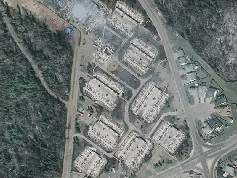
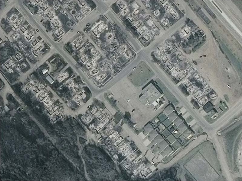
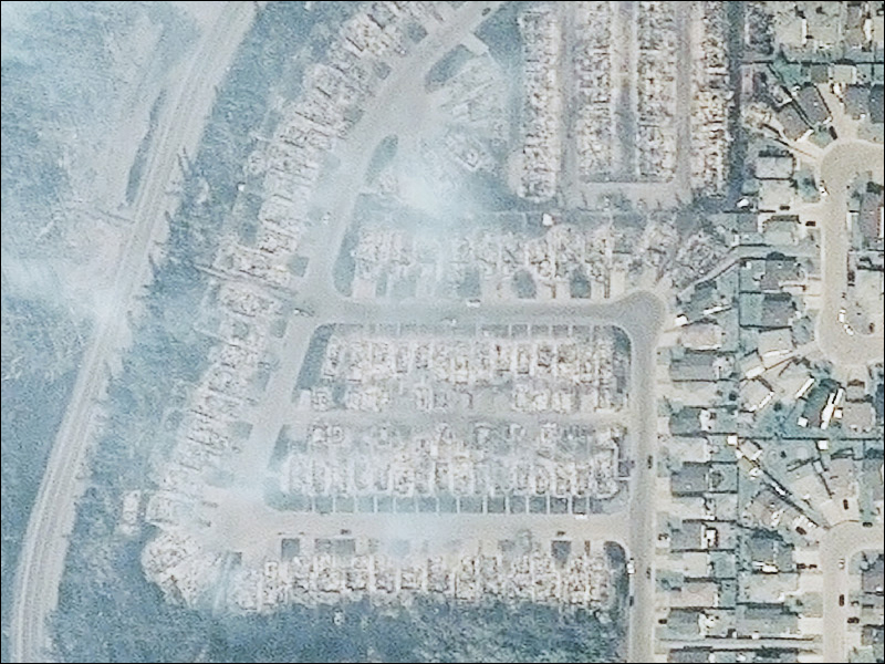
Fort McMurray is still too dangerous, damaged and chaotic for anyone but emergency workers to even enter, the better part of a week after apocalyptic wildfires destroyed parts of the city and forced nearly 100,000 to flee with not much but the clothes on their backs.

Over 2,400 homes and other buildings were destroyed, and more damaged by heavy smoke.
Slowly, however, a detailed picture of the damage is emerging, as seen from space.
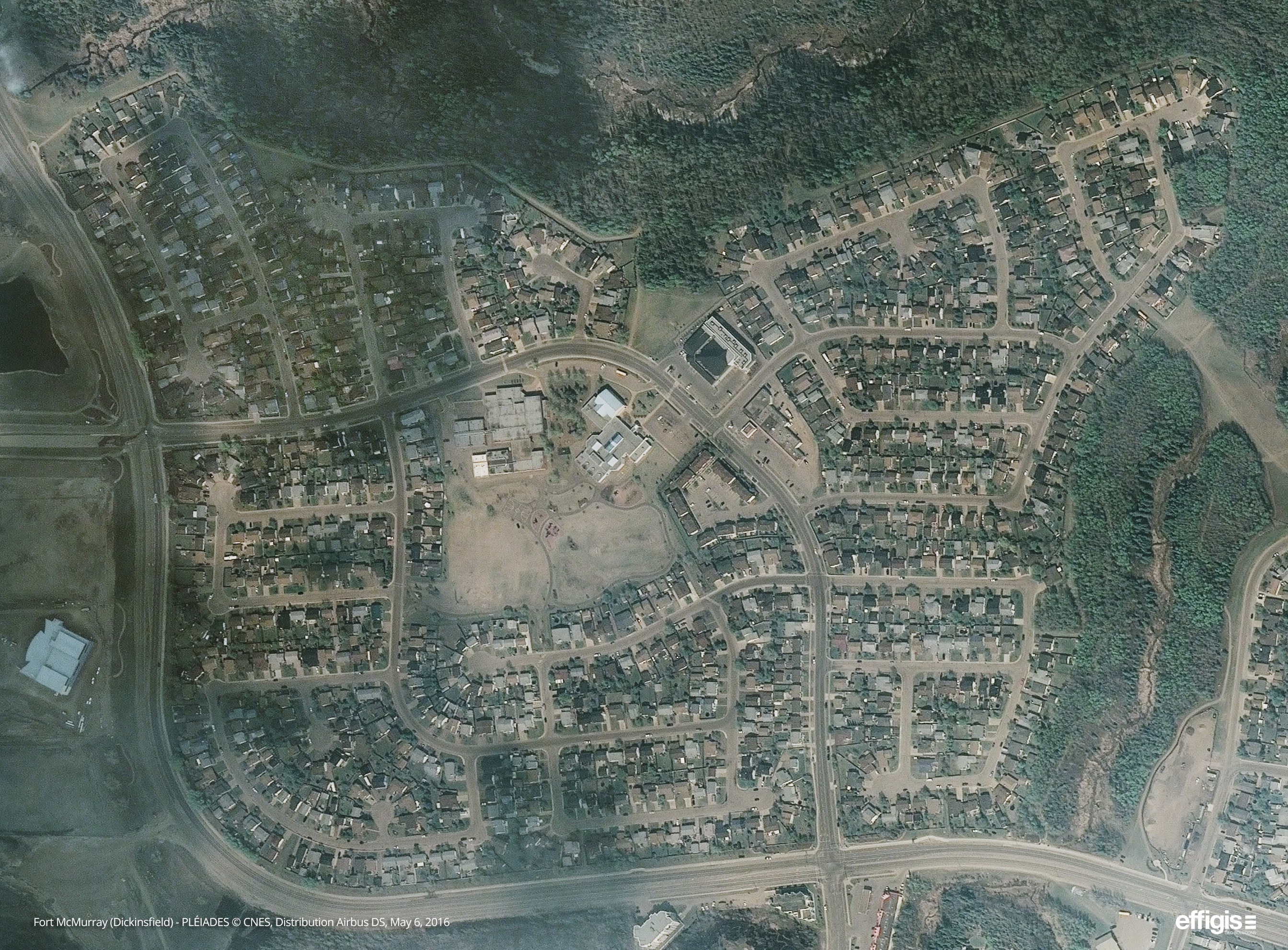
Satellite images taken May 6 were released to Global News on Friday by Effigis, a Montreal-based geospatial information company. The 50cm-resolution images were taken by Pléiades satellites.
We are presenting them as searchable satellite images, overlaid on a map of Fort McMurray. Switch from the ‘Overlay’ to ‘Background map’ tabs at the upper left to look at a map or pre-fire satellite image.
Below the maps, you’ll find links to full-size satellite images of Fort McMurray neighbourhoods, including maps not seen above.
Click on the links to see the maps. Once you are on the maps, you will be able to type in an address from the area highlighted and it will search for that dwelling. Please use the full address, including the city, for the best results.
Beacon Hill
- What is a halal mortgage? How interest-free home financing works in Canada
- Ontario doctors offer solutions to help address shortage of family physicians
- Capital gains changes are ‘really fair,’ Freeland says, as doctors cry foul
- Budget 2024 failed to spark ‘political reboot’ for Liberals, polling suggests
Dickinsfield

North Abasand
Waterways
Wood Buffalo
Links to full-size images
Click on the links below to see full-size images of Fort McMurray neighbourhoods, including maps not seen above. Several of the images linked are too large to embed in interactive maps. Mobile users: Files marked as large are over 20MB.
Wood Buffalo-Thickwood (cropped)
Wood Buffalo-Thickwood LARGE FILE
Timberlea LARGE FILE
Downtown LARGE FILE
Comments