

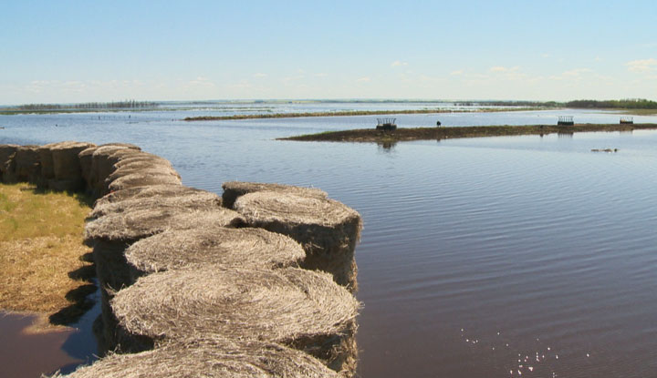
REGINA – Saskatchewan’s Water Security Agency (WSA) says a rapid melt of the remaining snowpack is expected as temperatures jump above seasonal. The agency says its latest spring runoff forecast shows that snow melt runoff is complete or nearly complete over most agricultural parts of the province.

“When you start losing some of that snowpack early, we don’t see the same response in spring runoff.”
READ MORE: Threats of ice jams and flooding remain in Selkirk, Manitoba
Boyle said there wasn’t a lot of runoff in the southern part of Saskatchewan.

Get breaking National news
He said local inflows “didn’t really materialize” on Buffalo Pound Lake, so the agency is diverting more water there from Lake Diefenbaker.
Officials are also moving water from Lake Diefenbaker down the Qu’Appelle River to bring Pasqua and Echo Lakes up to near the top of their summer operating range. It’s a change from the past few years when officials were trying to get lake levels down, he said.
Round Lake, further downstream along the Qu’Appelle River, set a record for peak water levels in 2014. But Boyle says it could be at a record low this year.
The WSA can’t operate the Round Lake control structure because agreements aren’t in place with the federal government and First Nations in the area.
However, the runoff is still going in east-central areas.
A satellite image from Monday shows significant snow cover remaining in the Upper Assiniboine, Swan, and Red Deer River Basins. That means water flows are still climbing on many streams and rivers in the region.
The agency cautions there could be some localized flooding in those areas.
“That area north of Yorkton had above normal precipitation in March and the beginning of April, and what we’re seeing is temperatures in the 20s and it’s not going to freeze at night. So you have significant snow cover there and we’re going to have a rapid response coming off the landscape,” said Boyle.
Daytime highs are forecast to be well above seasonal and near historical records on Tuesday and Wednesday over east central Saskatchewan. For example, Yorkton is expected to reach 20 degrees.
Boyle also cautions that the spring runoff forecast released Tuesday does not include potential spring rainfalls, which caused flooding in 2011 and 2014 in some areas.
“Rainfall can change a lot of things,” he said.
-
![]() Ottawa and Washington relationship ‘the worst in modern history’: Ex-US Ambassador to Canada
Ottawa and Washington relationship ‘the worst in modern history’: Ex-US Ambassador to Canada -
![]() U.S. Coast Guard suspends search for missing Ontario air ambulance crew, passengers
U.S. Coast Guard suspends search for missing Ontario air ambulance crew, passengers -
![]() BC Lions Gravy Bowl Game
BC Lions Gravy Bowl Game -
![]() Alicia Keys’ musical ‘Hell’s Kitchen’ hits Toronto with story about family, love and self-discovery
Alicia Keys’ musical ‘Hell’s Kitchen’ hits Toronto with story about family, love and self-discovery




Comments
Want to discuss? Please read our Commenting Policy first.