
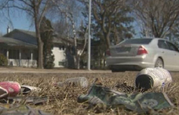
WINNIPEG — Now that the snow has nearly melted and the litter is starting to show, it’s the perfect time of year to rank which city neighbourhood is the dirtiest.

Take Pride Winnipeg travels city streets each spring, looking for litter. This year, northwest Winnipeg has taken the title of the dirtiest neighbourhood in the city – unseating Transcona.
The Take Pride Winnipeg 2016 Litter Index ranks the state of the city’s neighbourhood cleanliness based on a scale of 1-4, with the dirtier neighbourhoods getting the higher scores.
This year’s index shows the city is messier than it was last year, with an average index of 2.32 compared to 2.19 in 2015.
Northwest Winnipeg earned a score of 2.85, and the cleanest neighbourhood was the Winnipeg south area, with an average score of 2.4
Report from Take Pride Winnipeg
Area 1: Northwest – Average Score: 2.85
Worst Streets: Keewatin Street between Notre Dame Street and Logan Avenue, Oak Point Highway to Perimeter, Perimeter from Oak Point to McPhillips, Kinver Avenue between Keewatin Street and Garden Grove Drive, Selkirk Avenue between Keewatin Street and Sheppard Street, Burrows from Keewatin to McPhillips.
Area 2: North/Central Average Score: 2.54
Worst Streets: Redwood Avenue between Arlington Street and Main Street, Burrows Avenue between Main Street and Arlington Street, Dufferin Avenue between Salter Street and Main Street, Mountain between Arlington and Salter.
Area 3: Northeast Average Score: 1.96
Worst Streets: Chief Peguis Trail west of Henderson Highway, Raleigh Street/Gateway Road.
Area 4: Transcona Average Score: 2.50
Worst Streets: Lagimodiere Boulevard, Pandora from Ravenhurst to Hopka.
- Posters promoting ‘Steal From Loblaws Day’ are circulating. How did we get here?
- Canadian food banks are on the brink: ‘This is not a sustainable situation’
- Video shows Ontario police sharing Trudeau’s location with protester, investigation launched
- Solar eclipse eye damage: More than 160 cases reported in Ontario, Quebec
Area 5: West Average Score: 2.45
Worst Streets: Century from Portage to Dublin, Cavalier, Perimeter from Portage north.
Area 6: West End Average Score: 2.44
Worst Streets: Sherbrook Street from Portage Avenue to Cumberland Avenue, Cumberland Avenue from Sherbrook Street to Colony Street, Omand’s Creek, Maryland Street from Ellice Avenue to Portage Avenue.


Area 7: Downtown Average Score: 1.64
Worst Streets: Colony Street from St. Mary Avenue to Broadway, Bannatyne Avenue from Sherbrook Street to Princess Street, William Avenue from Sherbrook Street to Princess Street.
Area 8: St. Boniface Average Score: 2.37
Worst Streets: Bishop Grandin Boulevard from Lakewood Boulevard to St. Anne’s Road, St. Anne’s Road from Bishop Grandin Boulevard to Fermor Avenue, Fermor Avenue from St. Mary’s Road to Westmount.
Area 9: St. Vital/South Osborne Average Score: 2.17
Worst Streets: Perimeter between St. Anne’s Road and St. Mary’s Road, St. Anne’s from Perimeter to Bishop Grandin, Dakota from Bishop Grandin to Southglen.
Area 10: Southwest Average Score: 2.13
Worst Streets: Shaftesbury from Grant to Wilkes, Perimeter from Wilkes to Roblin, Taylor from Stafford to Kenaston.
Area 11: Fort Rouge/ Fort Garry Average Score: 2.39
Worst Streets: Confusion Corner, Stradbrook Street/River Avenue from Main Street to Donald Street.
Area 12: South Average Score: 2.4
Worst Streets: Kenaston Boulevard from Perimeter to Bishop Grandin Boulevard, Bison Drive from Waverley Street to Pembina Highway, McGillivray Boulevard from Pembina Highway to Waverley Street.
Comments