
Weather update: Monday July 13th 4pm

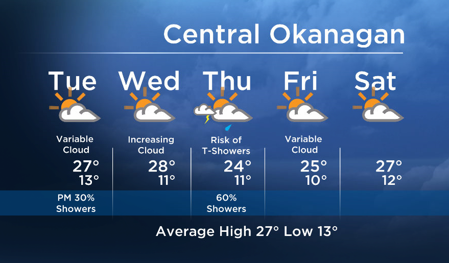
The pesky upper trough over the Pacific Northwest will keep a small risk of showers in the forecast for the valley, but the majority of the showers will stay near the mountains.
Breaking news from Canada and around the world
sent to your email, as it happens.
There will also be sun in the mix with temps near seasonal (mid to upper 20’s) from now until midweek.
The next upper low is expected to move in from the north into the BC Southern interior on Thursday. The cold front associated with this low will bring us a chance of showers with the risk of thundershowers on Thursday.


Tuesday’s daytime high range: 22 to 28C
More details coming up at 5, 6:30 and 11pm!
~ Duane/Wesla
More on Canada
- Ottawa approves B.C.’s ask for public drug use ban in decriminalization pilot
- Joly says Israeli Rafah invasion would be ‘unacceptable,’ urges ceasefire
- Trans Mountain pipeline expansion will boost Canadian oil prices ‘for years’: MEG Energy
- Delivery issue: Why Canada Post ‘must change’ to avoid collapse
Comments